Ticker for March 30, 2010
MESONET TICKER ... MESONET TICKER ... MESONET TICKER ... MESONET TICKER ...
March 30, 2010 March 30, 2010 March 30, 2010 March 30, 2010
I killed da wabbit
I expected to see some short bald guy singing "EAST WINDS WISE, WEST WINDS WISE"
as I walked out of the house today (any "looking in a mirror" jokes will be
automatically ignored!) as the winds were already whipping out of the south at
over 20 mph. Winds in the last hour have already approached 30 mph over much of
the state.
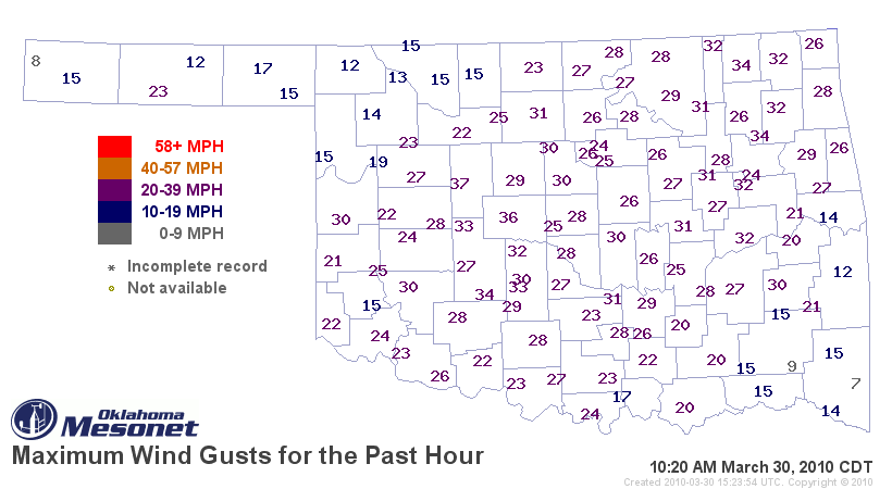
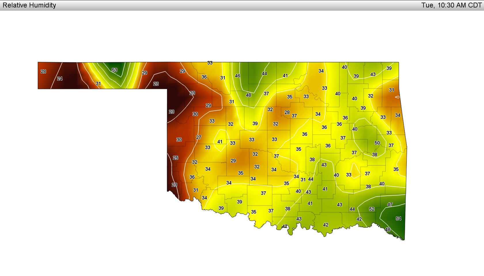
So add those winds to temperatures in the 80s today (approaching 90 in the west),
relative humidity values in the 20-30% range (these will continue to drop)
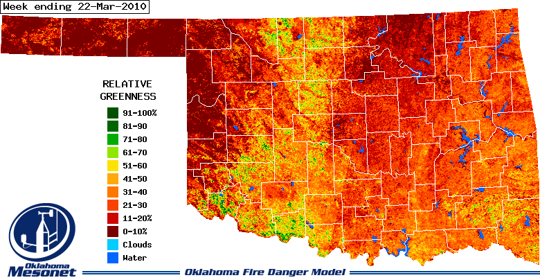
and still-dormant vegetation (this is a week or so old, but probably hasn't
changed a whole lot)
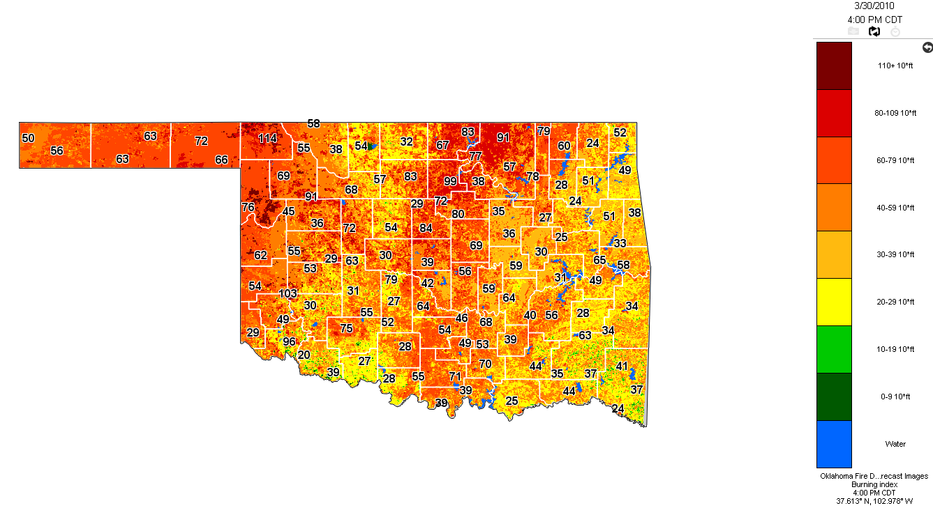
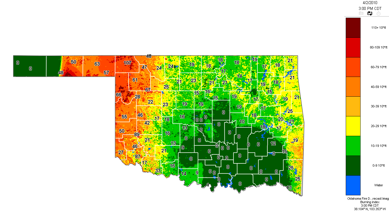
and what you end up with is extreme fire danger for the next several days. Here
is an Burning Index forecast from the Oklahoma Fire Danger Model on the OK-FIRE
website:
Things will hopefully improve by Friday with more moisture from the Gulf moving
up over the state due to an approaching storm system, along with improved
chances for rain.
You can read more about OK-FIRE and the Oklahoma Fire Danger Model here:
http://okfire.mesonet.org
http://agweather.mesonet.org/models/fire/description.html
Now, be vewy vewy quiet. I'm hunting fires.
Gary McManus
Associate State Climatologist
Oklahoma Climatological Survey
(405) 325-2253
March 30 in Mesonet History
| Record | Value | Station | Year |
|---|---|---|---|
| Maximum Temperature | 92°F | ARNE | 2010 |
| Minimum Temperature | 20°F | ANTL | 2003 |
| Maximum Rainfall | 5.20 inches | IDAB | 2002 |
Mesonet records begin in 1994.
Search by Date
If you're a bit off, don't worry, because just like horseshoes, “almost” counts on the Ticker website!