Ticker for March 31, 2010
MESONET TICKER ... MESONET TICKER ... MESONET TICKER ... MESONET TICKER ...
March 31, 2010     March 31, 2010     March 31, 2010     March 31, 2010


A shock to the system

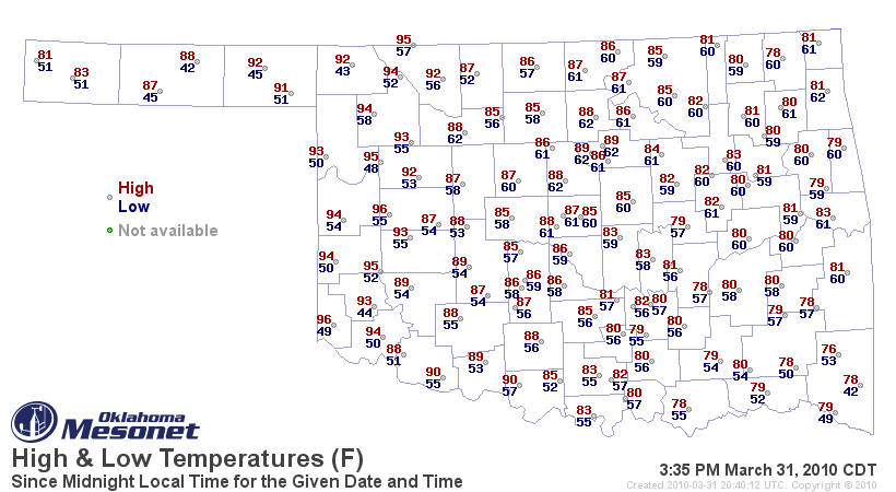
As advertised yesterday, temperatures have soared into the 90s across western
Oklahoma, as seen on the high/low Mesonet temperature map from 3:35 p.m.


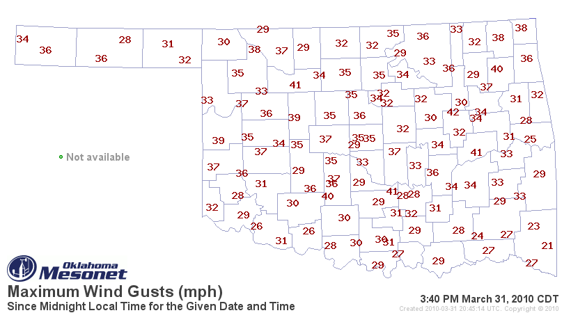
And again, the wind gusts were kicking up into the 30-40 mph range:


That's what we call "lip-crackin'" weather out in western Oklahoma (or in other
words, our normal climate).

The 96 degrees (thus far) recorded by the Mesonet sites at Butler and Hollis
are the highest temperatures we've seen since September 30, 2009, when three
Mesonet sites matched or topped that mark:

Beaver      100 degrees
Goodwell     96 degrees
Hooker       98 degrees

Maybe we will get some cool weather for a change in the next few days. This
heat spell is getting old!

Gary McManus
Associate State Climatologist
Oklahoma Climatological Survey
(405) 325-2253
March 31 in Mesonet History
| Record | Value | Station | Year |
|---|---|---|---|
| Maximum Temperature | 97°F | BUTL | 2010 |
| Minimum Temperature | 16°F | EVAX | 2019 |
| Maximum Rainfall | 5.36 inches | BOWL | 2015 |
Mesonet records begin in 1994.
Search by Date
If you're a bit off, don't worry, because just like horseshoes, “almost” counts on the Ticker website!