Ticker for November 6, 2008
MESONET TICKER ... MESONET TICKER ... MESONET TICKER ... MESONET TICKER ...
November 6, 2008 November 6, 2008 November 6, 2008 November 6, 2008
Wild Night: Some Information
Storms rumbled across the state last night, bringing strong winds
and heavy rain (honestly, when will they bring something different?).
For the archives, here's a rundown of some superlatives:
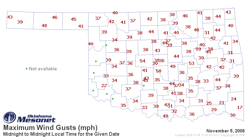
Peak observed wind gusts:
Rainfall results:
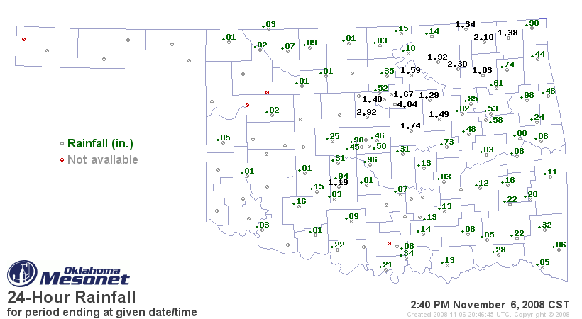
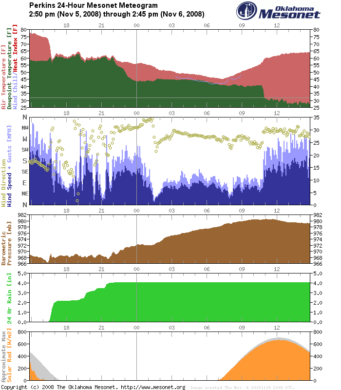
That 4.04" total at Perkins is pretty impressive ... even more so
when you consider that nearly two inches of that fell in TEN minutes:
Saving the BEST for last ... here's a compelling map. This is the
solar radiation (sunlight) map at about 5:30 yesterday evening:
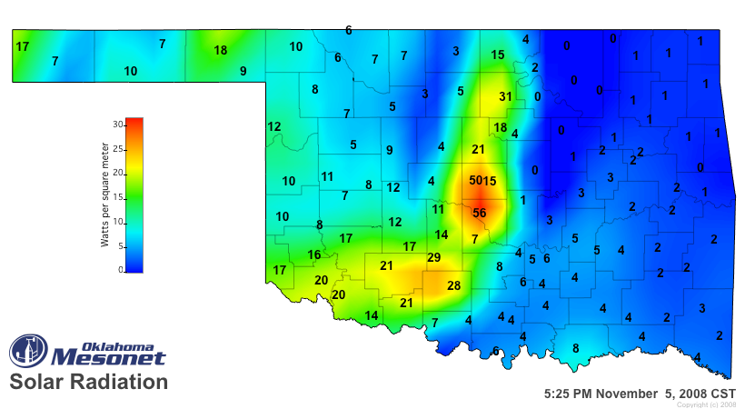
Check out the crazy-high SRAD values at Norman and in Oklahoma City
(middle of map). This is at sunset. Now, why would central OK have
more sunlight than western OK?
Because the sun was shining from both the west and the east.
No, no, we're not crazy. The high values reflect, uh, reflection.
The extra light was reflected off the 40,000-foot illuminated wall
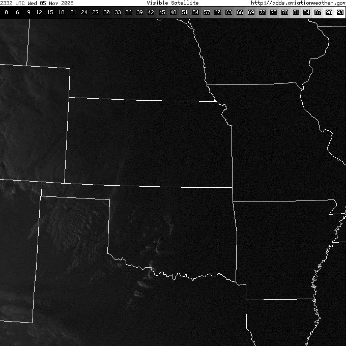
just to the east (also called a thunderstorm). Here's a satellite
image that shows the storms just east of the city:
Thank you to a BUNCH of different folks for suggesting and/or
providing today's content.
Climate Workshops Open Up
Hey, ever wanted to know what's up with the climate? What's the
deal with climate change? All that kinda stuff? Then you might
consider signing up for OCS's traveling climate road show! At the
Ticker, we're so excited that we've signed up for ALL of them!
See you there!
Important info at:
http://climate.ok.gov/
November 6 in Mesonet History
| Record | Value | Station | Year |
|---|---|---|---|
| Maximum Temperature | 89°F | BUFF | 2009 |
| Minimum Temperature | 19°F | GOOD | 2003 |
| Maximum Rainfall | 6.25 inches | RING | 2011 |
Mesonet records begin in 1994.
Search by Date
If you're a bit off, don't worry, because just like horseshoes, “almost” counts on the Ticker website!