Ticker for June 22, 2007
MESONET TICKER ... MESONET TICKER ... MESONET TICKER ... MESONET TICKER ...
June 22, 2007 June 22, 2007 June 22, 2007 June 22, 2007
The Guys in Research Call it a "Flux Capacitor"
The Ticker Research Labs have figured out time travel, and to prove
it, we are attaching the June 22nd Ticker for delivery on June 21st.
Now, it would be unethical to reveal too much about the future, but
a tip for investors: ray guns, robots and anything that ends with
"-o-matic"
Sea Breezes Aren't Just for Seas
If you've ever spent time at the beach, you've surely experienced
the early-afternoon relief borne by the sea breeze. The sea breeze
is just what it sounds like: a breeze blowing in off the sea. And,
on days when large-scale patterns are relaxed enough to keep overall
wind conditions light (par for the course in the tropics), the sea
breeze blows onshore at a refreshing clip.
The sea breeze is a well-studied and reliable phenomenon with many
cousins. They all share the same characteristic: they occur when
and where there are big differences in the heating characteristics
on either side of a boundary between surfaces.
To put that in English ... think about what the beach really is:
it's the boundary between a large body of water, and a large chunk
of land. Water's specific heat is much different than terrestrial
stuff, plus it's kinda transparent and fluid, so the sun's energy
is distributed through a slab, instead of focused on the surface.
The bottom line: on sunny days, the land side of the boundary gets
hotter, quicker, and that imbalance drives the sea breeze, which
blows from relatively cool to relatively warm. (Land also cools
more rapidly, which sets up an offshore "land breeze" during many
overnight hours).
Like we said earlier, the sea breeze has plenty of cousins. We've
talked about a "snow breeze" before:
http://ticker.mesonet.org/select.php?mo=02&da=07&yr=2003
OCS research has also quantified a "wheat breeze" (boundary between
wheat and non-wheat lands) and a "rainprint breeze" (boundary between
saturated soils and dry soils.
Anyway, today we have some fun pics of something more directly
related to the sea breeze, blowing onshore from Lake Superior.
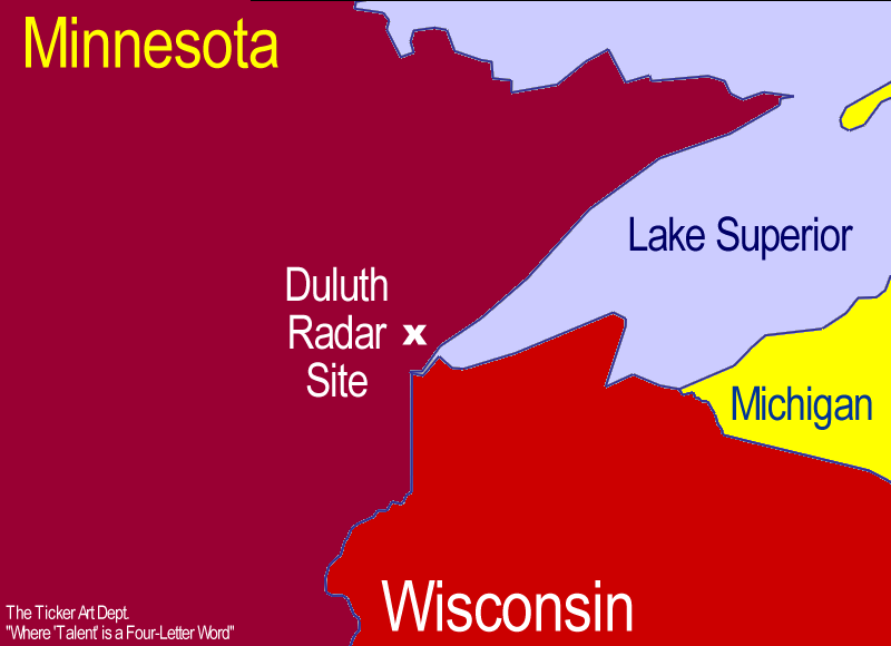
The following maps all pertain to the area immediately around the
Duluth, MN radar site:
At about 3:15, you can clearly see the lake breeze has already pushed
inland by a dozen miles (we measured it at 12 miles with our trusty
WeatherScope measuring tool):
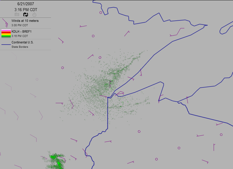
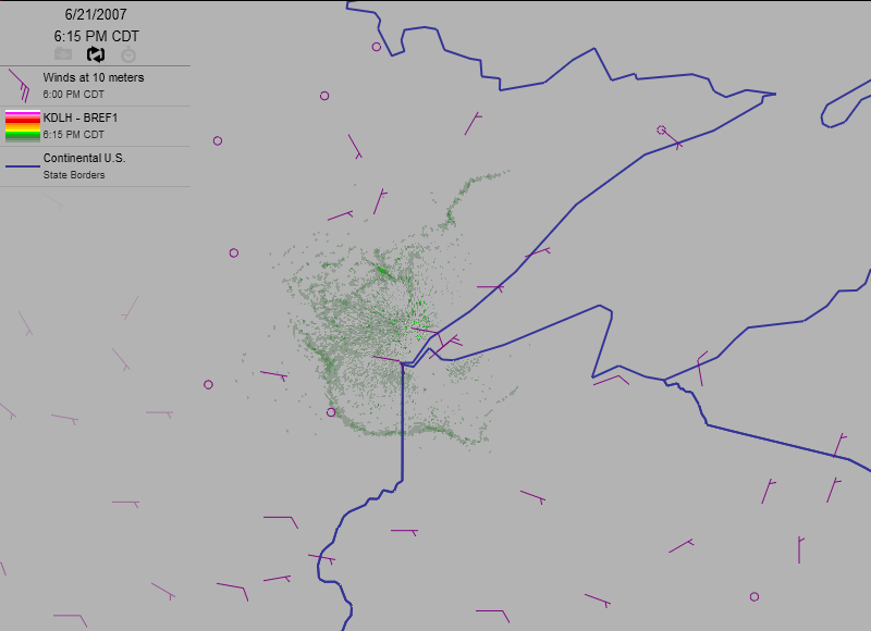
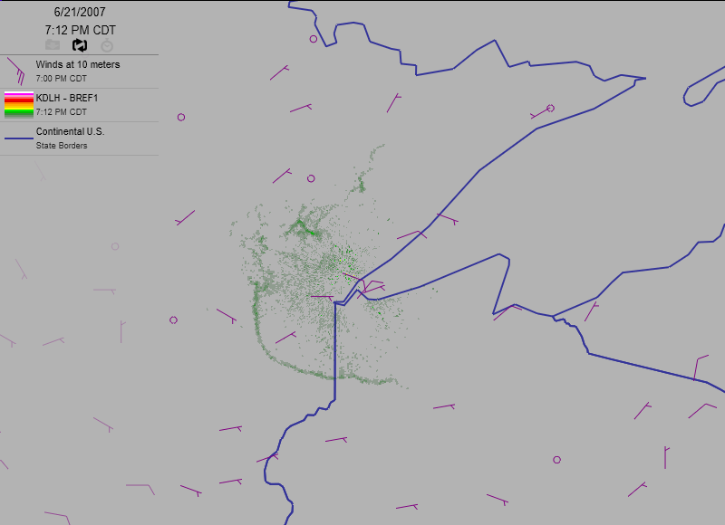
The extent of the lake breeze is indicated by the thin-line feature
that traces the western boundary of the lake.
An hour later the breeze pushed several more miles inland:
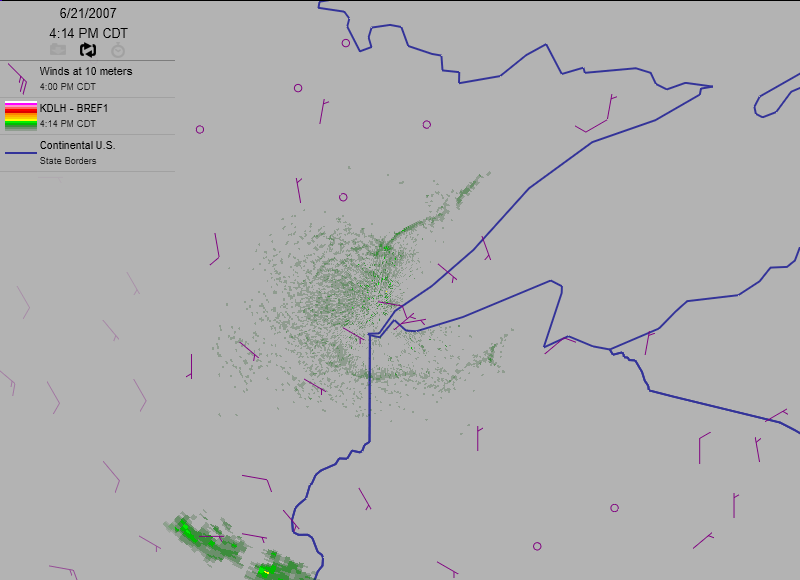
Dwell on a few things in the above image:
* first, all around the lake shore, winds (purple barbs) are
blowing onshore, literally blowing outward from the lake in
all directions.
* second, notice that the breeze boundary only shows up near
the radar. This shows the effect of the radar beam getting higher
with distance from the radar, eventually over-shooting the lake
breeze, which is very much a low-level phenomenon.
* thirdly, notice that the breeze pretty much expands uniformly
all around the lake (or at the very least the area near the radar).
This has to do with the generally light winds around the region,
which didn't interfere with its growth.
* fourthly, note the neat little concave "C" pattern at the eastern
end of the visible breeze in northern Wisconsin. That's the input
of the little finger of water directly to the east (that's
Chequamegon Bay for all you Wisconsophiles playing along at home).
The C-shape is the tip of the bay's own little contribution to
the lake breeze.
The following images show the continued expansion/advance of the
lake breeze during the following three hours:
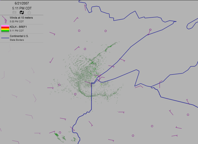
And, if you have a high-speed connection and a Quicktime Player, here's
the movie of the whole afternoon's events (warning: 1.58 MB):
https://content.mesonet.org/ticker/archive/20070622/duluth.mov
June 22 in Mesonet History
| Record | Value | Station | Year |
|---|---|---|---|
| Maximum Temperature | 104°F | TIPT | 1998 |
| Minimum Temperature | 49°F | BOIS | 2004 |
| Maximum Rainfall | 4.73″ | MANG | 1999 |
Mesonet records begin in 1994.
Search by Date
If you're a bit off, don't worry, because just like horseshoes, “almost” counts on the Ticker website!