Ticker for June 13, 2005
MESONET TICKER ... MESONET TICKER ... MESONET TICKER ... MESONET TICKER ...
June 13, 2005      June 13, 2005      June 13, 2005      June 13, 2005


A Tale of Two Seasons

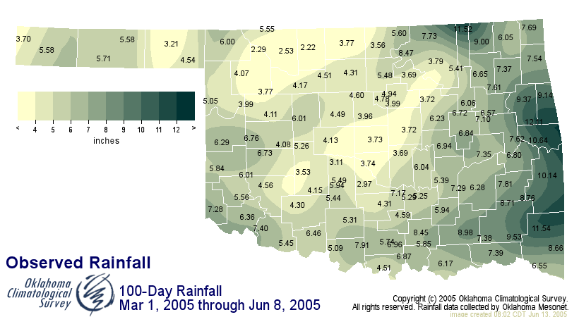
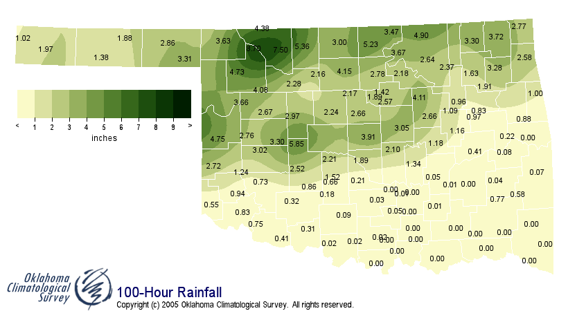
For many parts of Oklahoma, this season's precipitation has been
the worst of times, then the worst of timing. As of 4:00 am today,
their warm season could be divided into two portions: the first
one-hundred days, which brought little more than Great Expectations
of rainfall; and the last one-hundred hours, when it rained like
the Dickens. The following maps show the precipitation from each:


The following Mesonet stations received more rainfall in 100 hours
than the previous 100 days:

Mesonet      100-day total    100-hour total
Station      through Jun 8    through 4:00 am today
Alva         2.53"            7.50"
Blackwell    3.56"            5.23"
Cherokee     2.22"            5.36"
Freedom      2.29"            8.70"
Hinton       5.26"            5.85"
Oilton       3.72"            4.11"
Seiling      3.77"            4.08"
Spencer      3.73"            3.91"
Woodward     4.07"            4.73"

Unfortunately, the folks in greatest need of rain, roughly east of
U.S. Highway 81 and south of I-40 received very little of the deluge
witnessed in the northern half of the state.


And Now, Back to Our Boundary

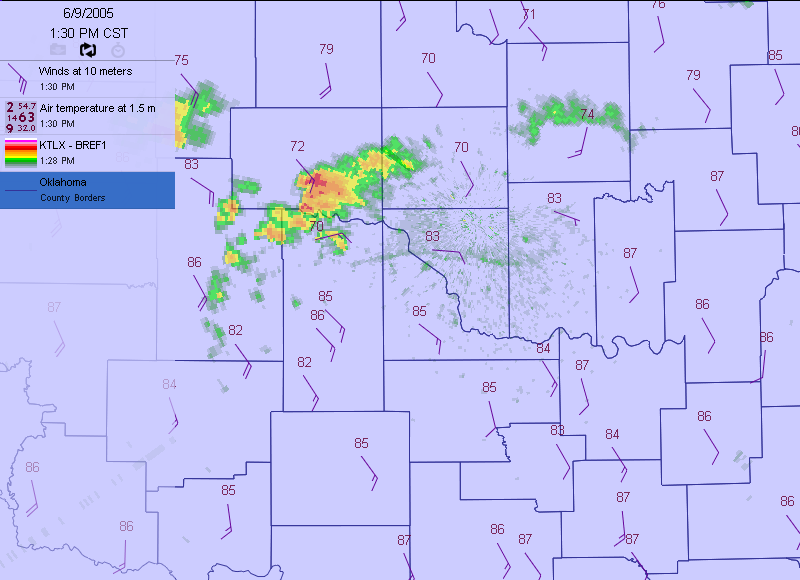
Thursday's Ticker featured the death of a cluster of storms and the
subsequent evolution of their dependent outflow boundary:

http://ticker.mesonet.org/select.php?mo=6&da=9&yr=2005

As its supporting downdraft expired, the boundary evolved from a
vital entity punching its way southward to a hapless victim, listlessly
adrift in the southeasterly winds.

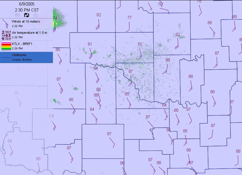
By the end of the movie, the outflow boundary disappeared as it drifted
away from the radar:

(here)
(gone)

Why did it disappear?  Two reasons:

1. Without a productive source of cooler, denser air, the boundary
lost much of its sharpness. As the gradient weakened, so too
did the radar's ability to detect it.

2. Radar beams are tilted, so they get higher off the ground with
distance. In other words, they can't detect low-level features
(like outflow boundaries and surface winds) more than a few miles
away. The remains of this particular boundary literally slipped
under the radar!
June 13 in Mesonet History
| Record | Value | Station | Year |
|---|---|---|---|
| Maximum Temperature | 110°F | BUFF | 2011 |
| Minimum Temperature | 47°F | BOIS | 2005 |
| Maximum Rainfall | 4.15 inches | HOBA | 2007 |
Mesonet records begin in 1994.
Search by Date
If you're a bit off, don't worry, because just like horseshoes, “almost” counts on the Ticker website!