Ticker for June 9, 2005
MESONET TICKER ... MESONET TICKER ... MESONET TICKER ... MESONET TICKER ...
June 9, 2005 June 9, 2005 June 9, 2005 June 9, 2005
The Rise and Fall of, uh, Air ... and an Associated Boundary
An interesting phenomenon showed up in a movie captured this
afternoon by OCS's WeatherScope software:
https://content.mesonet.org/ticker/archive/20050609/boundary.mov
(warning: Movie is 700kb! Individual frames are listed below.)
1: 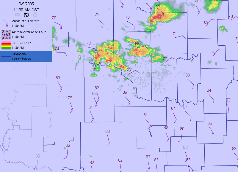
2: 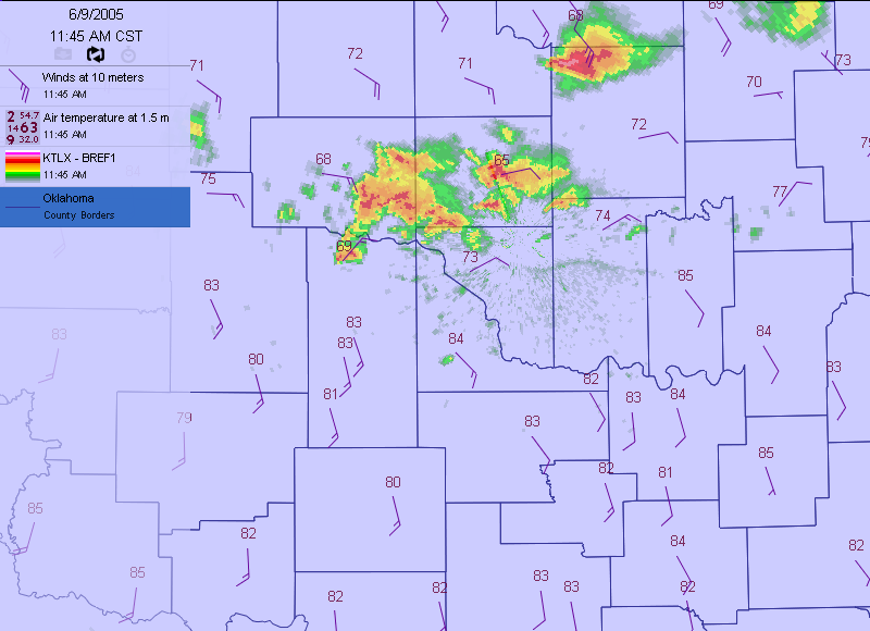
3: 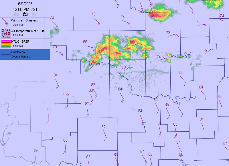
4: 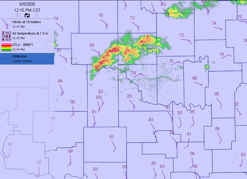
5: 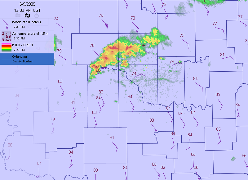
6: 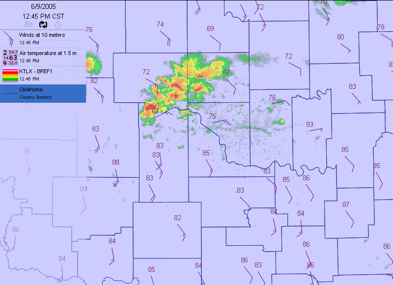
7: 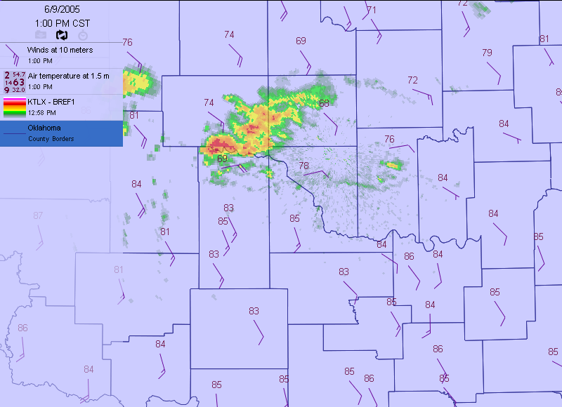
8: 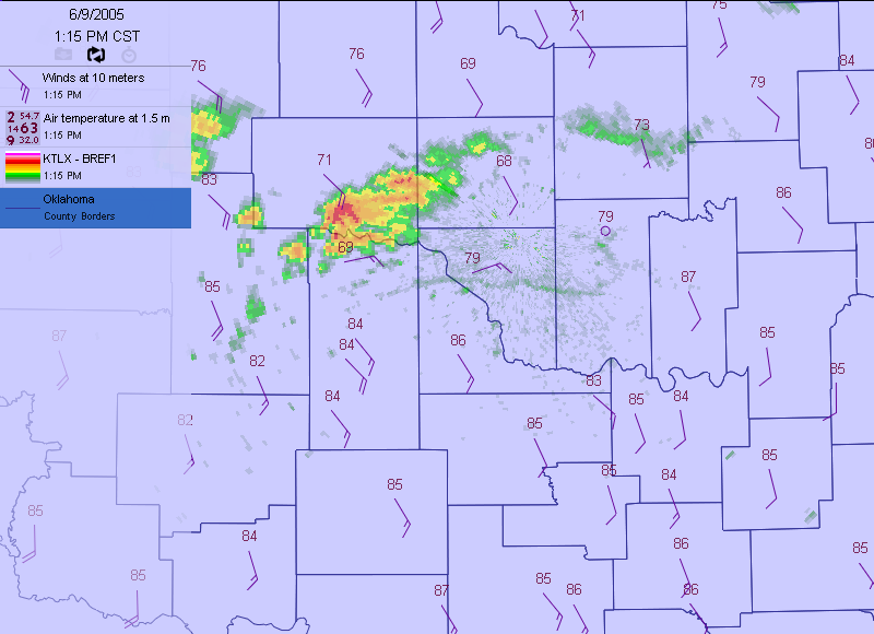
9: 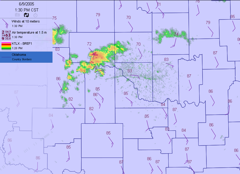
10: 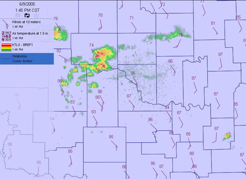
11: 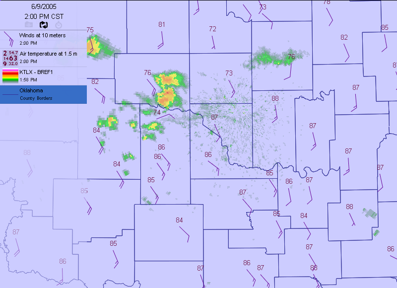
12: 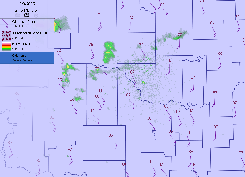
13: 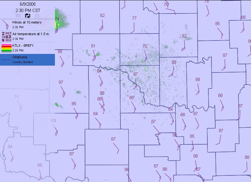
At 11:30 am (Frame 1), a cluster of thunderstorms sat over much
of the OKC metro area. Notice that most of the state was under a
regime of southeasterly winds ... the same warm winds we've felt
most of the day.
At 11:45 am (Frame 2), the storms hadn't moved much, but a distinct
thin line formed in the vicinity of the radar. It made a loose
serpentine shape over central Cleveland and Pottawatomie Counties.
By noon (Frame 3), the line materialized further, and crept slowly
to the south.
What was this line? Well, most thin lines on radar reflectivity imagery
represent some sort of boundary, and that's exactly what this line was:
an outflow boundary from the OKC thunderstorms. Outflow, in many ways,
is the "exhaust" of a thunderstorm. A mature storm is composed of an
updraft (which may suspend lots of precip), and a downdraft (where this
precip comes down, escorted by rain-cooled air). When the downdraft
hits the ground, it fans out, creating a boundary between the
the rain-cooled air from the storm and the warmer air around it.
So, back to our movie: For the next hour or so (frames 4-7), the
downdraft elements from the OKC storms kept nudging the boundary
ever southward.
However, by 1:15 pm (Frame 8), the storms seemed to dissipating -
that's because they were dissipating. By 1:45 pm (Frame 10), the
storms were no longer visible in Oklahoma County. This started a chain
of consequence that proved fatal to the outflow boundary:
a. When storms die, that means their updrafts die.
b. When updrafts die, downdrafts follow suit.
c. When downdrafts can no longer support an outflow boundary,
the boundary becomes a victim of the environment, namely the
large pattern of southeasterly winds across the state.
Notice that, by the movie's final frames, the outflow boundary,
abandoned by its attendant downdrafts, raced northwestward at about
15 miles per hour, which (not coincidentally) was the general
direction and speed of the winds.
The boundary had all but disappeared by the movie's last frame.
Why did that happen? That will be the topic of the next Ticker!
June 9 in Mesonet History
| Record | Value | Station | Year |
|---|---|---|---|
| Maximum Temperature | 104°F | ALTU | 2011 |
| Minimum Temperature | 43°F | EVAX | 2020 |
| Maximum Rainfall | 5.12 inches | BOWL | 2008 |
Mesonet records begin in 1994.
Search by Date
If you're a bit off, don't worry, because just like horseshoes, “almost” counts on the Ticker website!