Ticker for January 6, 2005
MESONET TICKER ... MESONET TICKER ... MESONET TICKER ... MESONET TICKER ...
January 6, 2005    January 6, 2005    January 6, 2005    January 6, 2005


A Snow-Eating Beast Rumbles Down from the Mountains

Fans of satellite imagery (and you know who you are) may appreciate
today's visible imagery loop from Colorado.  First, look at the
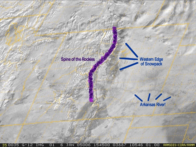
movie's first frame:


You'll notice a few neat things and some points of reference for
the movie.  First of all, the Arkansas River shows up in eastern
Colorado, indicating that the white stuff is indeed snow and not
clouds.  Second, we're marked the general location of the Rocky
Mountains, Now, the Entire Ticker Staff is composed of flatlanders,
so don't hold it against us if we missed by a range or so!  Thirdly,
we've marked the location of the western edge of the snowpack as
of shortly after sunrise this morning.

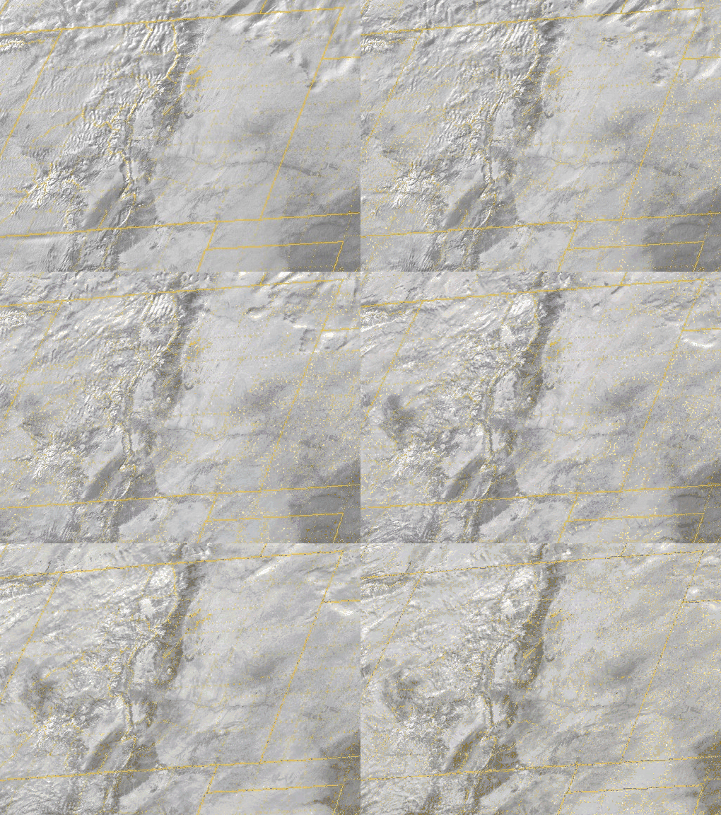
Now, watch a three-hour loop:


Notice the western edge of the snowpack retreating eastward over
time?  It's subtle, but it's there!  In fact, just a few pixels of
progress on the satellite image is several miles of progress in
reality. So the snowpack is retreating significantly!

What's happening?  Well, the atmospheric flow is highly zonal ... or,
in other words, it is strongly west-to-east (if you track some of the
wispy higher clouds, you can see this for yourself). As this westerly
flow subsides in the lee of the Rockies, it warms adiabatically and
contributes to a warmer, dry, westerly surface flow. In fact, today's
temperatures in the lee of the Rockies soared into the upper 30s by
mid-afternoon.  This relatively warm, relatively dry surface flow
can melt the heck out of snow!

Sometimes these warm westerly winds are called "chinook" winds, a
Native word that means, loosely, "snow eater".

Acknowledgement:
The base images for this movie are from the Cooperative Institute
for Research in the Atmosphere: http://www.cira.colostate.edu/


Bone-Chilling Cold in Wake of Winter Storm

The storm that delivered ugly weather earlier this week has wrapped
up and pushed off to the northeast.  As a parting gift, it left
clearing skies and calmer winds during the overnight hours.  During
the daytime, this is a welcome respite from wind chills, but during
the darkness, calm and clear spells "cold" .. and the coldness is
amplified by the frozen precipitation populating the ground.

The resultant temperatures this morning in the north and west were
frigidly cold.  Here are some selected Mesonet observations:

Kenton      0 F   1:55 a    Woodward    6 F   7:35 a
Boise City  1 F   2:50 a    Blackwell   8 F   7:40 a
Goodwell    3 F   3:40 a    Watonga     8 F   6:30 a
Hooker      4 F   7:30 a    Copan       8 F   7:30 a
Newkirk     6 F   6:55 a    Freedom     8 F   6:35 a
Beaver      6 F   6:25 a    Buffalo     8 F   4:55 a
Slapout     6 F   7:25 a    Arnett      8 F   7:40 a
May Ranch   6 F   7:10 a
January 6 in Mesonet History
| Record | Value | Station | Year |
|---|---|---|---|
| Maximum Temperature | 80°F | MANG | 2008 |
| Minimum Temperature | -12°F | NOWA | 2014 |
| Maximum Rainfall | 2.48 inches | BROK | 2021 |
Mesonet records begin in 1994.
Search by Date
If you're a bit off, don't worry, because just like horseshoes, “almost” counts on the Ticker website!