Ticker for January 4, 2005
MESONET TICKER ... MESONET TICKER ... MESONET TICKER ... MESONET TICKER ...
January 4, 2005    January 4, 2005    January 4, 2005    January 4, 2005


Freezing Rain Sensors, by Proxy

As a freezing rain event unfolds in northwestern Oklahoma, several
Mesonet sensors are once again serving as a canary in a coal mine
(or should that be "cold mine"?), indicating indirectly whether
icing is occurring or possible.

Some icy values to keep an eye on today:

The good old-fashioned current weather map:
http://www.mesonet.org/public/current.html

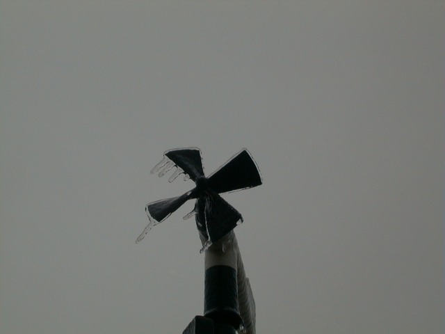
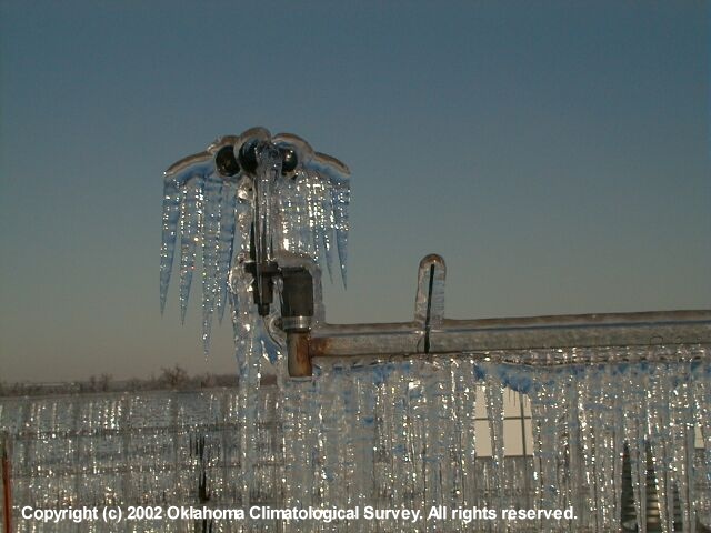
Some of the best and earliest indicators of icing are Mesonet wind
observations. As ice accumulates on the propvanes, they slow down
and eventually grind to a halt. The resulting wind speeds of zero
serve as a signal that ice has begun to accumulate (at the ten-meter
height, anyway).

Some examples from the past:
Feb 2001:
Feb 2002:

The Mesonet's QA Manager (she's quick!) will "flag" wind monitors
that are iced up, so missing wind barbs may also indicate icing.

Air temperatures near or below 32 F can also be monitored closely
on the current weather map.

The Weather Trends section:
http://www.mesonet.org/public/weathertrends.html

The incremental rainfall can show you how much precip has occurred
in the last X hours, but it can also serve the canary-in-coal-mine
function ("coal miner's water"?).  If you know precip is falling
from the sky, but the rainfall observations have stopped, it may
indicate freezing of precipitation at the rain gauge.  The rain
guages are located just inches above the surface.

Also in this section, you can keep an eye on the front's progress
with the temperature change maps.

Lastly, soil temperature maps:
http://www.mesonet.org/public/summary.html

These can show where ground temperatures are approaching freezing.
Soil temps aren't the most exact way to tell whether precip will
freeze on the surface, because a lot of physics can happen between
the two-inch-deep sensor and the surface.  But, they can provide
some useful information nonetheless.
January 4 in Mesonet History
| Record | Value | Station | Year |
|---|---|---|---|
| Maximum Temperature | 72°F | HOLL | 2022 |
| Minimum Temperature | -6°F | BOIS | 2015 |
| Maximum Rainfall | 5.42 inches | COOK | 1998 |
Mesonet records begin in 1994.
Search by Date
If you're a bit off, don't worry, because just like horseshoes, “almost” counts on the Ticker website!