Ticker for January 12, 2005
MESONET TICKER ... MESONET TICKER ... MESONET TICKER ... MESONET TICKER ...
January 12, 2005 January 12, 2005 January 12, 2005 January 12, 2005
Exceptional Warm Front Crosses - wait, Ravages - Oklahoma
Pity the poor warm front.
It inevitably shares its parent storm system with a sibling. But
physics has relegated it to a lower stature, far behind its burlier
brother: the cold front.
When a cold front moves to Point B, it goes with gusto. The surface
front is the leading edge of a denser airmass, which does its work
from the ground up. The warm front, on the other hand, plies
its trade meekly, dragged along as a reluctant boundary as warm air
slides over cool. It hardly trumpets its existence to the world,
and the boundary is often muddled into a weak, almost gradual,
contrast.
Our meteorological language drives home this infernal inferiority.
We would never think of insulting the cold front with such a
watered-down moniker as "cool front". Yet we obviously believe warm
fronts are unworthy of the word "hot". We celebrate cold fronts with
words like "invasion", "barrelling" and "howling". But for warm
fronts, we only indirectly recognize their existence, opting for
fuzzy descriptors like "warming trend" and "moisture return".
Even the early front-drawers knew this. They rewarded the cold front
with menacing teeth, while issuing polite -nay, feeble- little bumps
to the warm front.
Let's face it: when it comes to winning friends and influencing people,
warm fronts just don't have the gusto, pinache, verve or elan of cold
fronts. Storm after storm, season after season, year after year, warm
fronts invisibly perform their duties in the earth's unending quest to
put cold air where it belongs and the warm air where it belongs.
But once in a while, a warm front can muster the sharp gradient, the
howling wind shift and the heroic temperature change of its
oft-celebrated blue-toothed counterpart.
This morning a warm front did just that in southern Oklahoma. And
we've got to admit: it was impressive. In ten years of paying
attention to these types of things, the Entire Ticker Staff agrees
that we've never seen such a majestic warm front as that which
passed through Stigler this morning:
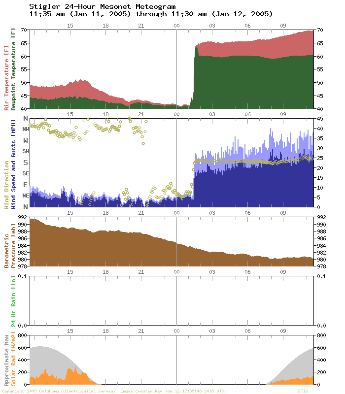
Look at that temperature spike! Twenty degrees warmer in just a
few minutes? Those are numbers that a cold front would brag about!
At one in the morning, nonetheless! And the wind shift: from light
and variable to howling out of the south at 20 mph?
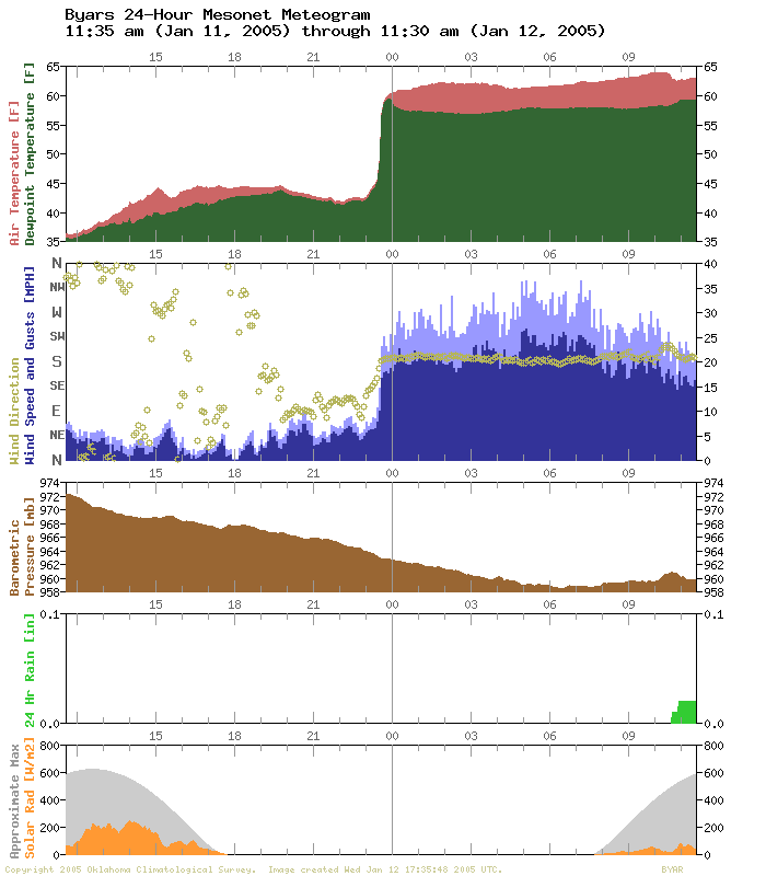
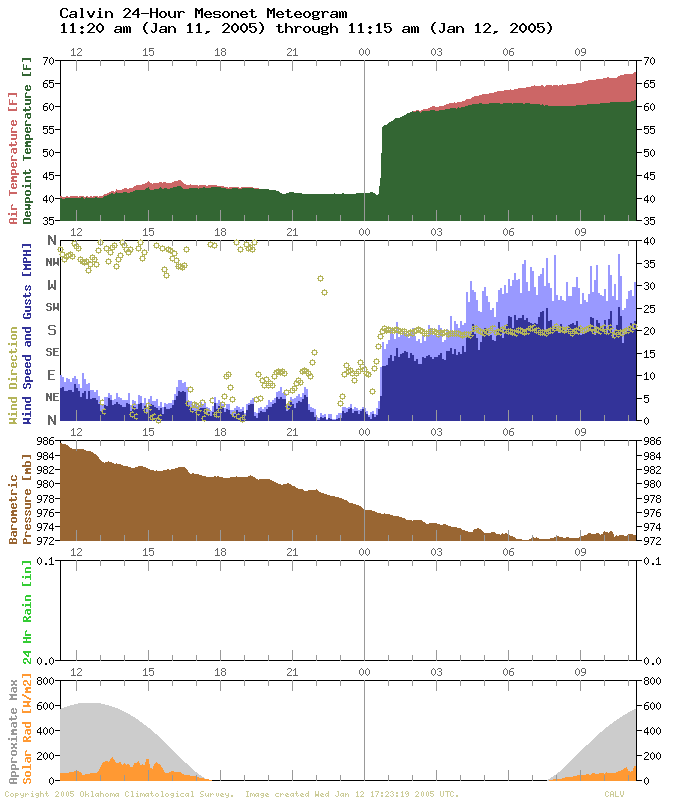
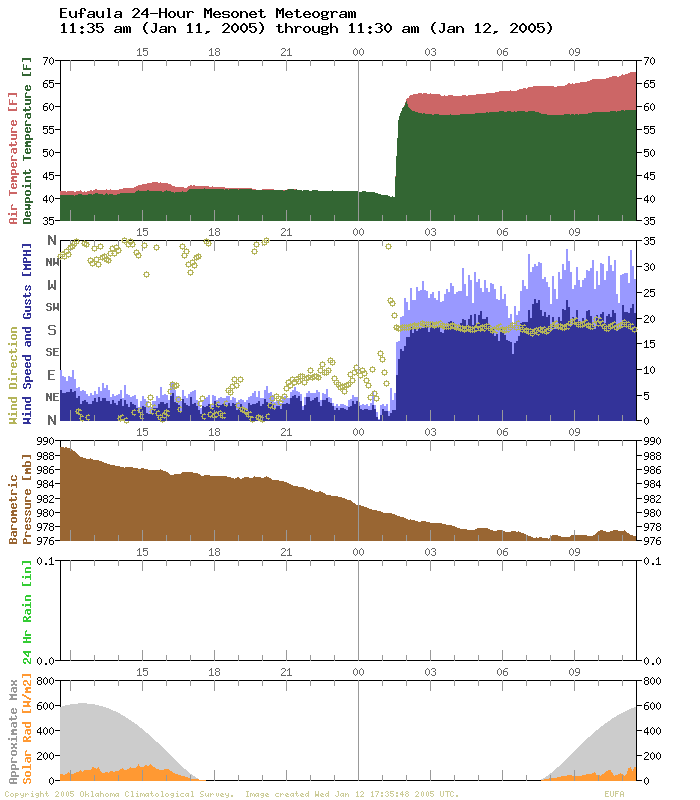
The same invading warm front barreled through Byars, Calvin, and
Eufaula, among other places:
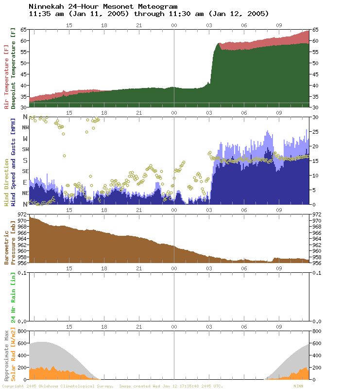
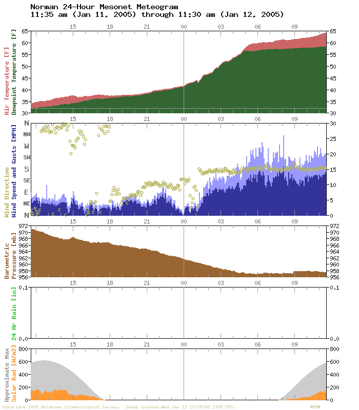
It shot through Ninnekah, but was curiously less abrupt at Norman:
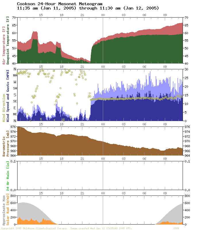
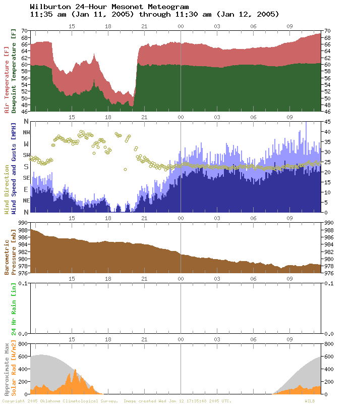
And, as if to show that whimsy was as much in its repertiore as
forcefulness, it toyed with Cookson and Wilburton in eastern Oklahoma:
After a few hours of glory, the warm front adopted the ways of so
many warm fronts before it: a gradual, almost anonymous warming trend.
As if compelled to return to the same diligent and thoroughly
unspectacular work to which its ilk has been typecast, it quietly
re-assumed its bland, underappreciated labors.
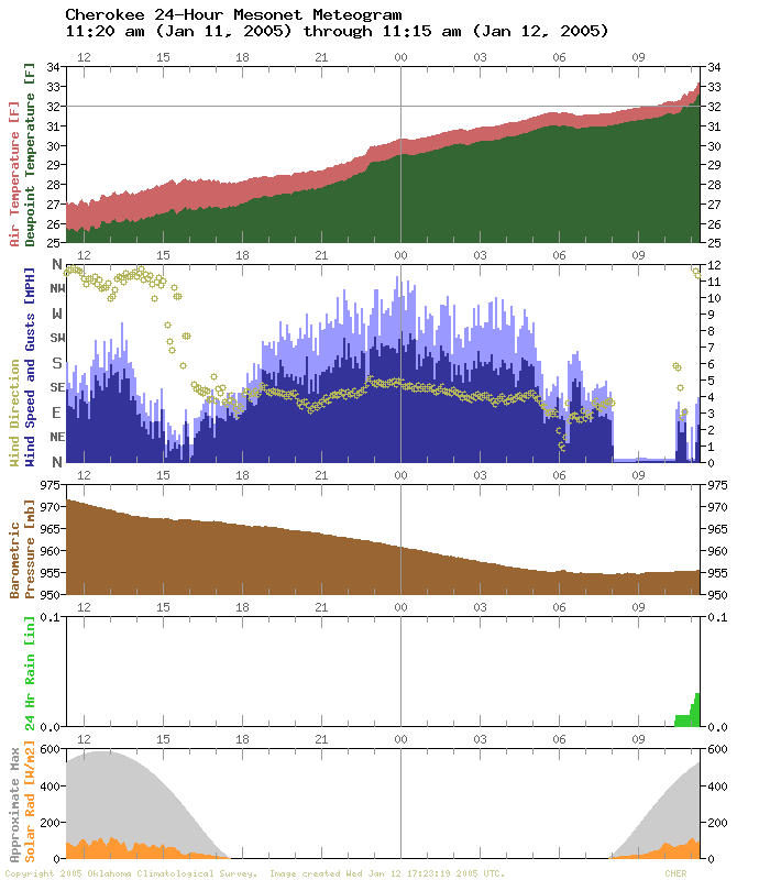
By the time the front reached Kansas, it even helped to melt a
few drips of frozen precipitation out of the Cherokee rain gauge:
By then, forecasters were already speaking of the next storm system,
and, yes ... its associated *cold* front.
Pity the poor warm front.
January 12 in Mesonet History
| Record | Value | Station | Year |
|---|---|---|---|
| Maximum Temperature | 80°F | BURN | 2000 |
| Minimum Temperature | -1°F | NEWK | 2011 |
| Maximum Rainfall | 2.10 inches | DURA | 2007 |
Mesonet records begin in 1994.
Search by Date
If you're a bit off, don't worry, because just like horseshoes, “almost” counts on the Ticker website!