Ticker for June 29, 2004
MESONET TICKER ... MESONET TICKER ... MESONET TICKER ... MESONET TICKER ...
June 29, 2004 June 29, 2004 June 29, 2004 June 29, 2004
A Big, Thick Steaming Bowl of Ticker Soup
There's a lot going on weather- and climate-wise this week, which is
not always the case in June. So, we'll take topics a couple at a
time over the next few days.
A Tale of Two Months
It's been the best of climes and the worst of climes this month.
The jet stream's month-long (and significantly anomalous) sojourn
to the north brought very warm temperatures to the state in May,
and these persisted though the first two weeks of June. Mother Nature
then over-compensated for her late-spring transgressions by delivering
a [relatively] chilly two weeks to close the month.
This mood swing shows up well when looking at this month's maximum
and minimum temperatures compared to normal:
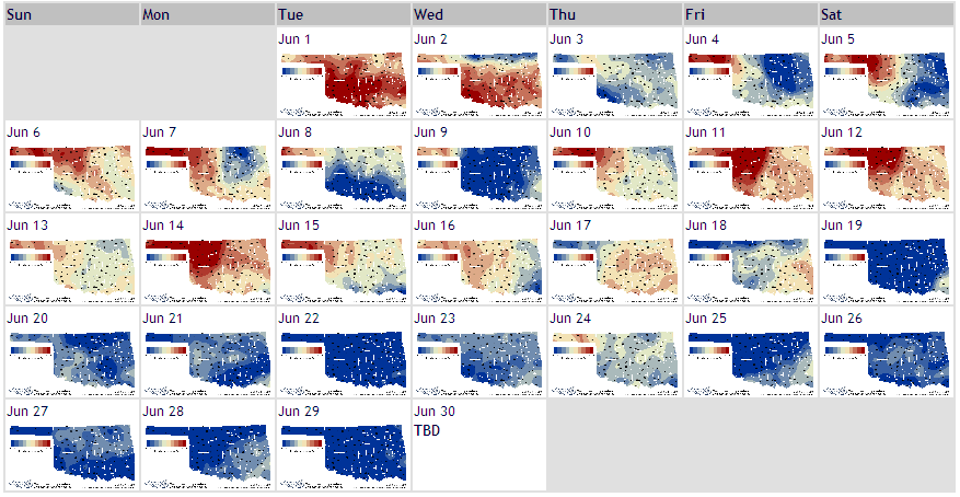

A couple of subtleties to note:
* Prolonged dry weather led to very dry soils by the first days
of June. These dry soils are evidenced in the large temperature
range in the first days of the month (note below-normal lows with
above normal highs). Dry soils plus copious June sunshine meant
that much of the sun's work went toward raising sfc temps during
the day.
* When the rains came, the soils moistened, allowing a growing
fraction of the sun's energy to be dedicated to latent heating
processes. As a result, daily ranges were smaller. For example,
this week's mins were near normal, with highs much less than
normal. This effect showed up in the eastern 2/3 of the state
within the first week of the month, and in the western third near
mid-month.
The June Sun: It's Powerful!
In late June, the sun is still very high in the sky, and its
appearance, however brief, can have a profound impact on weather
conditions. Take, for instance, yesterday afternoon's weather
at Spencer, detailed in its Mesonet meteogram:
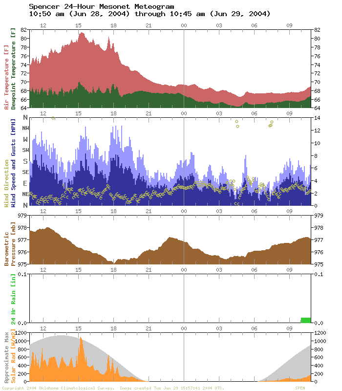
See the solar radation panel at the bottom? The orange value shows
the observed incident shortwave solar radiation (a ten-cent phrase
that means "sunlight" in English). The gray value shows an
approximate expected value under clear skies. So, during the times
that the orange trace neared the gray trace, the sun was out! The
Spencer meteograms shows several periods of clear or nearly-clear
skies: shortly after 3pm and shortly before 6pm.
Now check out the winds at Spencer (the blue traces). They peaked
at, you guessed it, shortly after 3pm and shortly before 6pm!
The temperature trace also shows higher temps in response to these
short periods of sunlight. And, if you look closely, you can see
elevated dew points at these times, too. These elevated dew points
are indicative of enhanced evaporative processes during the high-sun
intervals.
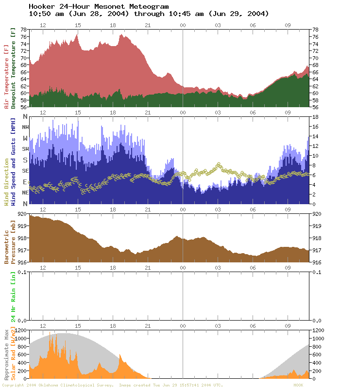
We've also included a meteogram from Hooker that shows the same
interplay between sunlight, winds and temperature:
Hooker's neighboring station, Goodwell, enjoyed a slightly (slightly!)
more uniform sun-day, and it's temperature and wind trace was
noticeably more consistent throughout the day:
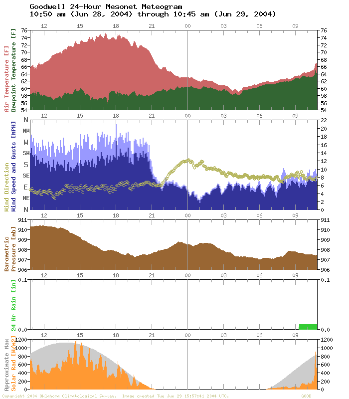
Once again, and we can't repeat this enough: Meteograms contain
some of the absolute BEST learning opportunities out there!
June 29 in Mesonet History
| Record | Value | Station | Year |
|---|---|---|---|
| Maximum Temperature | 111°F | HOOK | 1998 |
| Minimum Temperature | 47°F | GOOD | 2007 |
| Maximum Rainfall | 4.34 inches | CLAR | 1995 |
Mesonet records begin in 1994.
Search by Date
If you're a bit off, don't worry, because just like horseshoes, “almost” counts on the Ticker website!