Ticker for February 19, 2004
MESONET TICKER ... MESONET TICKER ... MESONET TICKER ... MESONET TICKER ...
February 19, 2004 February 19, 2004 February 19, 2004 February 19, 2004
Wind Borne Dust Strikes Again
Today's synoptic situation has many of the same characteristics as the
event that deposited dust and muddy rain on Chicago a few months ago.
Here's the Ticker from that event:
http://ticker.mesonet.org/select.php?mo=12&da=17&yr=2003
Anyway, today's strong dynamics generated some very strong surface
winds and pulled one heck of a dryline/dust storm in its wake. In
fact, take a look at this afternoon's radar imagery out of
Frederick:
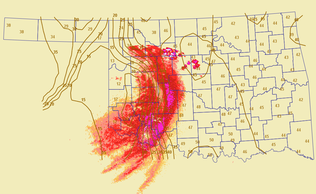
That large swath of radar reflectivities, unfortunately, is not
precipitation. It's the leading edge of a substantial wall of blowing
dust associated with very strong westerly winds behind the dryline.
Dew point temperatures (shown in brown on the map) are down around 10F
in much of western Oklahoma.
The dust comes from our neighboring states, namely West Texas and
Eastern New Mexico, which are suffering the same fate as western
Oklahoma today.
Or, as a kindly lady from Weatherford told the Ticker this afternoon:
"It tastes like Texas out here today."
(We choose to decline the very tempting and obvious editorial comment)
February 19 in Mesonet History
| Record | Value | Station | Year |
|---|---|---|---|
| Maximum Temperature | 81°F | ALTU | 2004 |
| Minimum Temperature | -8°F | CHIC | 2021 |
| Maximum Rainfall | 2.94 inches | BURN | 1997 |
Mesonet records begin in 1994.
Search by Date
If you're a bit off, don't worry, because just like horseshoes, “almost” counts on the Ticker website!