Ticker for February 16, 2004
MESONET TICKER ... MESONET TICKER ... MESONET TICKER ... MESONET TICKER ...
February 16, 2004 February 16, 2004 February 16, 2004 February 16, 2004
Hoary Frost Pics Return: This Time They're Native!
A couple of weeks ago, the Ticker ran some interesting shots of frost
deposition of several habits in Utah:
http://ticker.mesonet.org/select.php?mo=01&da=28&yr=2004
That particular Ticker generated quite a bit of e-mail feedback,
especially from residents of western Oklahoma, who see it more often
than those of us in our Ivory Ticker Tower suspected.
This weekend, Pete Thurmond snapped some beautiful frosty pictures
on his ranch near Cheyenne. The sumac plant is a Ticker favorite
for fall color, but here's a wonderful winter visual:
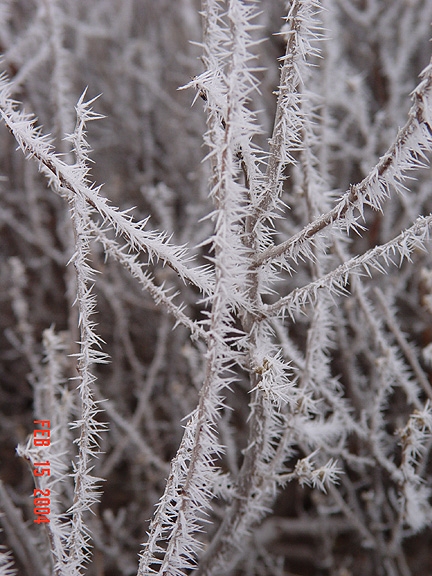
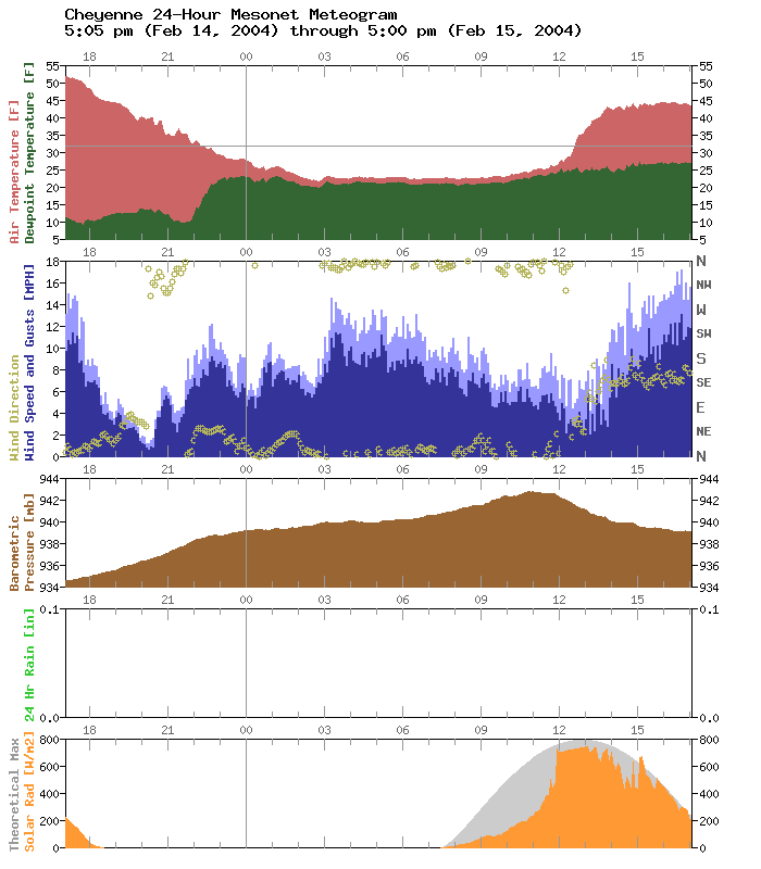
That photo was taken just a few hundred yards from the Cheyenne Mesonet
site. The Cheyenne meteogram from Friday night and Saturday morning
showed tremendous frosting potential, with temperatures and dew points
converging in the mid-20s for almost twelve hours:
Interestingly, Pete observed heavy frost on the southern end of his
ranch, but not the northern end, which lies a couple hundred feet lower.
The following two shots were taken near each end of the ranch:

(south end: about 2300 feet above sea level)
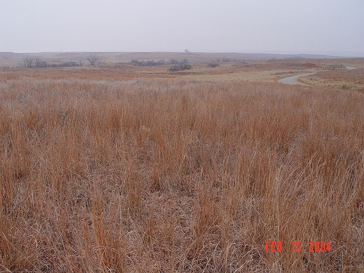
(north end: about 2100 feet above seas level)
The Ticker Staff tried to come up with insightful and profound closing
remarks, but we think Pete's words can't be beat:
"You wouldn't think the kind of elevation differences we have
in Oklahoma could make a difference in microclimate, but they do."
Thanks Pete!
February 16 in Mesonet History
| Record | Value | Station | Year |
|---|---|---|---|
| Maximum Temperature | 85°F | HOLL | 2011 |
| Minimum Temperature | -22°F | NOWA | 2021 |
| Maximum Rainfall | 3.37 inches | TALI | 2008 |
Mesonet records begin in 1994.
Search by Date
If you're a bit off, don't worry, because just like horseshoes, “almost” counts on the Ticker website!