Ticker for March 5, 2003
MESONET TICKER ... MESONET TICKER ... MESONET TICKER ... MESONET TICKER ...
March 5, 2003      March 5, 2003      March 5, 2003      March 5, 2003


Frontal Zone Soup and Air Mass Sandwich, Please

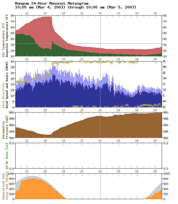
Yesterday's frontal antics left behind some interesting meteograms
in southwestern Oklahoma.  Take, for instance, yesterday afternoon's
dew point trace at Mangum:


A dryline punch shows up as a decreasing dew point during the early
afternoon, and the cold front shows up as an abrupt (and we mean
*abrupt*) increase in dew point.

... wait a second ...

How could this mass of very cold, very dry air show up as an upward
spike in dew point? ... hmmm ...

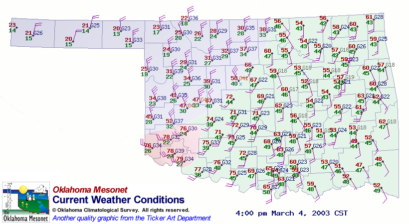
Take a look at the 4:00 pm weather map, as a cold front bears down
on Mangum:


The light green area represents the air mass that graced the state for
the last few days: notice that dew point temperatures here were in
the mid 40s.  The pink area is the portion of the state behind
yesterday's dry line that invaded from west Texas.  The blue area
is the part of the state behind the cold front at 4:00 pm.

The dew points in northwest Oklahoma were 20 degrees or less, which is
representative of the larger air mass to follow.  But notice the dew
points along the cold air mass's leading edge: they're in the 30s!
This is an example of the mixing that goes on along the frontal zone.

In other words, as the leading edge of the "blue" air plowed across
the region, it mixed in some of the "green" air along the way.
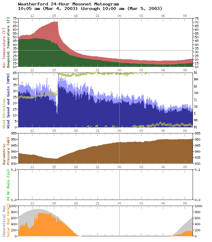
In a region where the dry slot didn't exist, the dew point trace
gradually assumed the characteristics of the "blue" air mass:


Because this process takes time (it took hundreds of miles and several
hours to mix in the characteristics of the "green" air), there wasn't
much of a "pink" component in the frontal zone soup at Mangum.
As a result, the dew point at Mangum immediately jumped to the mid-30s
values of the blue-green mix, giving us a dandy meteogram.
March 5 in Mesonet History
| Record | Value | Station | Year |
|---|---|---|---|
| Maximum Temperature | 92°F | ALTU | 2009 |
| Minimum Temperature | -2°F | KENT | 2019 |
| Maximum Rainfall | 0.80″ | REDR | 2021 |
Mesonet records begin in 1994.
Search by Date
If you're a bit off, don't worry, because just like horseshoes, “almost” counts on the Ticker website!