Ticker for March 4, 2003
MESONET TICKER ... MESONET TICKER ... MESONET TICKER ... MESONET TICKER ...
March 4, 2003 March 4, 2003 March 4, 2003 March 4, 2003
Now That's A Cold Front!
A whopper of a cold front is screaming across Oklahoma this afternoon,
plunging temperatures from the 60s and even 70s down to the low 20s:
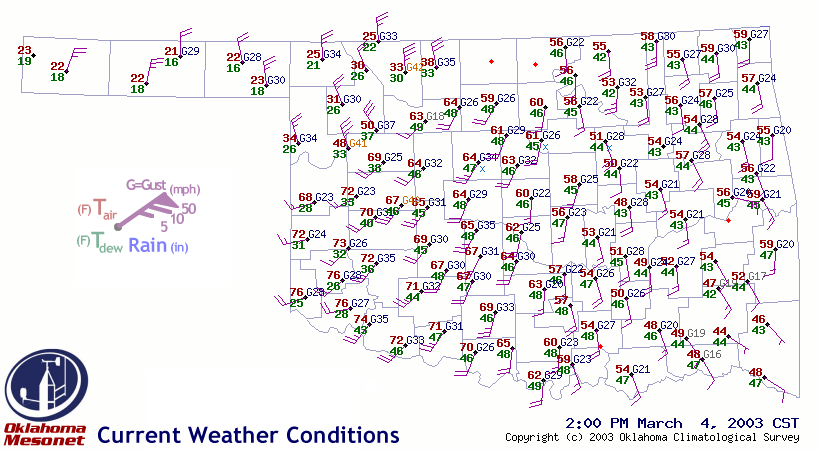
Ahead of the front, it's a tale of several distinct modes: calm, cloudy
and cool in the southeast; mild, windy and dry in central and northeast
Oklahoma; and warm, very windy and very dry in the southwest.
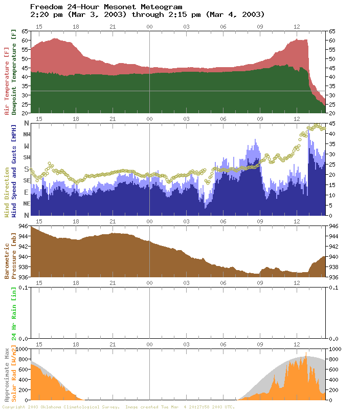
The Freedom Mesonet meteogram shows just how dramatically the front
is arriving in northwestern Oklahoma:
A look at changes over the last 24 hours tells the story. Temps are
crashing behind the front, as much as 40 degrees lower than yesterday.
Cloud cover in the east has suppressed heating a bit, and a dryline
punch into the southwest is responsible for much warmer and much
drier air compared to yesterday:
Air temps: 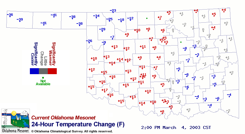
Dewpoints: 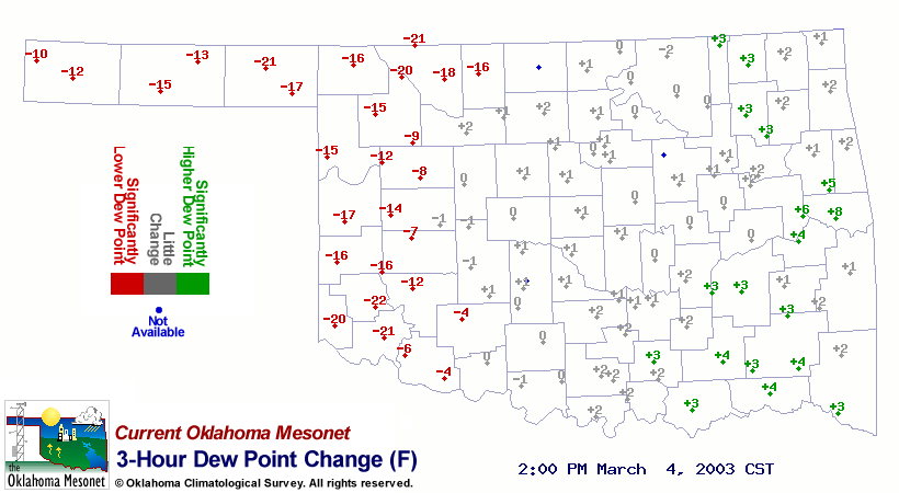
Cool Topo Effect
Dr. Jeff Basara, OCS's Director of Research, points out a cool
topographic effect behind the aforementioned dryline.
Data from the West Texas Mesonet shows the effect of strong westerlies
coming off the South Plains of Texas over the Cap Rock Escarpment.
Anybody who's travelled in the area (to a Texas Tech game, perhaps)
knows how substantially the Cap Rock stands over the north Texas plains.
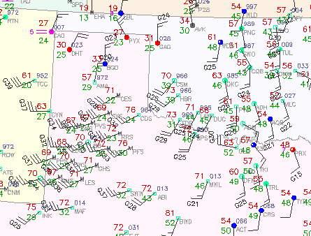
It's a bit difficult to read, but that cluster of stations south of
Amarillo is the West Texas Mesonet. Notice the temperatures at its
eastern stations (mid-to-upper 70s) compared those at its western
stations (around 70). That represents warming brought on by a
rapid change in elevation, on the order of a 1000 feet or so.
The Ticker staff did some messing around with dry adiabatic lapse rates
(exciting neurons that have slept for years), and these temperature
differences of five or six degrees Fahrenheit are right in line!
March 4 in Mesonet History
| Record | Value | Station | Year |
|---|---|---|---|
| Maximum Temperature | 91°F | HOLL | 2009 |
| Minimum Temperature | -5°F | VINI | 2002 |
| Maximum Rainfall | 5.31″ | KING | 2004 |
Mesonet records begin in 1994.
Search by Date
If you're a bit off, don't worry, because just like horseshoes, “almost” counts on the Ticker website!