Ticker for April 18, 2002
MESONET TICKER ... MESONET TICKER ... MESONET TICKER ... MESONET TICKER ...
April 18, 2002     April 18, 2002     April 18, 2002     April 18, 2002


MCS Leaves Signature on Norman Meteogram

The Ticker's Meteogram Appreciation Week continues today with a
great catch by Dr. Jeffrey Basara, OCS's Director of Research and
OU School of Meteorology Adjunct Assistant Professor.

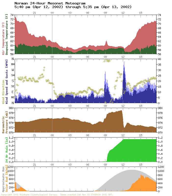
The following meteogram is from Saturday morning at Norman:


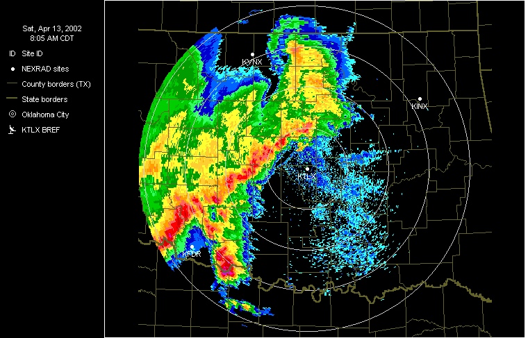
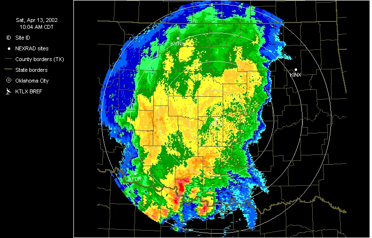
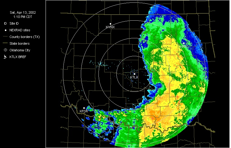
During the late morning hours, a mesoscale convective system passed
from west to east across the area:


The leading edge approached Norman at about the nine o'clock hour,
with gusty winds, heavy rainfall and a bit of a temperature spike.

The MCS's associated mesohigh shows up clearly in the meteogram's
pressure panel.  At 9:00, the station pressure rises noticably.
During three-hours or so of moderate-to-heavy rainfall (the last
2.5 hours at a remarkably constant rate, by the way), the station
pressure remained at this elevated level.  But at about about noon,
the pressure crashed and crashed hard: about 7 mb in fifteen minutes.

Notice the wind's behavior at this time: 20-25 minutes of sustained
strong winds ... from the east.  These winds were related to the
concurrent sharp pressure drop because they were the result of gradient
flow from the mesohigh to the wake low that trailed the MCS (which
shows up nicely in the final radar panel above).

Just a few minutes later, the winds had subsided and begun a slow
return to southerly.  And the station pressure returned to the
synoptic-scale tendencies it had followed before being interrupted
by the mesohigh/wake low couplet.
April 18 in Mesonet History
| Record | Value | Station | Year |
|---|---|---|---|
| Maximum Temperature | 101°F | ALTU | 2011 |
| Minimum Temperature | 22°F | BOIS | 2013 |
| Maximum Rainfall | 3.17″ | TAHL | 2009 |
Mesonet records begin in 1994.
Search by Date
If you're a bit off, don't worry, because just like horseshoes, “almost” counts on the Ticker website!