Ticker for April 17, 2002
MESONET TICKER ... MESONET TICKER ... MESONET TICKER ... MESONET TICKER ...
April 17, 2002     April 17, 2002     April 17, 2002     April 17, 2002


Another Great Meteogram

The Ticker staff loves meteograms.  There's always so much packed in
24 hours of data!

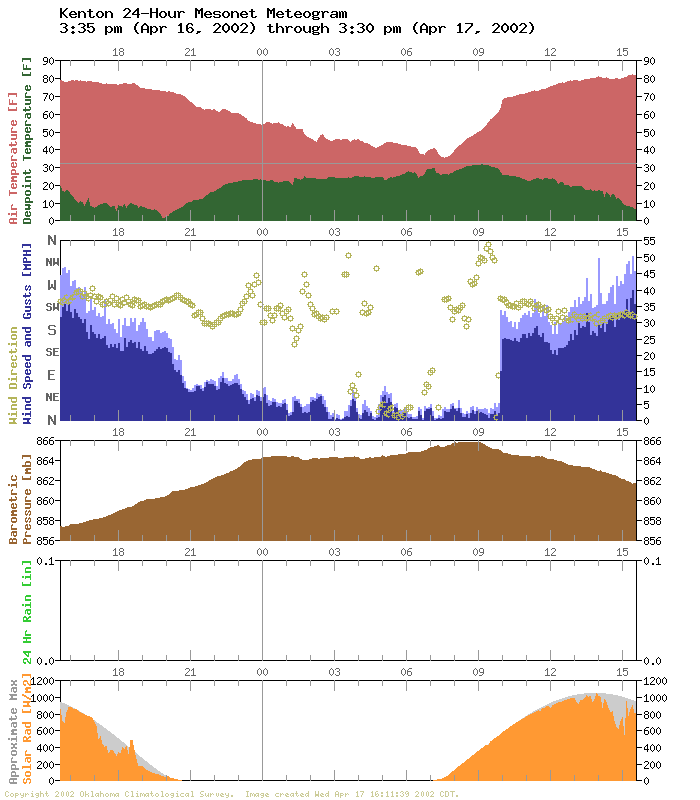
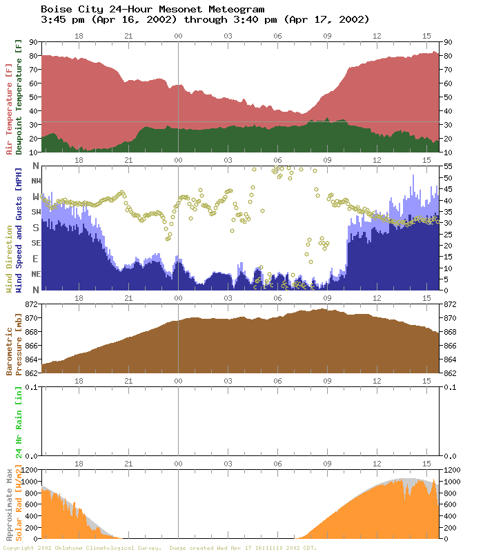
Today's meteograms at Kenton and Boise City in the western panhandle
show a very unusual feature:


Note the wind speed and direction panel.  Both stations observed light
and variable winds most of the morning, then a rapid (we mean *rapid*)
return to strong southerly winds.  It looks a lot like a cold front's
passage, in terms of the abruptness of the feature, but it's obviously
not a cold front.

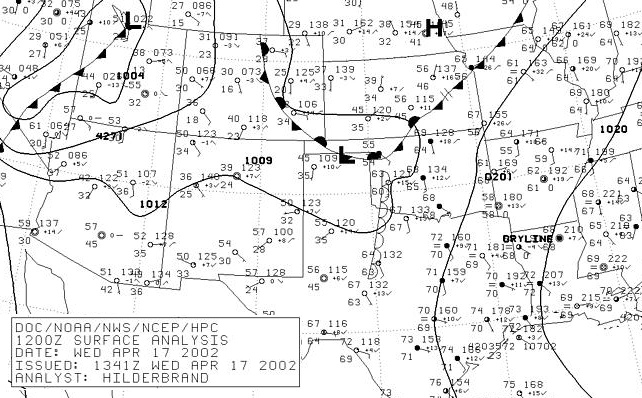
The feature is associated with the remnants of a front that nosed into
the panhandle overnight, as depicted in this surface plot from the
National Weather Service:


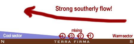
After a chilly morning, temperatures in the western panhandle rose
quickly with the sun.  The front's retreat (or, its outright
dissolution) was hastened by mixing processes that eroded its very
shallow leading edge.  When that happened, the western panhandle
found itself in a very windy warm sector!  Also notice that at this
point on both meteograms, the rise in surface temperatures shifted
to a new rate.

The Ticker Art Department (volunteers, obviously) drafted the
following cartoon to present the concept:


Except for storm-related features, it is very rare for southerly
winds to introduce themselves so abruptly and so dramatically as they
did in the panahndle today.
April 17 in Mesonet History
| Record | Value | Station | Year |
|---|---|---|---|
| Maximum Temperature | 102°F | GRA2 | 2006 |
| Minimum Temperature | 22°F | BOIS | 2020 |
| Maximum Rainfall | 6.57 inches | MEDI | 2013 |
Mesonet records begin in 1994.
Search by Date
If you're a bit off, don't worry, because just like horseshoes, “almost” counts on the Ticker website!