Ticker for February 22, 2001
MESONET TICKER ... MESONET TICKER ... MESONET TICKER ... MESONET TICKER ...
February 22, 2001 February 22, 2001 February 22, 2001 February 22, 2001
Sunny Corridor Apparent Across Oklahoma
Today, a corridor of cloud-free skies stretched north-south across the
state, which brought about some interesting observations.
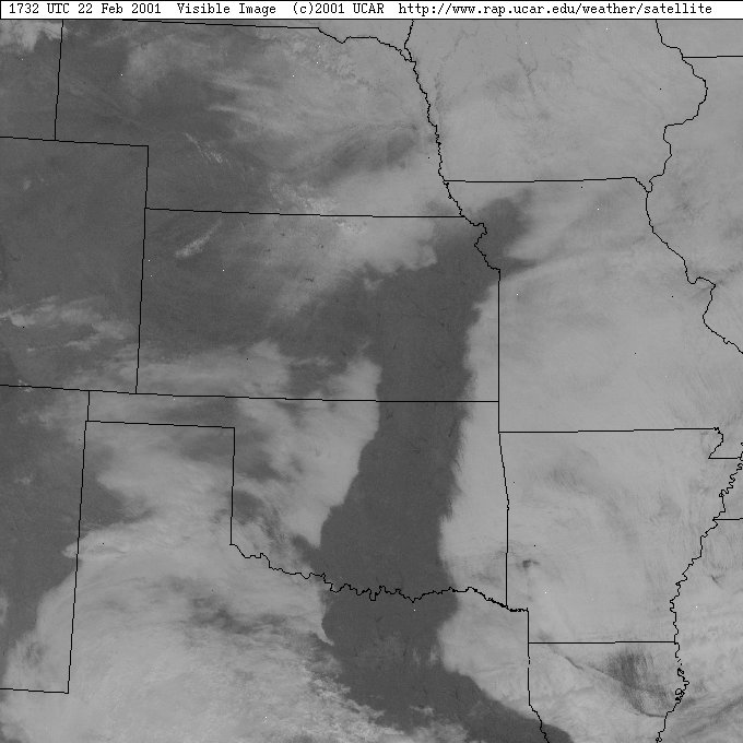
Here's a satellite image from about 11:30 this morning:
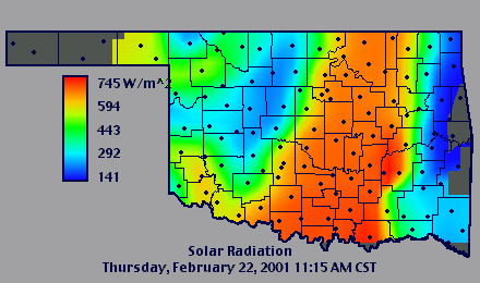
Here's the same cloud deck as "Seen" by the Oklahoma Mesonet's solar
radiation sensors:
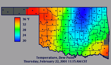
Air at the surface was considerably drier in the clear belt than that
under cloudy conditions:
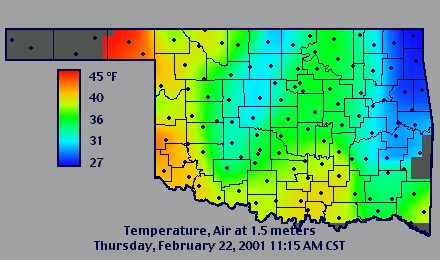
By late morning, temperatures in this drier, sunnier belt began to
outpace the rest of the state:
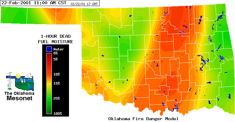
In fact, the dry, warmer conditions meant that fuel moisture in the
belt dropped dramatically:
By late afternoon, the eastern edge of the cloud shield had held its
ground, for the most part:

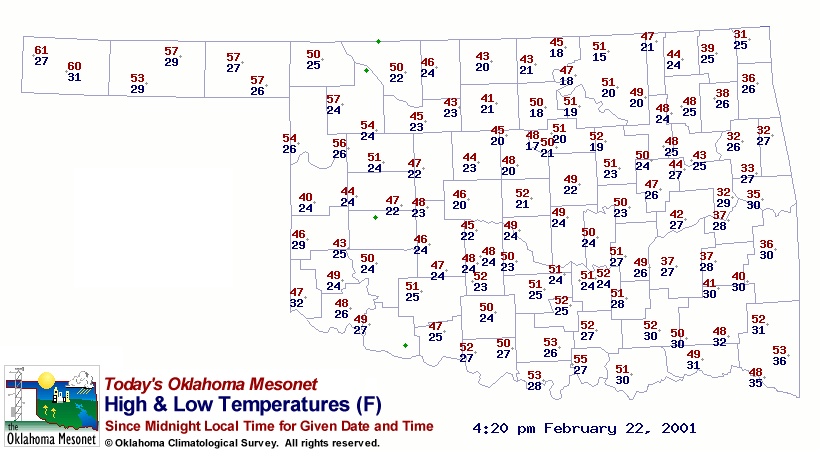
Locations that remained under this cloud shield had considerably
lower maximum temperatures (note the max temps in the 30s in the eastern
tier of counties compared to 40s and 50s just a few miles west):
February 22 in Mesonet History
| Record | Value | Station | Year |
|---|---|---|---|
| Maximum Temperature | 86°F | HOLL | 2017 |
| Minimum Temperature | -2°F | HOOK | 2013 |
| Maximum Rainfall | 2.74 inches | BROK | 2018 |
Mesonet records begin in 1994.
Search by Date
If you're a bit off, don't worry, because just like horseshoes, “almost” counts on the Ticker website!