Ticker for September 21, 2000
MESONET TICKER ... MESONET TICKER ... MESONET TICKER ... MESONET TICKER ...
September 21, 2000 September 21, 2000 September 21, 2000 September 21, 2000
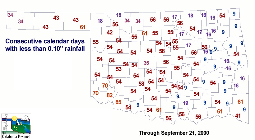
Yet Another Dry Day
For about two-thirds of the state, it's been more than a month without
significant rainfall, and the majority of the state is within a week
of making it two months. The following graphic depicts the number of
consecutive days with less than 0.10" rainfall at each Mesonet station.
After reading the NWS forecasts, we've taken the liberty of assuming
today's (lack of) results.
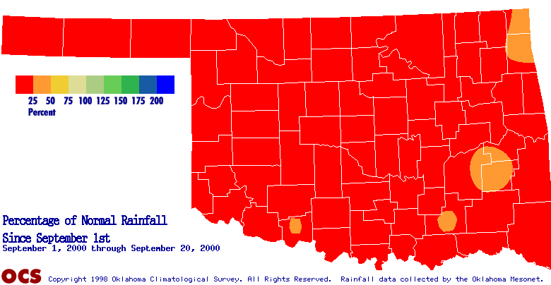
The stations which have received some rainfall in the last month are
still very below normal for the month and season. The following two
graphics show percentage of normal rainfall since August 1 and since
September 1, respectively.
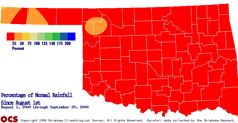
According to data from the Oklahoma Mesonet, none of Oklahoma's nine
climate divisions have observed even one-fifth of normal rainfall
since August 1st. Eight of the climate divisions, and the statewide
average, are below ten percent of normal rainfall for that period.
The Oklahoma Climatological Survey maintains a Drought 2000 Update
page at
http://climate.mesonet.org/drought2000/
The page is updated with the latest Mesonet data every 24 hours.
September 21 in Mesonet History
| Record | Value | Station | Year |
|---|---|---|---|
| Maximum Temperature | 103°F | WALT | 1998 |
| Minimum Temperature | 38°F | NOWA | 2000 |
| Maximum Rainfall | 14.20 inches | FITT | 2018 |
Mesonet records begin in 1994.
Search by Date
If you're a bit off, don't worry, because just like horseshoes, “almost” counts on the Ticker website!