Ticker for February 17, 2000
MESONET TICKER ... MESONET TICKER ... MESONET TICKER ... MESONET TICKER ...
February 17, 2000 February 17, 2000 February 17, 2000 February 17, 2000
Active Weather Day
Daylight unfolded on severe thunderstorms over large parts of the state.
Gusty winds and locally heavy precipitation were observed over the eastern
two-thirds of the state, including these Mesonet rainfall totals:
Tahlequah 1.37"
Marshall 1.13"
Bowlegs 0.92"
Waurika 0.91"
Porter 0.91"
Okemah 0.85"
Ninnekah 0.82"
Washington 0.81"
As those storms weakened and/or exited Oklahoma, high wind warnings were
issued for the panhandles of Oklahoma and Texas. The Boise City and
Kenton Mesonet stations both recorded gusts over 40 mph for much of this
afternoon.
This afternoon, roughly the southern half of the state is under a tornado
watch and the northwestern quarter (excluding the western panhandle) is
under a severe thunderstorm watch.
As a warm front surges north of the Red River shortly after 4:00 pm
(notice the stiffer southerly winds and higher temps along the
southernmost tier of counties west of I-35)
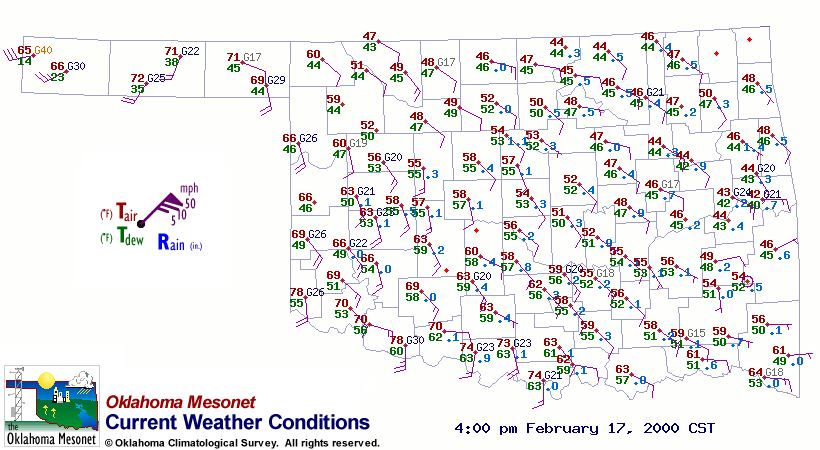
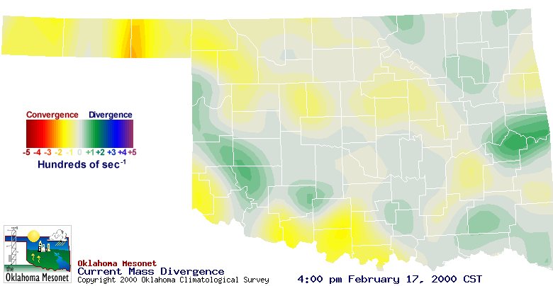
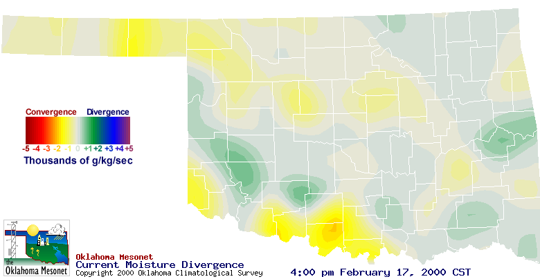
Mesonet convergence and moisture convergence products are picking up
its signal:
February 17 in Mesonet History
| Record | Value | Station | Year |
|---|---|---|---|
| Maximum Temperature | 85°F | ALTU | 2011 |
| Minimum Temperature | -2°F | HOLL | 2021 |
| Maximum Rainfall | 1.56 inches | TULN | 2022 |
Mesonet records begin in 1994.
Search by Date
If you're a bit off, don't worry, because just like horseshoes, “almost” counts on the Ticker website!