Ticker for January 4, 2000
MESONET TICKER ... MESONET TICKER ... MESONET TICKER ... MESONET TICKER ...
January 4, 2000 January 4, 2000 January 4, 2000 January 4, 2000
All Quiet West of the Cold Front
As most of you know, FROPA is meteorologese for "frontal passage", and
we had quite a FROPA yesterday. The cold front rolled in with an army
of low clouds and stong northerly winds bringing up the rear.
After attacking western Oklahoma with below-zero wind chills, the front
advanced in to the Ark-La-Tex and spawned some severe weather, even
tornadoes, in the process.
Today, western Oklahoma has warmed back up and temperatures have returned
into the 50s in some locations.
Take a look at the surface ridge, indicated by the Mesonet wind field,
in the following graphic:
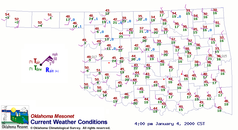
The surface ridge seems to run from roughly Pawhuska to OKC to Lawton.
Now look at the 24-hour temperature change map at:
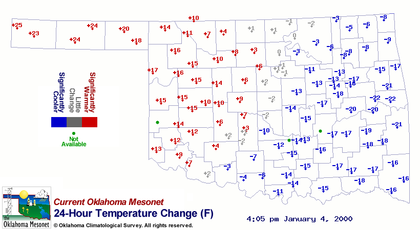
The greatest temperature recovery is west of the ridge line! Admittedly,
much of this has to do with the position of the front 24 hours ago, but
it's not entirely coincidental.
January 4 in Mesonet History
| Record | Value | Station | Year |
|---|---|---|---|
| Maximum Temperature | 72°F | HOLL | 2022 |
| Minimum Temperature | -6°F | BOIS | 2015 |
| Maximum Rainfall | 5.42 inches | COOK | 1998 |
Mesonet records begin in 1994.
Search by Date
If you're a bit off, don't worry, because just like horseshoes, “almost” counts on the Ticker website!