Ticker for August 23, 1999
MESONET TICKER ... MESONET TICKER ... MESONET TICKER ... MESONET TICKER ...
August 23, 1999 August 23, 1999 August 23, 1999 August 23, 1999
Avoiding the Obvious for the Moment ...
There's a lot going on in the weather today! Hurricane Bret made
landfall along the south Texas gulf coast last night, and a cold
front is prompting showers in Oklahoma this morning.
All of this fun weather is great, but the Ticker would like to
present a subtlety from this morning's Mesonet data. A quick look
at the 24-hour temperature change map shows the effect of an
approaching cold (well, for August, anyway) front on a summer night:

Dew points near 70 F and enhanced southerly winds mean warmer
overnight and morning temperatures, and that's exactly what the
graphic shows. A well-defined nose of warmer morning temperatures
(sompared to yesterday) is easily discernible on the warm side of
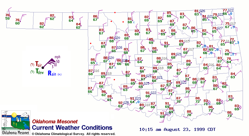
front. For reference here was the weather map at that time:
The eastern half of the state may get some relief
with a frontal passage this afternoon, but they paid their dues
this morning!
August 23 in Mesonet History
| Record | Value | Station | Year |
|---|---|---|---|
| Maximum Temperature | 113°F | ALTU | 2024 |
| Minimum Temperature | 52°F | NOWA | 2009 |
| Maximum Rainfall | 5.40 inches | BEAV | 2019 |
Mesonet records begin in 1994.
Search by Date
If you're a bit off, don't worry, because just like horseshoes, “almost” counts on the Ticker website!