Ticker for August 20, 1999
MESONET TICKER ... MESONET TICKER ... MESONET TICKER ... MESONET TICKER ...
August 20, 1999 August 20, 1999 August 20, 1999 August 20, 1999
Fire Danger Continues to Rise
A quick look at today's Keetch-Byram Drought Indices shows that
dryspell conditions have certainly taken hold in southern and eastern
Oklahoma. Values above 600 are commonplace in these regions.
Pat McDowell of the Oklahoma Dept. of Agriculture's Foresty Divisions
reports that fire danger conditions are definitely in a bulding mode.
The Forestry Division responded to 31 wildfires yesterday alone.
The blazes burned ore than 4500 acres yesterday.
The Latest KBDI image is available at:
http://agweather.mesonet.org/fire/data/1999081922kd.html
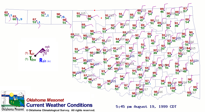
Dew Point Minimum Shows Up Again
For the second straight day, a marked minimum and dewpoint temperatures
has materialized in Oklahoma. The latest Oklahoma weather map at
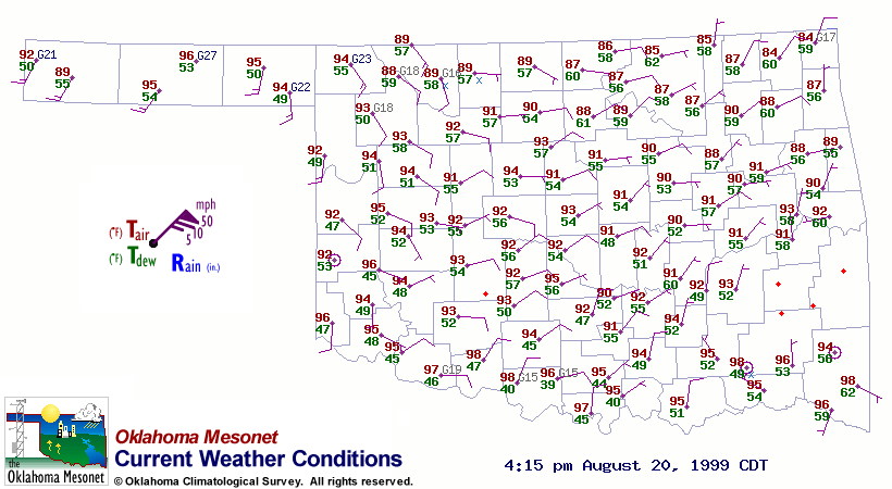
shows the minimum developing in south-central Oklahoma. As of 4:00 pm,
the Ringling dew point was 39 F!
A very similar pocket showed up yesterday afternoon in central Oklahoma.
An image is available at:
Perhaps evidence of "dry convection" behind the front?
latest Mesonet weather map.
August 20 in Mesonet History
| Record | Value | Station | Year |
|---|---|---|---|
| Maximum Temperature | 111°F | WAUR | 2023 |
| Minimum Temperature | 47°F | ELRE | 2015 |
| Maximum Rainfall | 3.45 inches | MAYR | 1996 |
Mesonet records begin in 1994.
Search by Date
If you're a bit off, don't worry, because just like horseshoes, “almost” counts on the Ticker website!