Ticker for July 22, 1999
MESONET TICKER ... MESONET TICKER ... MESONET TICKER ... MESONET TICKER ...
July 22, 1999 July 22, 1999 July 22, 1999 July 22, 1999
It's Not the Heat. It's the humidity. But it's a dry heat. etc...
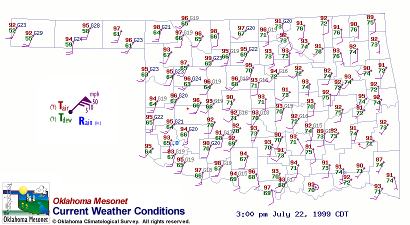
Today, temperatures have risen into the mid 90s in western Oklahoma
and into the low 90s in eastern Oklahoma. So why are heat index
values higher in the east?
It's because eastern Oklahoma's temperatures are carrying a little
baggage, in the form of mid 70s dewpoint temperatures. Western
Oklahoma is basking in comparatively dry mid 60s dew points.
Current Wx Map (updated every 15 minutes):

Current Heat Index Map (updated every 15 minutes):

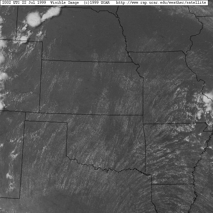
Cu Clouds Take a Photo Op
Nothing particularly earth-shattering here, just a neat satellite
image. Notice how the cumulus clouds line up with the surface wind
field ("looks like iron fillings near a magnet", according to the
Mesonet quality assurace guru).
3 pm wind field:
3 pm visible satellite image:
July 22 in Mesonet History
| Record | Value | Station | Year |
|---|---|---|---|
| Maximum Temperature | 112°F | GRA2 | 2018 |
| Minimum Temperature | 56°F | GOOD | 2006 |
| Maximum Rainfall | 2.75 inches | BEAV | 2015 |
Mesonet records begin in 1994.
Search by Date
If you're a bit off, don't worry, because just like horseshoes, “almost” counts on the Ticker website!