MESONET TICKER ... MESONET TICKER ... MESONET TICKER ... MESONET TICKER ...
December 29, 2017 December 29, 2017 December 29, 2017 December 29, 2017
Another normal extreme year
Normally Oklahoma weather is quite extreme, but Oklahoma weather being normal is
also an extreme. So we're extremely proud to present this year's extremes as
recorded by the Oklahoma Mesonet. We normally do this at the end of the year, and
we're extremely proud of the Mesonet's ability to capture these extremes.
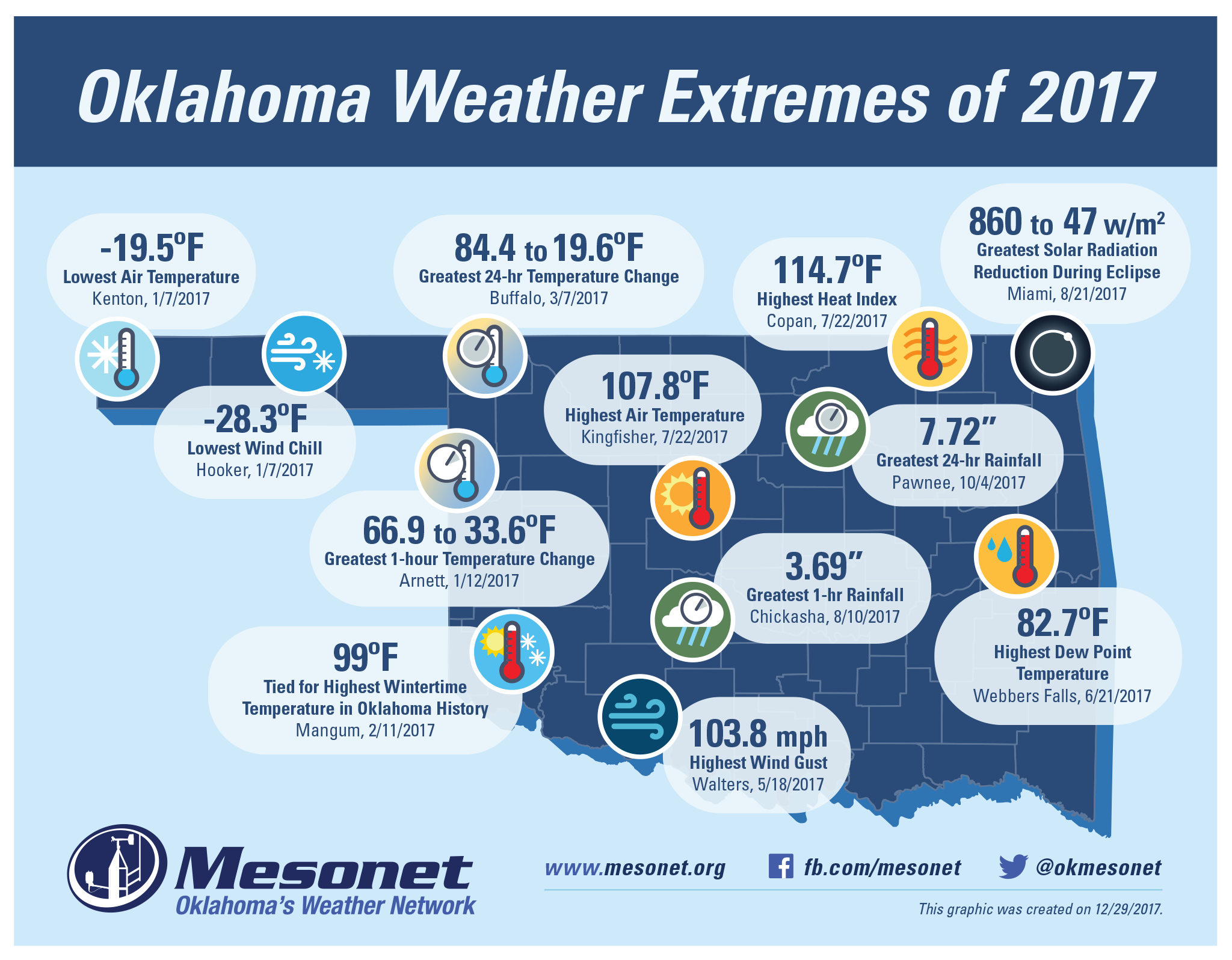
Without further ado, THE OKLAHOMA WEATHER EXTREMES OF 2017, as measured/calculated/
recorded by the Oklahoma Mesonet.
http://ticker.mesonet.org/archive/20171229/2017.Mesonet.Weather.Extremes.png
Now normally we'd be extremely confident posting a map like this on Dec. 29, but
as per usual for Oklahoma, we have have more extreme weather on tap for this
weekend. Oh, that high temperature of 107.8 degrees at Kingfisher is safe. As is
the 7.72 inches of rainfall in 24 hours at Pawnee. I'm positive the heat index
of 114.7 degrees at Copan is gonna stand. I'm even somewhat confident that the
-19.5 degrees at Kenton recorded last January 7 is safe (for those that don't
remember, that was the one day it was cold last winter). Not so sure about the
wind chill of -28.3 degrees at Hooker that day. If anybody would give us trouble,
it would be the Kenton Mesonet site. Or it's cold, calculating sister Eva just
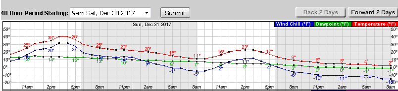
to its east. But I see the NWS wind chill forecast for Kenton "only" dropping
to a balmy -10 degrees by 12am New Year's Day.
http://ticker.mesonet.org/archive/20171229/kenton-temp-forecast.png
However, it's the Panhandle, where extremes are eaten for breakfast. A stray
gust here or there...what we're getting at is IF one of these extremes through
December 29 is surpassed in the next two days, we will issue an updated map.
Given what parameters are more apt to be surpassed, let's hope we stand pat!
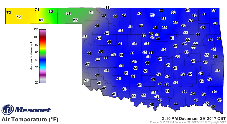
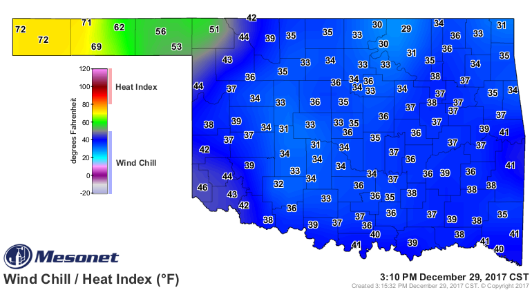
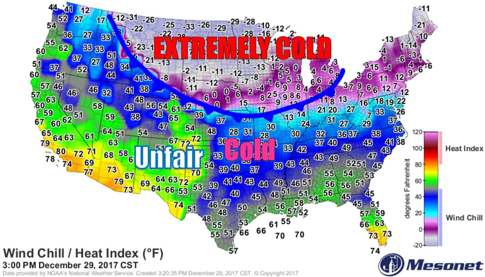
And talk about extremes, how about 70s in the western Panhandle right now,
yet it feels like the 30s everywhere else? How's that fair? Not only do those
Panhandlers get to live in the best part of the state, they get to be warm too?
http://ticker.mesonet.org/archive/20171229/current-temps.png
http://ticker.mesonet.org/archive/20171229/current-windchills.png
The barbarians are at the northern gate, my friends. It's about to get extreme.
http://ticker.mesonet.org/archive/20171229/barbarians.png
Gary McManus
State Extremeologist
Oklahoma Mesonet
Oklahoma Climatological Survey
(405) 325-2253
gmcmanus@mesonet.org
==================================================
The OCS/Mesonet Ticker
https://ticker.mesonet.org/
To subscribe or unsubscribe from the Ticker
or for questions about the Ticker or its content
Phone or Email the Ticker Manager at OCS
Phone: 405-325-2253 Email: ticker@mesonet.org
---------------------------------------------------
-C- Copyright 2024 Oklahoma Climatological Survey
===================================================
|


 Tweet
Tweet