MESONET TICKER ... MESONET TICKER ... MESONET TICKER ... MESONET TICKER ...
December 10, 2015 December 10, 2015 December 10, 2015 December 10, 2015
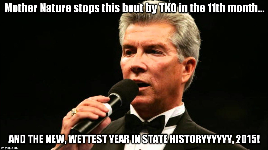
DOWN GOES 1957! DOWN GOES 1957!
http://ticker.mesonet.org/archive/20151210/buffer.jpg
What a monumental year for precipitation in Oklahoma! The official numbers
released yesterday by NCEI indicate that November finished as the second wettest
on record for Oklahoma (dating back to 1895) with a statewide average of 5.91
inches, just on the heels of November 2004's 5.97 inches. That brought the
January-November statewide average to an official total of 48 inches on the dot,
13.56 inches above normal.
Not only is that the wettest January-November on record, the 48 inches tops 1957's
January-December record annual total of 47.88 inches, with 3 weeks to spare!
That, ladies and gentlemen, is a TKO!
Just looking at the monthly graph, you can see which months propelled us to the
record. Obviously May, which ended not only as the wettest May on record but the
wettest MONTH on record (for any month), topping October 1941's 10.75 inches with
a whopping 14.44 inches.
http://ticker.mesonet.org/archive/20151210/2015-rainfall-graph.png
And of course the wet April and July played their part, and November finished
1957 off. The April-July statewide average of 29.53 inches was also the wettest
such period on record for the state. Odd also to see that 6 of the 11 months
thus far were below normal, first when drought was going strong from January
through March (mid-April really) and later when the flash drought struck from
August through October (mid-October really). Here's an official accounting for
each month versus the 1981-2010 normals, as calculated by NCEI (the National
Centers for Environmental Information), formerly known as NCDC (the National
Climatic Data Center).
-***-
Month Statewide Average Departure from Normal Rank
-----------------------------------------------------------------------------
January 1.21" -0.35" 56th Driest
February 1.18" -0.65" 48th Driest
March 2.41" -0.63" 67th Driest
April 4.85" +1.59" 17th Wettest
May 14.44" +9.62" 1st Wettest
June 4.81" +0.29" 35th Wettest
July 5.43" +2.55" 8th Wettest
August 2.45" -0.50" 51st Driest
September 2.05" -1.48" 31st Driest
October 3.26" -0.28" 43rd Wettest
November 5.91" +3.40" 2nd Wettest
December ???? ????? ???????????
------------------------------------------------------------------------------
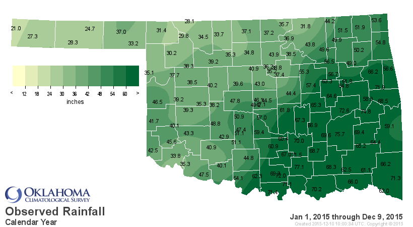
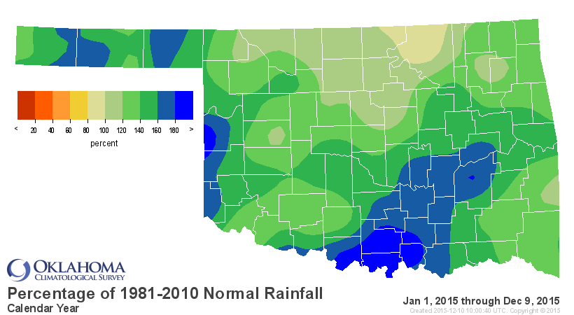
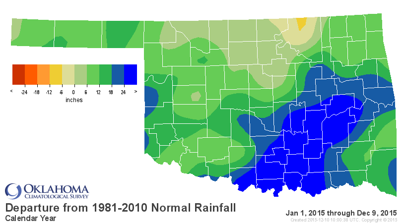
And if we take a look at the Mesonet maps for the year thus far, we can tell
what part of the state propelled us to this record. Obviously, at 24" to more
than 35" above normal at places like Tishomingo (77.1 inches for the year
thus far), south central through east central Oklahoma buoyed the record total.
http://ticker.mesonet.org/archive/20151210/caltot.png
http://ticker.mesonet.org/archive/20151210/calpct.png
http://ticker.mesonet.org/archive/20151210/caldel.png
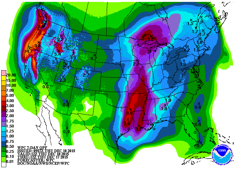
With another system coming in this weekend, and heavy rainfall possible once
again across the eastern half of the state
http://ticker.mesonet.org/archive/20151210/7day-rainfall-forecast.gif
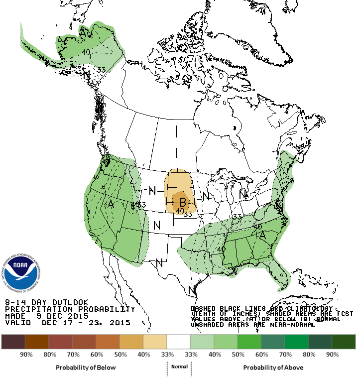
and more wet weather possible later next week
http://ticker.mesonet.org/archive/20151210/dec17-23-precip-outlook.gif
we can still grow this record. Right now, it's still considered preliminary since
NCEI will continue to get records dribbling in not only for November but also
October as well, and then again for December. But the chances of that number
dropping below the magical 1957 mark of 47.88 inches are slim to none, as they
say. And the additional rainfall we see this weekend should obliterate any
chances of that occurring at any rate.
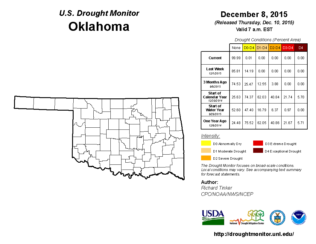
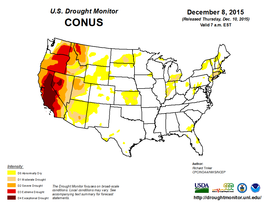
To nobody's surprise, and timed perfectly with the record breakage, the latest
U.S. Drought Monitor shows the state once again free of drought or abnormally
dry conditions!
http://ticker.mesonet.org/archive/20151210/20151208_OK_trd.png
In fact, that flash drought that plagued much of the Southern Plains and the
Southeast U.S. has now all but vanished. We just need El Nino to work its magic
on the West and the whole country will be in tip-top shape.
http://ticker.mesonet.org/archive/20151210/20151208_conus_text.png
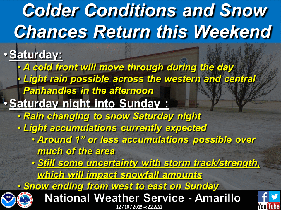
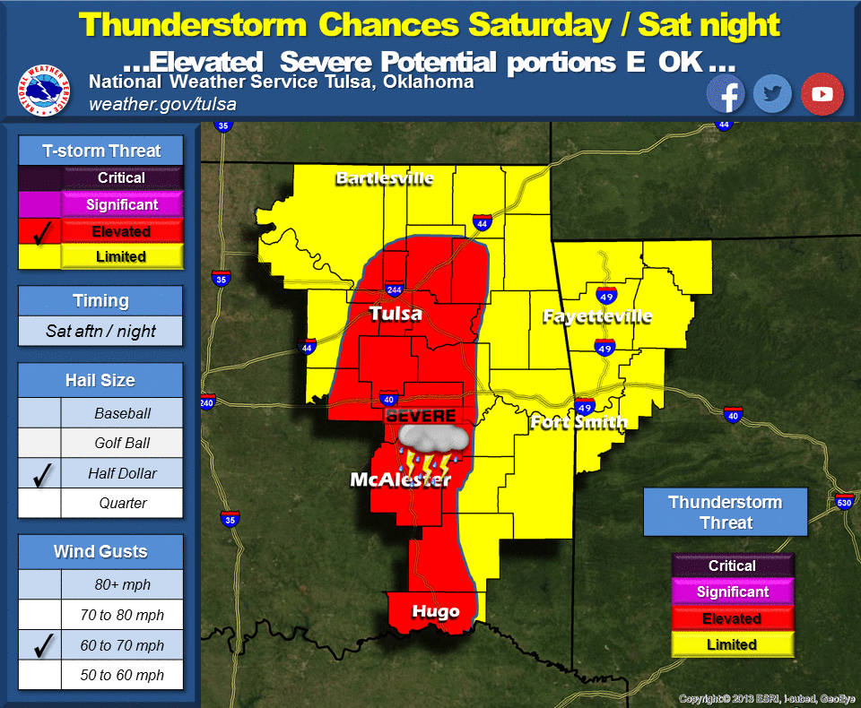
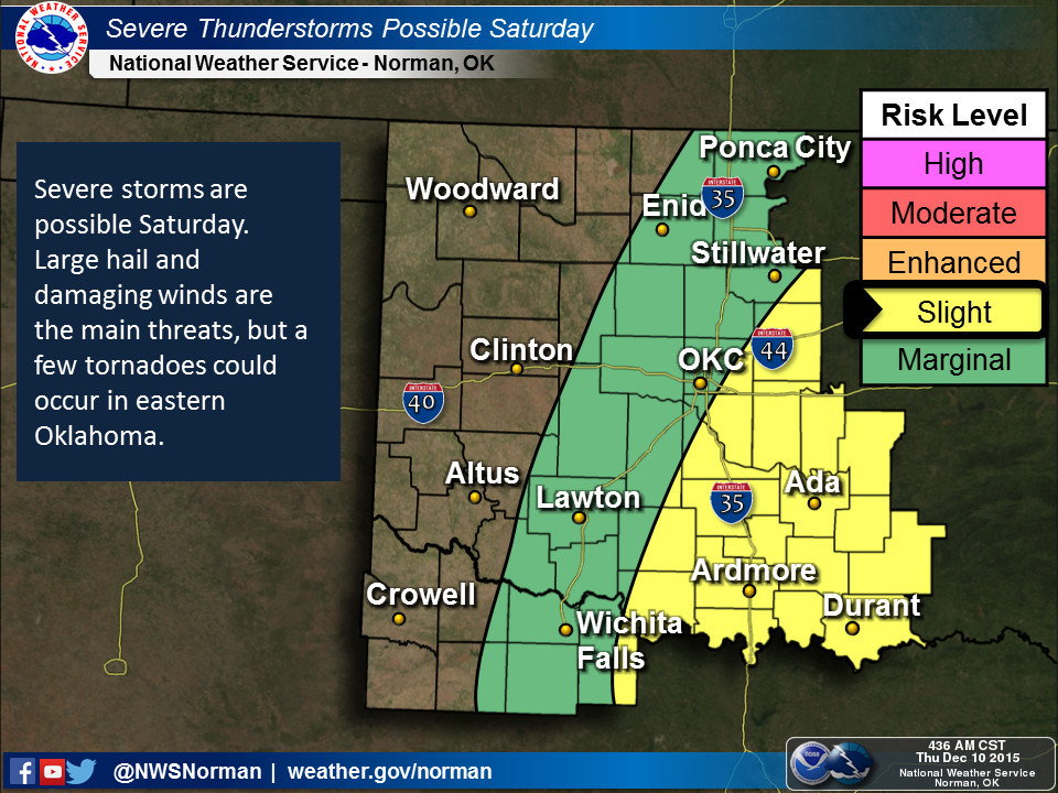
Now as you go out and celebrate the big record this weekend (come on, surely
I'm not the only one??), remember there will be a chance of severe weather
across central and eastern Oklahoma, and maybe a bit of snow in the far
northwest.
http://ticker.mesonet.org/archive/20151210/nws-amarillo-snow.gif
http://ticker.mesonet.org/archive/20151210/nws-tulsa-svr.png
http://ticker.mesonet.org/archive/20151210/nws-norman-svr.jpg
No big whoop (just like 1957 now).
Gary McManus
State Climatologist
Oklahoma Mesonet
Oklahoma Climatological Survey
(405) 325-2253
gmcmanus@mesonet.org
==================================================
The OCS/Mesonet Ticker
https://ticker.mesonet.org/
To subscribe or unsubscribe from the Ticker
or for questions about the Ticker or its content
Phone or Email the Ticker Manager at OCS
Phone: 405-325-2253 Email: ticker@mesonet.org
---------------------------------------------------
-C- Copyright 2024 Oklahoma Climatological Survey
===================================================
|


 Tweet
Tweet