MESONET TICKER ... MESONET TICKER ... MESONET TICKER ... MESONET TICKER ...
December 9, 2015 December 9, 2015 December 9, 2015 December 9, 2015
Wait, what's going to happen this weekend?
http://ticker.mesonet.org/archive/20151209/clint.jpg
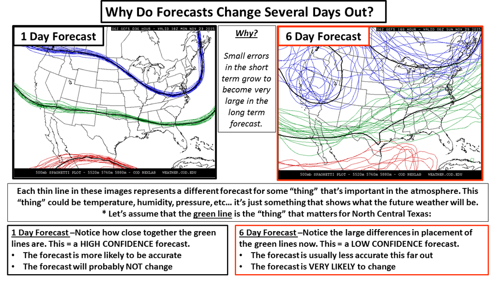
Remember this graphic from not too long ago?
http://ticker.mesonet.org/archive/20151123/forecasting-chaos.png
Well from what I can tell, that's the type of fun the local forecasters are having
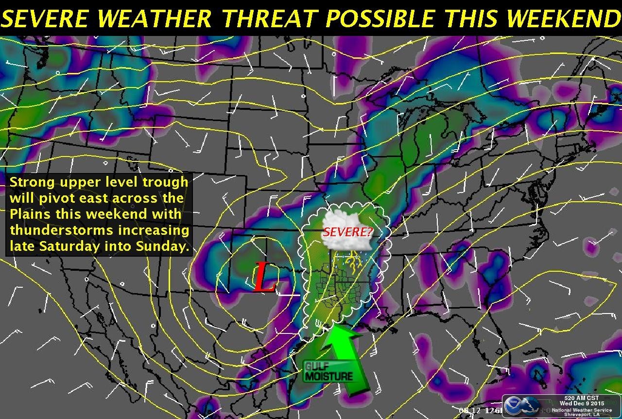
with this system headed towards the Plains this weekend. Here is the overall
setup, with thanks to our friends in the Shreveport NWS office.
http://ticker.mesonet.org/archive/20151209/weekend-storm-system.jpg
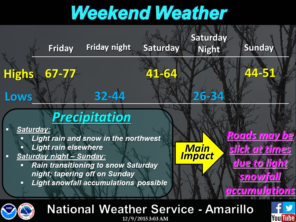
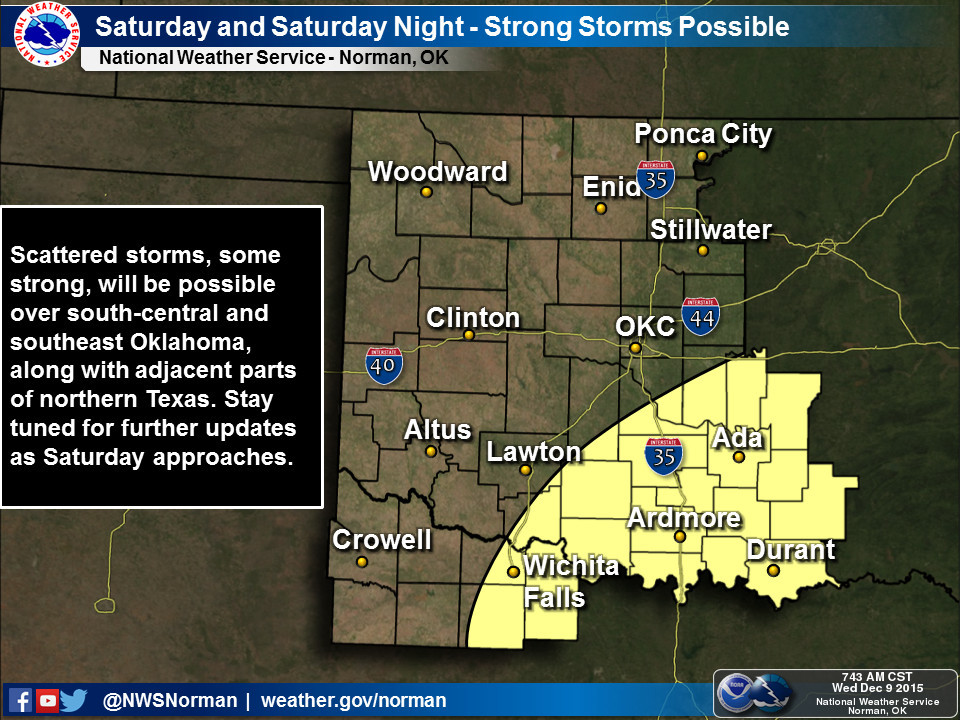
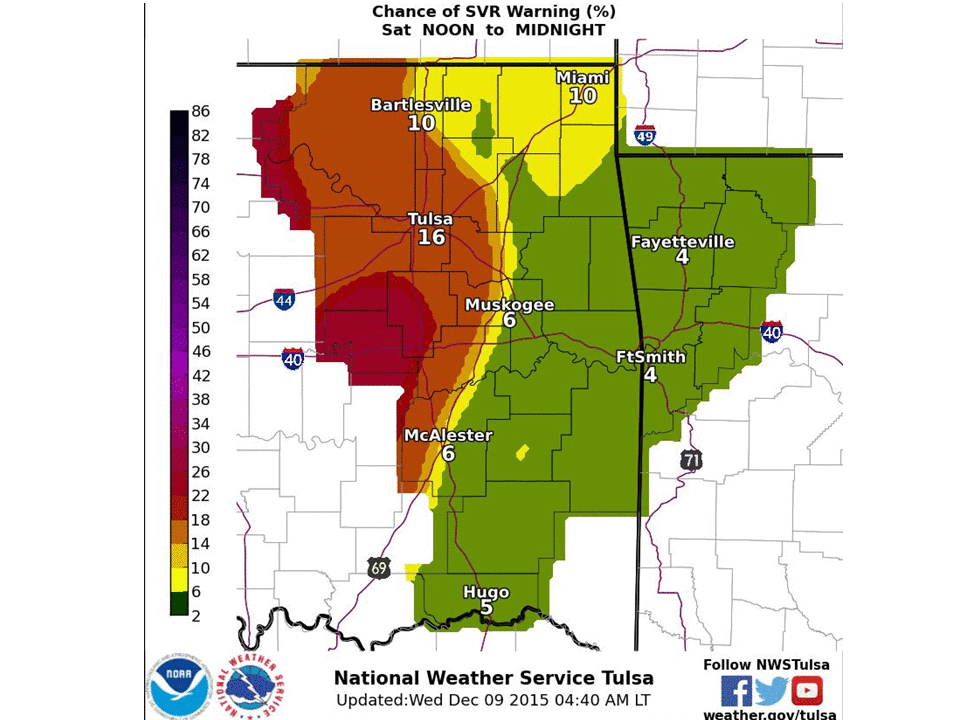
So it looks to me like the forecasters in Amarillo (covering the OK Panhandle) are
more worried about some frozen stuff, while Norman and Tulsa, along with Shreveport,
are talking possible severe (but not TOO severe) weather.
http://ticker.mesonet.org/archive/20151209/nws-amarillo.gif
http://ticker.mesonet.org/archive/20151209/nws-norman.jpg
http://ticker.mesonet.org/archive/20151209/nws-tulsa.png
I've read the latest forecast discussions from all the local NWS offices, and
what sticks out to me is the difficulty in getting a good consensus forecast
from all the model output. Pay special attention to Amarillo's!
Here are some quotes, fer instance:
NWS-Tulsa -- "Extended models continue to struggle with the evolution of the
next upper wave ejecting out of the southwestern states for this
weekend."
NWS-Norman -- "...SOME SNOW MAY MIX WITH THE RAIN IN THE NORTHWEST...BUT AT THIS
TIME...ACCUMULATION OF SNOW APPEARS QUITE UNLIKELY."
NWS-Amarillo -- "MODELS CONTINUE TO STRUGGLE WITH THE EVOLUTION OF THE NEXT
POWERFUL (storm system) TO IMPACT THE AREA OVER THE WEEKEND.
SOLUTIONS...SUGGESTS ONLY MINIMAL (moisture potential) AND
POTENTIAL FOR A DUSTING OF SNOW SOMETIME LATE SATURDAY TO THE
ECMWF (European model) WHICH CUTS OFF AN IMPRESSIVE LOW AND
TRACKS IT JUST SOUTH OF THE AREA EFFECTIVELY BURYING THE
PANHANDLE IN SNOW (WITH POTENTIAL FOR BLIZZARD CONDITIONS)."
So a dusting of snow to a blizzard? Not even the BRAUM'S METER is gonna try and
handle that one. In essence, the forecast models aren't handling this system
very well and so the forecasters are keeping options open to some degree. What
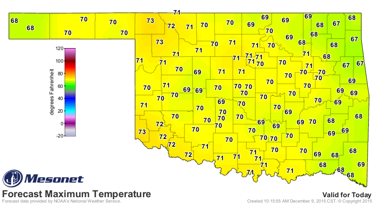
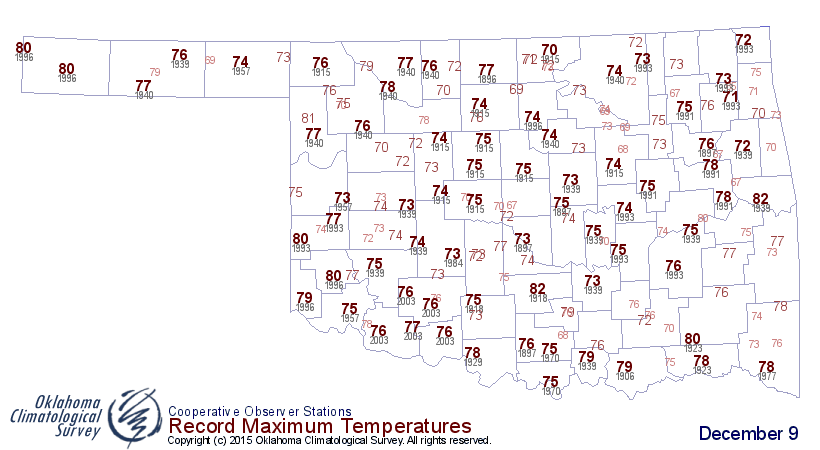
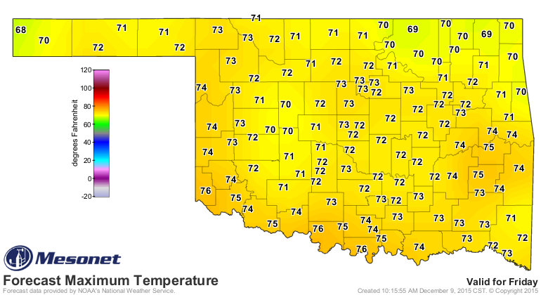
we DO KNOW is that it's going to be warm through Friday. In fact, even today we
will get close to some record high temperatures.
http://ticker.mesonet.org/archive/20151209/todays-forecast-highs.png
http://ticker.mesonet.org/archive/20151209/todays-record-highs.png
http://ticker.mesonet.org/archive/20151209/fridays-forecast-highs.png
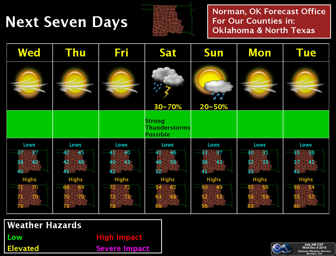
And it doesn't appear like this is going to be a prolonged cool down, as highs
next week go right back to seasonable or above.
http://ticker.mesonet.org/archive/20151209/nws-norman-7day-planner.jpg
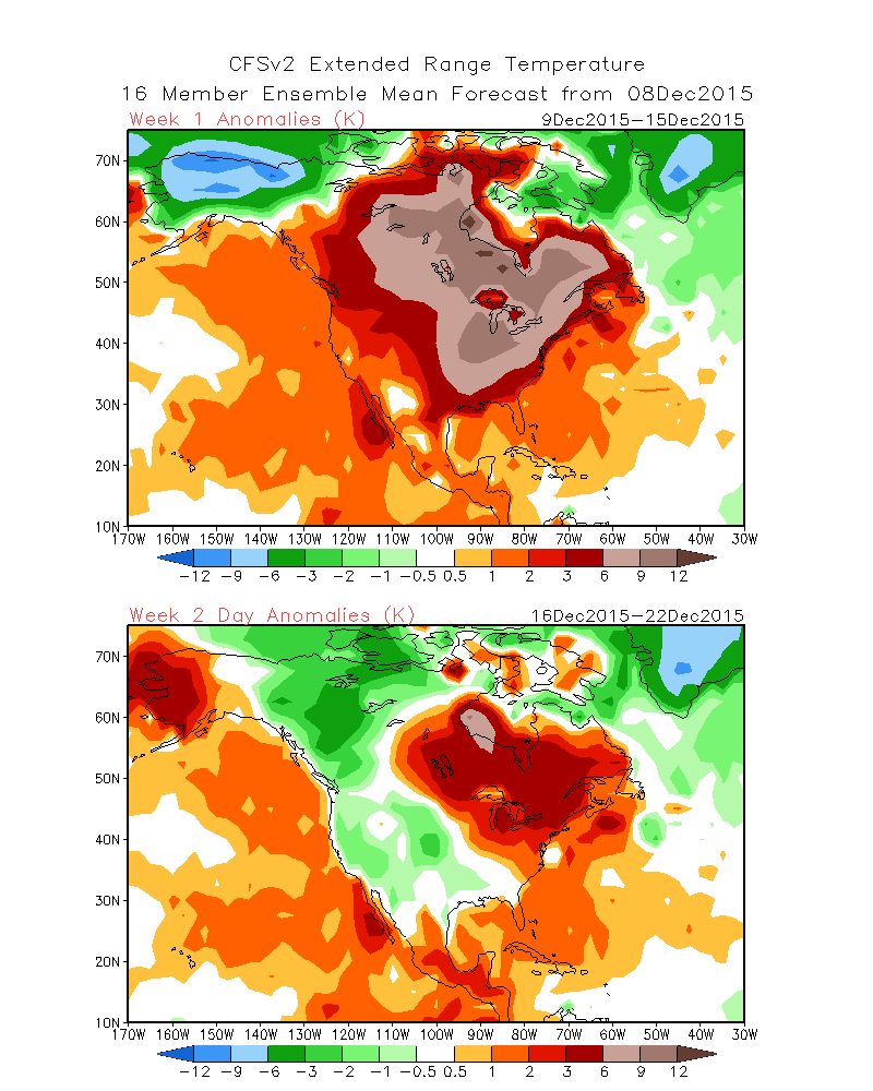
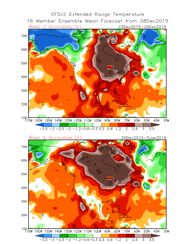
Farther out than that...that's territory for the more adventurous than I. I've
seen lots of talk of really cold air building for latter parts of the month.
There are hints of some below normal temps for later next week, but weeks 3 and
4 still look much above average. At least according to this particular forecast
model.
http://ticker.mesonet.org/archive/20151209/week1-week2-outlooks.gif
http://ticker.mesonet.org/archive/20151209/week3-week4-outlooks.gif
So a winter wonderland for Christmas, or Santa making his own gravy in that
red felt suit? Your model is as good as mine. I did get one thing right, however.
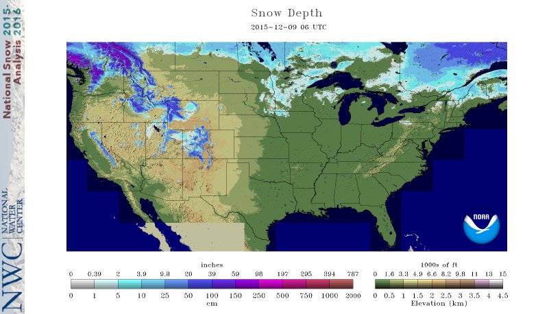
Just as I thought, most of that snow that fell the previous few weeks be gone!
http://ticker.mesonet.org/archive/20151209/us-snow-depth.jpg
Gary McManus
State Climatologist
Oklahoma Mesonet
Oklahoma Climatological Survey
(405) 325-2253
gmcmanus@mesonet.org
==================================================
The OCS/Mesonet Ticker
https://ticker.mesonet.org/
To subscribe or unsubscribe from the Ticker
or for questions about the Ticker or its content
Phone or Email the Ticker Manager at OCS
Phone: 405-325-2253 Email: ticker@mesonet.org
---------------------------------------------------
-C- Copyright 2024 Oklahoma Climatological Survey
===================================================
|


 Tweet
Tweet