MESONET TICKER ... MESONET TICKER ... MESONET TICKER ... MESONET TICKER ...
November 18, 2015 November 18, 2015 November 18, 2015 November 18, 2015
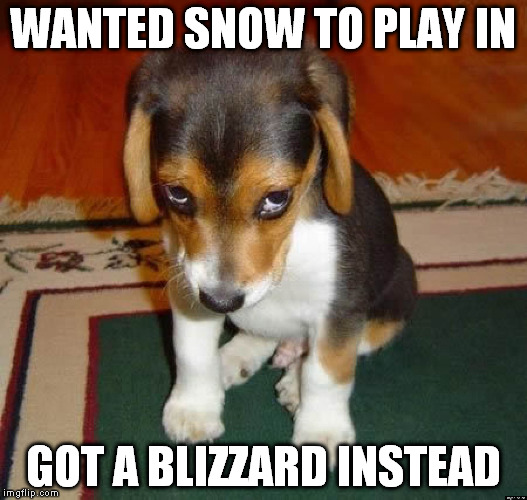
It has snowed in Oklahoma!
http://ticker.mesonet.org/archive/20151118/ashamed.jpg
We posted the image yesterday of the expected snowfall in the Panhandle from the
Amarillo NWS office, but apparently, they got more than they bargained for in
Boise City. Here was that forecast image.
http://ticker.mesonet.org/archive/20151117/nws-amarillo-snow.gif
But looking at the storm reports from yesterday, as well as information from
the Cimarron County NRCS office, I'd say they had a good old time slipping and
sliding out that way.
PRELIMINARY LOCAL STORM REPORT...SUMMARY
NATIONAL WEATHER SERVICE AMARILLO TX
316 AM CST WED NOV 18 2015
..TIME... ...EVENT... ...CITY LOCATION... ...LAT.LON...
..DATE... ....MAG.... ..COUNTY LOCATION..ST.. ...SOURCE....
..REMARKS..
0202 PM SNOW BOISE CITY 36.73N 102.51W
11/17/2015 E2.0 INCH CIMARRON OK TRAINED SPOTTER
BLOWING SNOW IS REDUCING VISIBILITIES IN TOWN TO LESS
THAN 1/8 MILE.
0802 PM SNOW BOISE CITY 36.73N 102.51W
11/17/2015 E5.0 INCH CIMARRON OK LAW ENFORCEMENT
NEAR WHITE OUT CONDITIONS IN BLOWING SNOW.
1055 PM SNOW BOISE CITY 36.73N 102.51W
11/17/2015 E6.0 INCH CIMARRON OK LAW ENFORCEMENT
Boise City ended officially with 6 inches on the ground, and as you can see
from the reports above, "near white out conditions in blowing snow."
In other words, a blizzard. The Mesonet meteogram from Boise City and the wind
gust map from yesterday shows that winds were gusting to over 50 mph as late
as 8pm before calming down to a mere 10-20 mph, and the wind chill bottomed
out into the single digits.
http://ticker.mesonet.org/archive/20151118/BOIS.met.gif
http://ticker.mesonet.org/archive/20151118/yesterday.gust.gif
You should also notice that the temperature has rebounded quite nicely back into
the mid-40s, so that snow is not long for this world (if it's even still there).
The only other snow report I can find is a trace from Guymon, so it must not
have spread too far east. But the gates to winter are open now. Let the snow
begin. Long range forecasts are showing some type of "event" for next week
into Thanksgiving, but whether that means rain or some other type of precip,
simply too far out to tell. But those forecasting folks will know more as we
get closer. Looks to me to be closer to 70 degrees than 30 degrees right now,
but that can change in a hurry.
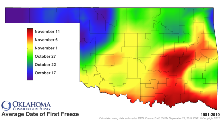
We're still well past our average date of the first fall freeze for quite a few
stations scattered through the state.
http://ticker.mesonet.org/archive/20151118/avg_firstfreeze.1981-2010.png
http://ticker.mesonet.org/archive/20151118/tmin.le32.png
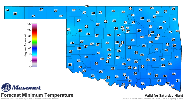
It looks like that might end for most of those stations this weekend as well.
http://ticker.mesonet.org/archive/20151118/sunday-morning-lows.png
BRRRRR indeed!
Gary McManus
State Climatologist
Oklahoma Mesonet
Oklahoma Climatological Survey
(405) 325-2253
gmcmanus@mesonet.org
==================================================
The OCS/Mesonet Ticker
https://ticker.mesonet.org/
To subscribe or unsubscribe from the Ticker
or for questions about the Ticker or its content
Phone or Email the Ticker Manager at OCS
Phone: 405-325-2253 Email: ticker@mesonet.org
---------------------------------------------------
-C- Copyright 2024 Oklahoma Climatological Survey
===================================================
|


 Tweet
Tweet