MESONET TICKER ... MESONET TICKER ... MESONET TICKER ... MESONET TICKER ...
October 19, 2015 October 19, 2015 October 19, 2015 October 19, 2015
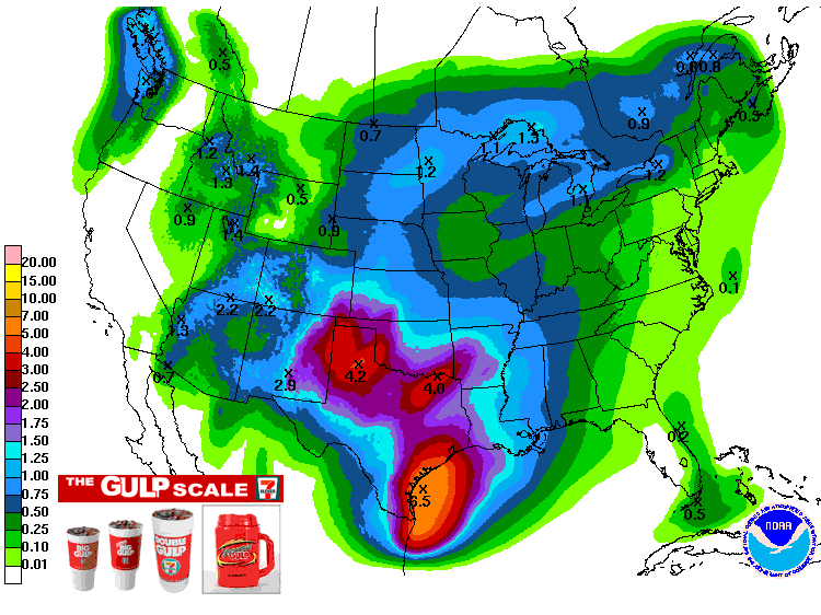
Pick your gulp (of rain) this week!
A large, slow upper-level low pressure system will slowly approach our area
during the week and slowly give us a chance for a nice slow, steady rainfall --
our first in what has been a very VERY slow fall thus far.
SLOW DOWN!
Check out the 7-day rainfall forecast from the Weather Prediction Center for
the low-down (but not the slow-down) on what size of Gulp you might be getting.
(sorry Braum's, you're free advertising comes this winter...maybe)
http://ticker.mesonet.org/archive/20151019/7day-rainfall-forecast.gif
The best news there is that the southern edges of the state appear to be bearing
the brunt of this storm, with up to 4 inches of rain being forecast. Now of
course that doesn't mean everybody will get 4 inches, and it might even mean
some will get 6 and some get 2 in those areas. But it's our first REAL GOOD chance
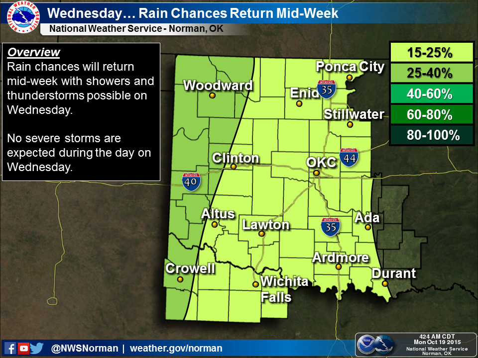
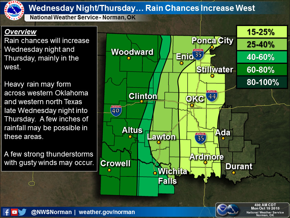
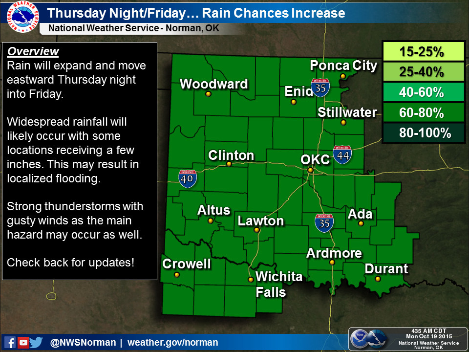
of widespread moisture in those areas since July. Our local NWS offices have a
bit more on the timing of the rain, which should start sometime on Wednesday and
last through sometime this weekend.
http://ticker.mesonet.org/archive/20151019/nws-norman-wed.jpg
http://ticker.mesonet.org/archive/20151019/nws-norman-wed.thurs.jpg
http://ticker.mesonet.org/archive/20151019/nws-norman-thurs.fri.jpg
http://ticker.mesonet.org/archive/20151019/nws-norman-7day.jpg
http://ticker.mesonet.org/archive/20151019/nws-amarillo.gif
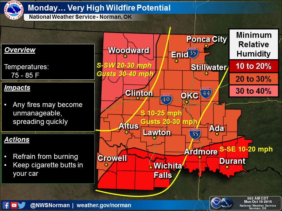
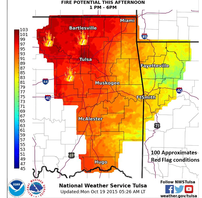
Until we get there, though, we have one more day of fairly intense fire danger.
http://ticker.mesonet.org/archive/20151019/nws-norman-fire.jpg
http://ticker.mesonet.org/archive/20151019/nws-tulsa-fire.png
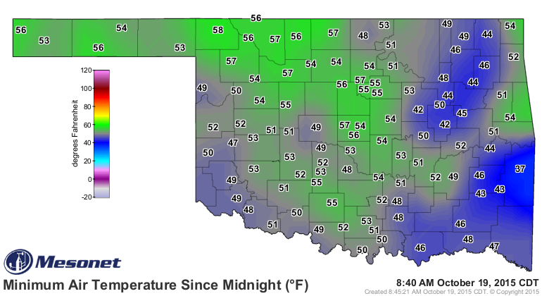
There's still no sign of any frigid air anytime soon, although I consider this
morning pretty frigid!
http://ticker.mesonet.org/archive/20151019/todays-lows.png
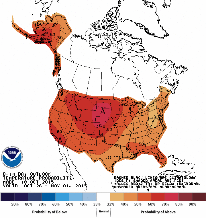
But from the CPC's 8-14 day temperature outlooks, they still see increased odds
for above normal temperatures. Remember, this map looks mighty reddish, but that
doesn't mean 90s since we're in late-October. So maybe upper 70s or so. Normal
highs that time of year are in the upper 60s-low 70s and lows are in the mid- to
upper-40s.
http://ticker.mesonet.org/archive/20151019/oct26-nov1-temp-outlook.gif
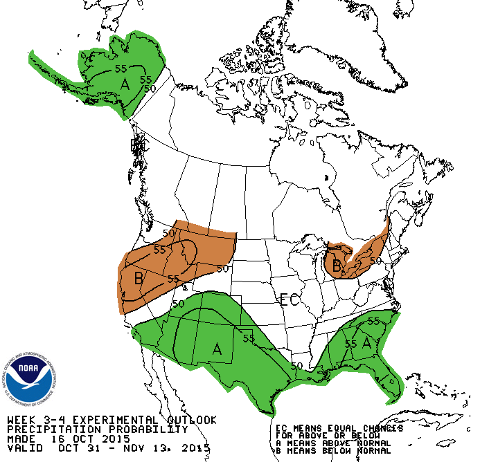
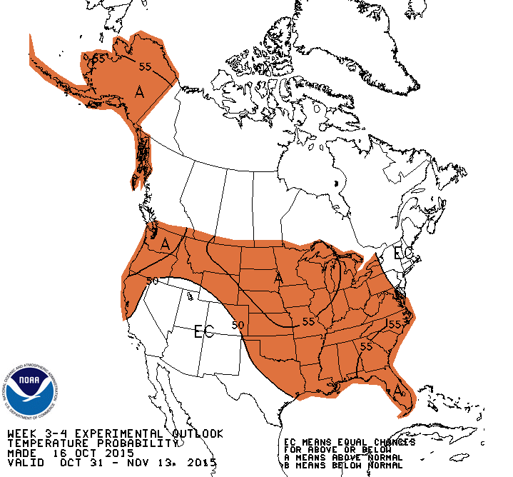
The 3-4 week outlooks from CPC, valid for the first two weeks of November, see
us with increased odds of above normal temperatures and for western OK, precip
as well.
http://ticker.mesonet.org/archive/20151019/WK34prcp.gif
http://ticker.mesonet.org/archive/20151019/WK34temp.gif
So if you need to plant, do it. If you need a drink, wait for it. And if you
want snow more of the same weather we've been having, enjoy it while we can.
Gary McManus
State Climatologist
Oklahoma Mesonet
Oklahoma Climatological Survey
(405) 325-2253
gmcmanus@mesonet.org
==================================================
The OCS/Mesonet Ticker
https://ticker.mesonet.org/
To subscribe or unsubscribe from the Ticker
or for questions about the Ticker or its content
Phone or Email the Ticker Manager at OCS
Phone: 405-325-2253 Email: ticker@mesonet.org
---------------------------------------------------
-C- Copyright 2024 Oklahoma Climatological Survey
===================================================
|


 Tweet
Tweet