MESONET TICKER ... MESONET TICKER ... MESONET TICKER ... MESONET TICKER ...
August 16, 2022 August 16, 2022 August 16, 2022 August 16, 2022
No accidents
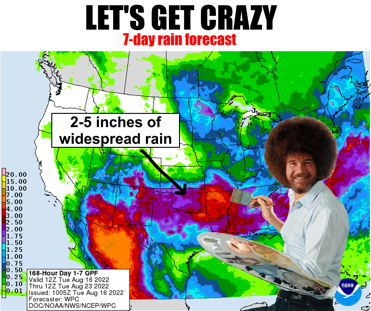
https://ticker.mesonet.org/archive/20220816/7day-rain-forecast.png
Yes, from the author of "Hot Days and How To Love Them," "Winter is From Mars,
Summer is From Mercury," and "Harry Potter and the Too High Electric Bill" comes
Mother Nature's latest classic: "Of Mice and Drought and Floods." So we go from
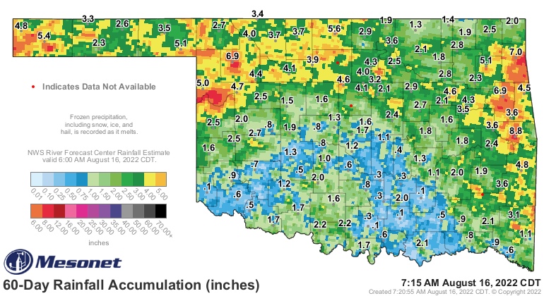
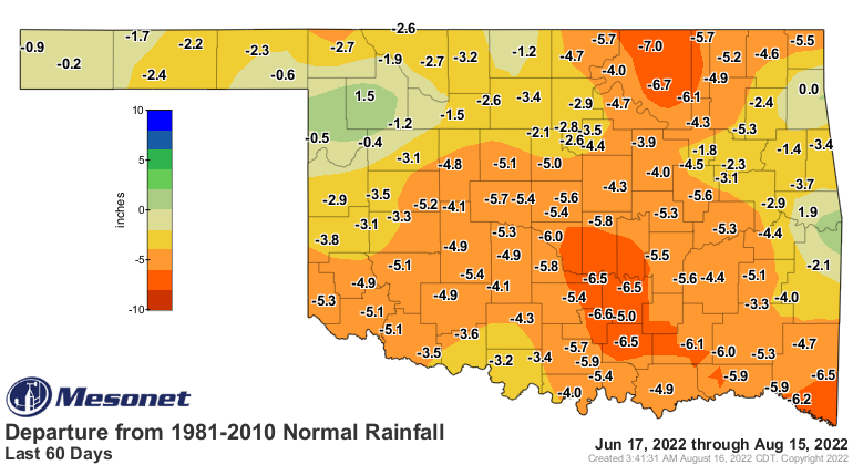
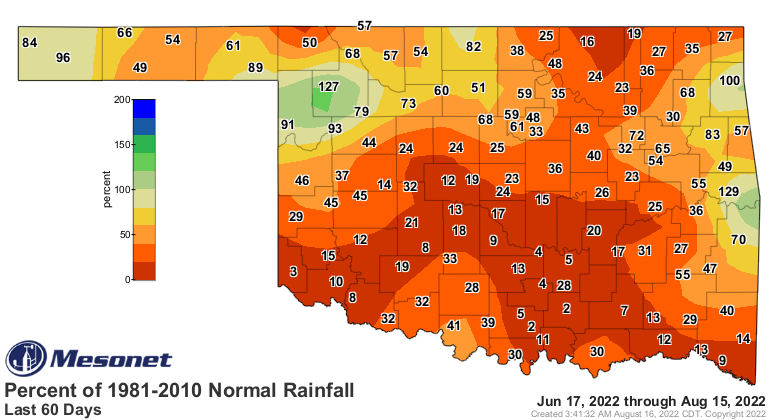
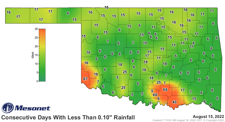
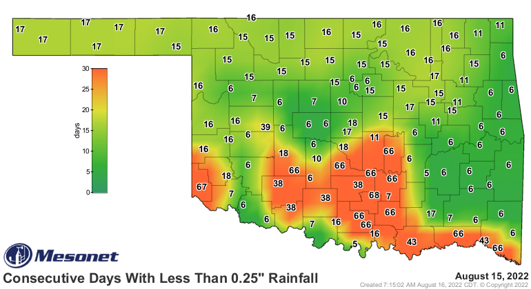
almost no rain over the last 66 days in parts of the state
https://ticker.mesonet.org/archive/20220816/60-day-rain-totals.png
https://ticker.mesonet.org/archive/20220816/del60day_rain.current.png
https://ticker.mesonet.org/archive/20220816/pct60day_rain.current.png
https://ticker.mesonet.org/archive/20220816/mesonet.rainfall.tenthinch.png
https://ticker.mesonet.org/archive/20220816/mesonet.rainfall.quarterinch.png
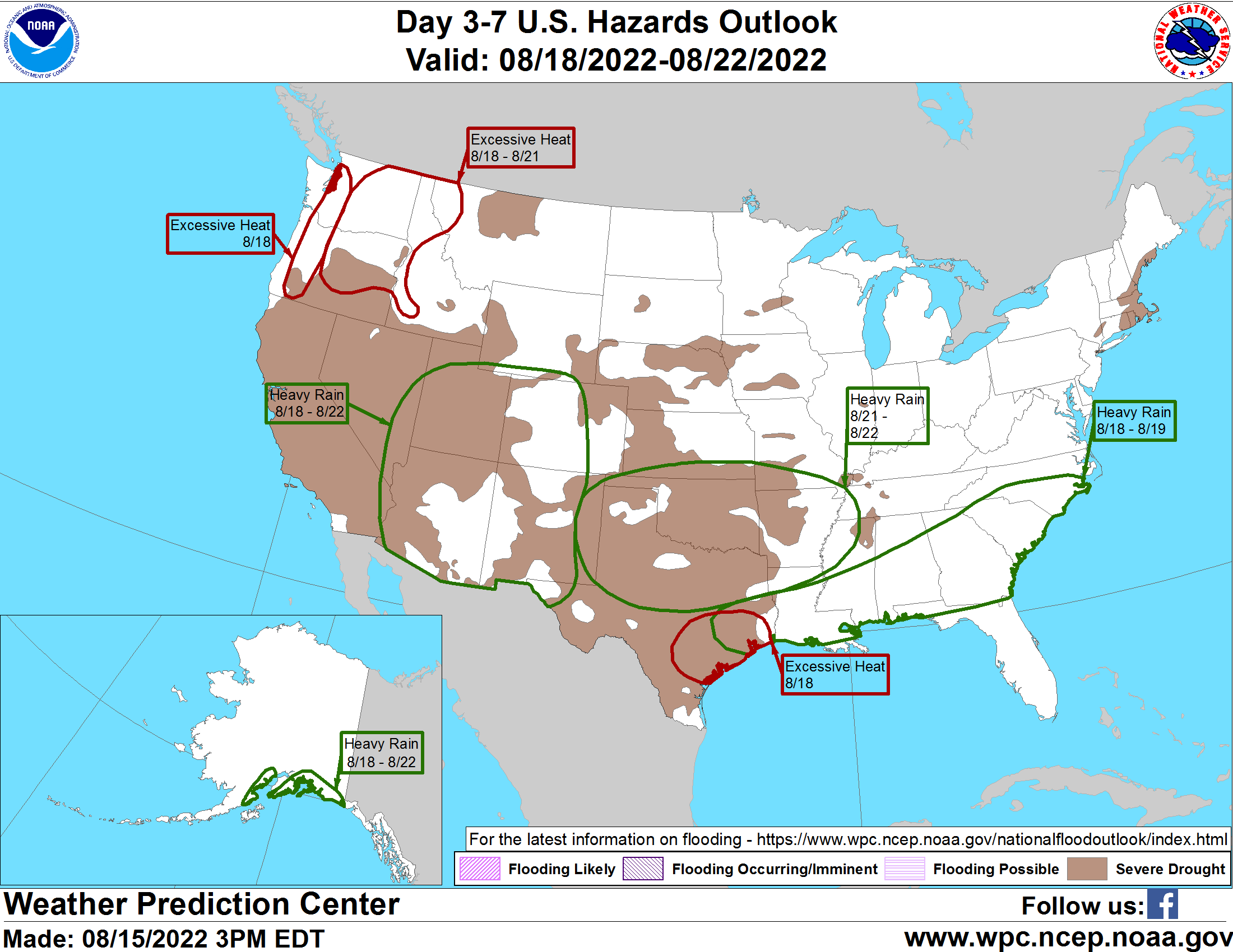
to the possible upcoming dangers of excessive rainfalls directly after drought,
when the ground is baked hard and water tends to just run off into flash flood
situations.
https://ticker.mesonet.org/archive/20220816/aug18-22-hazards.png
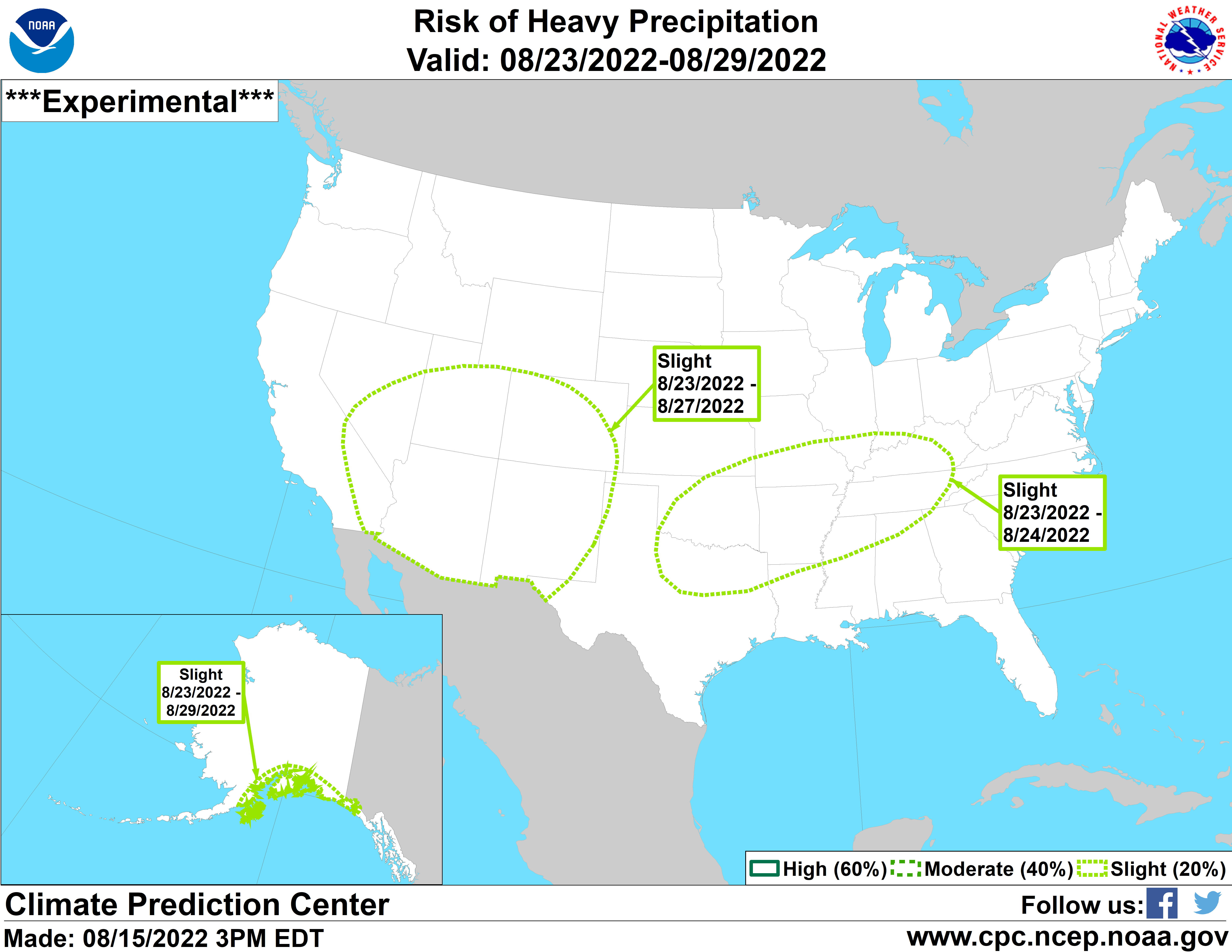
https://ticker.mesonet.org/archive/20220816/aug23-29-heavy-rain.png
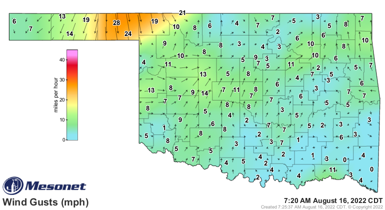
Ya see, the front that is approaching the state now and has entered the Panhandle
isn't going to do much except cool us down (like that's not enough!) and maybe
bring some showers and storms to the northern half of the state today and the
southern half of the state tomorrow (like that's not enough!).
https://ticker.mesonet.org/archive/20220816/current-winds.png
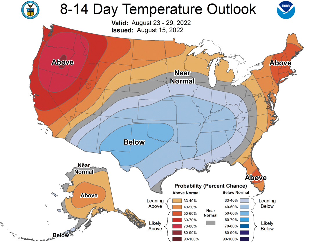
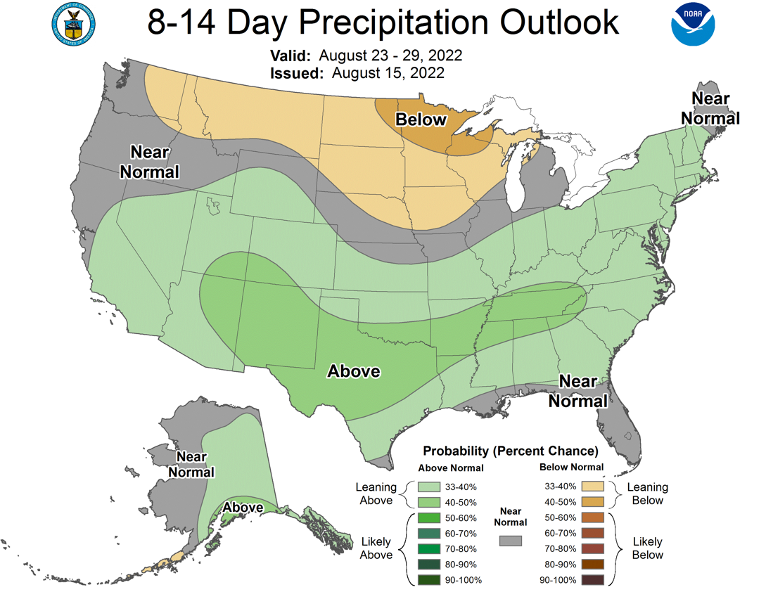
No, it's the three or four successive fronts that are being forecast for the
next couple of weeks that appear to drive a nail into the coffin of our summer
heat wave and possibly do deadly damage to our runaway flash drought. So not
only are we looking at some widespread rain and relief this weekend into early
next week, but this mild and wet spell should extend well into next week and
possibly beyond.
https://ticker.mesonet.org/archive/20220816/aug23-29-temps.png
https://ticker.mesonet.org/archive/20220816/aug23-29-rain.png
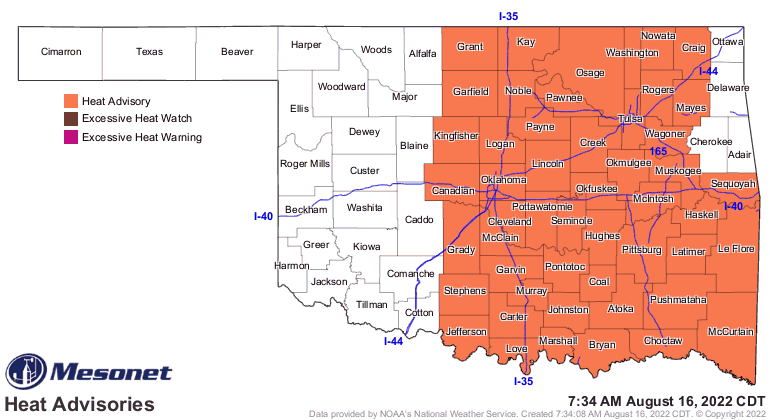
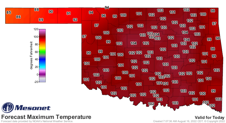
So one last REALLY hot day today in this REALLY HOT summer before we cool down
for a couple of days, see a couple of merely "hot" days to end the week, then
see successive cold fronts every few days that knock the summer heat back a
peg or three.
https://ticker.mesonet.org/archive/20220816/latest.oklahoma.heat.gif
https://ticker.mesonet.org/archive/20220816/todays-forecast-highs.png
https://ticker.mesonet.org/archive/20220816/nws-norman-7day-temps.png
And remember what I always say: "I asked for CHERRY Pop Tarts!"
No, not that one...this one: "There are no bad forecasts, just happy little
accidents."
Gary McManus
State Climatologist
Oklahoma Mesonet
Oklahoma Climatological Survey
gmcmanus@Mesonet.org
==================================================
The OCS/Mesonet Ticker
https://ticker.mesonet.org/
To subscribe or unsubscribe from the Ticker
or for questions about the Ticker or its content
Phone or Email the Ticker Manager at OCS
Phone: 405-325-2253 Email: ticker@mesonet.org
---------------------------------------------------
-C- Copyright 2024 Oklahoma Climatological Survey
===================================================
|


 Tweet
Tweet