MESONET TICKER ... MESONET TICKER ... MESONET TICKER ... MESONET TICKER ...
August 13, 2018 August 13, 2018 August 13, 2018 August 13, 2018
Quick, make some chili!
http://ticker.mesonet.org/archive/20180813/todays-forecast-highs.png
Neighbor (chances are, you're not my neighbor, but play along), how long has it
been since you had a big, thick, steaming bowl of Wolf Brand Chili? Well...good
for you. Was that in NEW YORK CITY???
Okay, I butchered that, but as somebody who craves a good bowl of chili but
refuses to break protocol and eat it when the heat index is 106, I say if highs
are going to be in the mid-70s...go for it. Sorry far western OK, you'll have
to stick with cold turkey sandwiches for a bit longer. Still, 80s are better
than the mid-90s that are normal for this time of year.
This is all thanks to the rain (and the clouds that bring that moisture) currently
deluging the southern half of the state.
http://ticker.mesonet.org/archive/20180813/ok-current-radar.png
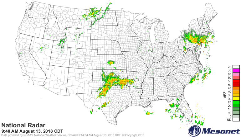
And we're just about the only action in the country.
http://ticker.mesonet.org/archive/20180813/national-radar.png
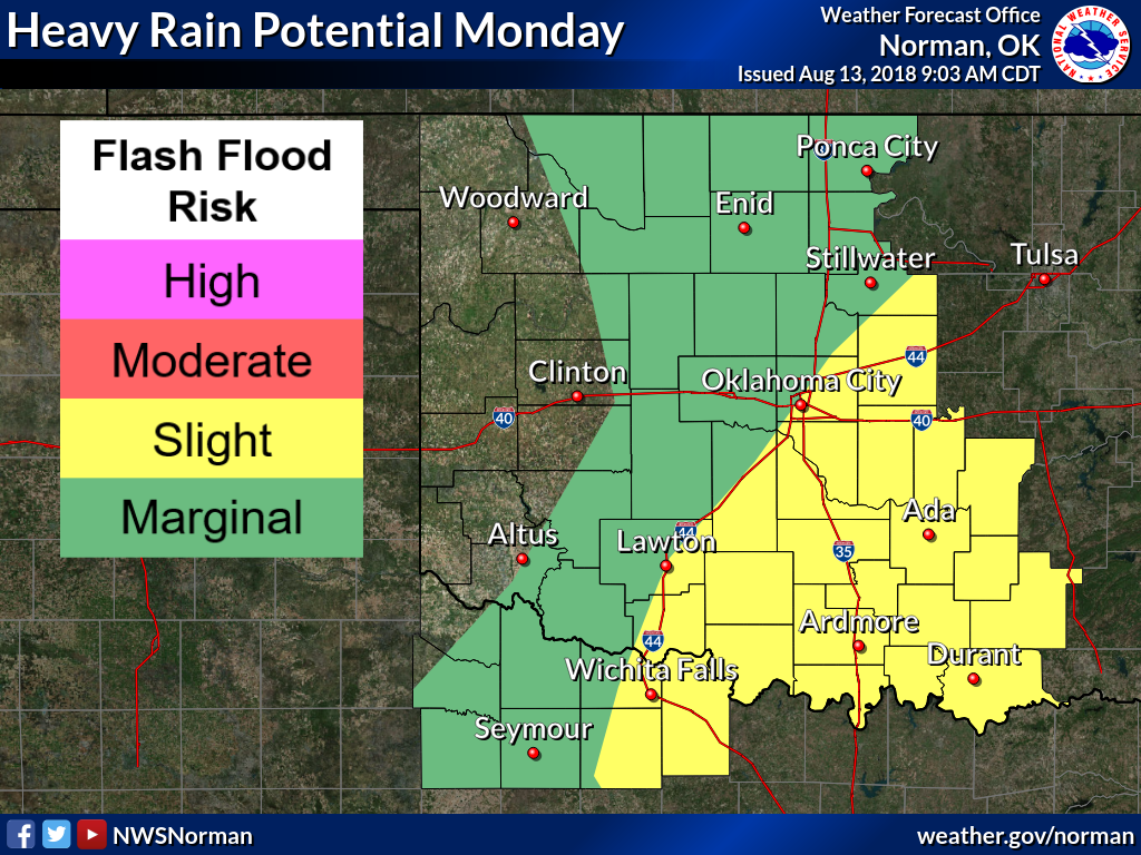
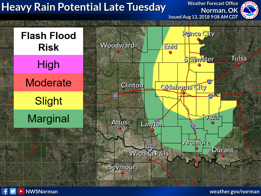
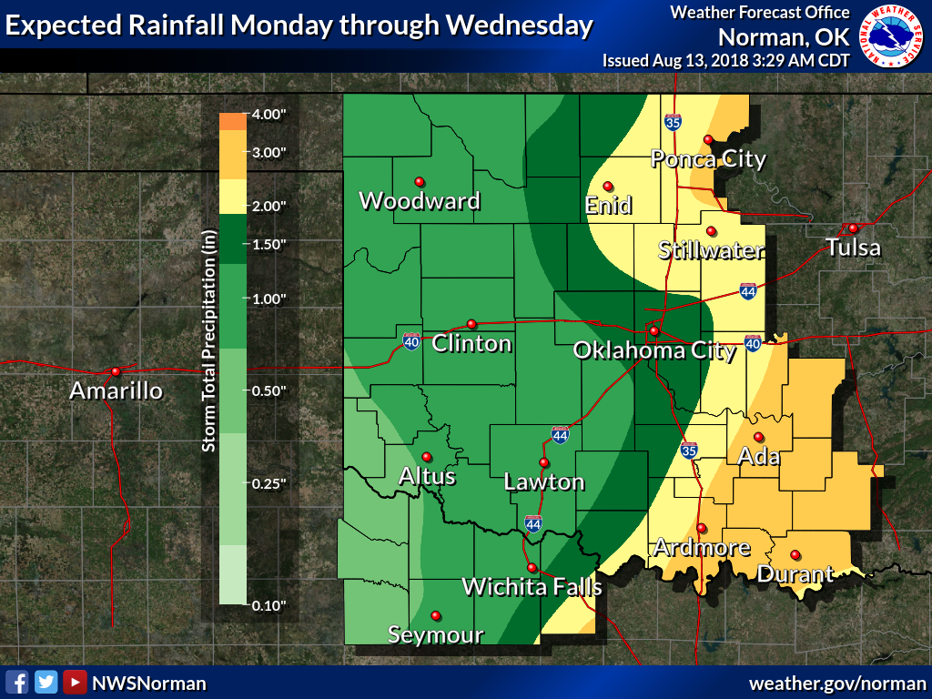
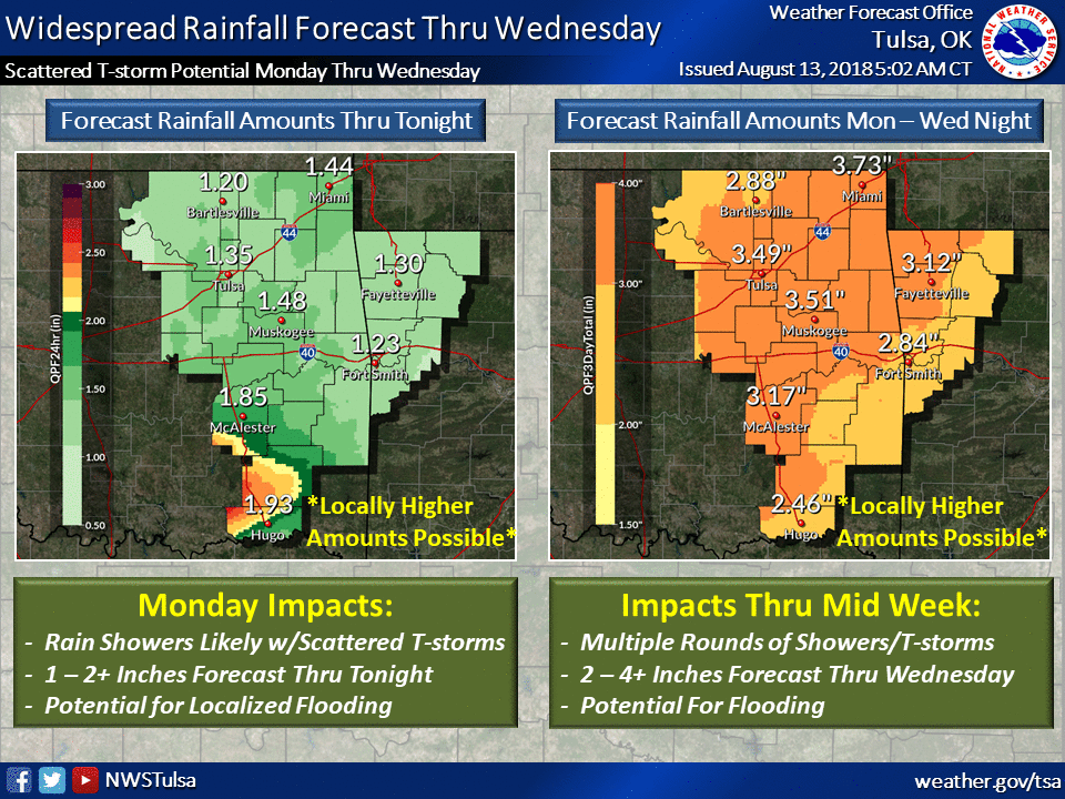
Here's the setup, heavy rains today in the SE half of the state, heavy rains
tomorrow night along the I-35 corridor into NE OK, then more chances of rain
as we approach the weekend. Some helpful graphics from our local NWS friends.
http://ticker.mesonet.org/archive/20180813/nws-norman-monday-heavy-rains.png
http://ticker.mesonet.org/archive/20180813/nws-norman-tues-heavy-rains.png
http://ticker.mesonet.org/archive/20180813/nws-norman-rain-totals.png
http://ticker.mesonet.org/archive/20180813/nws-tulsa-rain-amounts.png
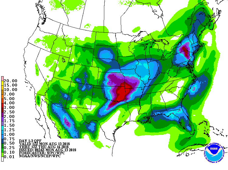
The rain is great, of course. And the totals over the next three days are going
to do wonders for drought-stricken areas in most of the state.
http://ticker.mesonet.org/archive/20180813/3day-rainfall-forecast.gif
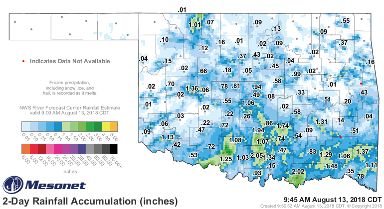
But if you go by what we're seeing on those forecast amounts, it's not great
news for far SW OK where D4 Exceptional drought now exists. We really need that
area to get some long duration moderate rains. The 1.13 inches in Altus over
the last 48 hours is wonderful, but it's extremely localized.
http://ticker.mesonet.org/archive/20180813/2day-rain-totals.png
Gary McManus
State Climatologist
Oklahoma Mesonet
Oklahoma Climatological Survey
(405) 325-2253
gmcmanus@mesonet.org
==================================================
The OCS/Mesonet Ticker
https://ticker.mesonet.org/
To subscribe or unsubscribe from the Ticker
or for questions about the Ticker or its content
Phone or Email the Ticker Manager at OCS
Phone: 405-325-2253 Email: ticker@mesonet.org
---------------------------------------------------
-C- Copyright 2024 Oklahoma Climatological Survey
===================================================
|


 Tweet
Tweet