MESONET TICKER ... MESONET TICKER ... MESONET TICKER ... MESONET TICKER ...
June 3, 2015 June 3, 2015 June 3, 2015 June 3, 2015
Apparently it reached 90 degrees yesterday
http://ticker.mesonet.org/archive/20150603/apparently.jpg
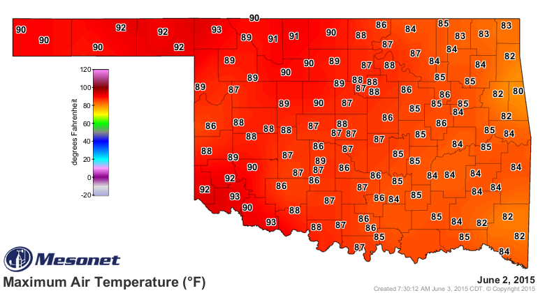
Yes, the Mesonet don't lie. Check it out for yourself.
http://ticker.mesonet.org/archive/20150603/yesterdays-highs.png
In fact, there were a whole slew of 90s yesterday across western Oklahoma as we
are sitting under a nice dome of high pressure (no rain, don't complain!). That
brings the total number of 90s reached by the Mesonet to 73 for the year thus
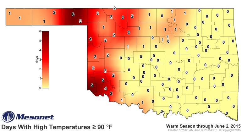
far. That seems pretty low, and the days with 90 degrees map looks pretty paltry.
http://ticker.mesonet.org/archive/20150603/tmax.ge90.png
You know when Beaver leads the number of days with 90 degrees, something has gone
kerflooey. And that kerflooey was obviously all the rain during May, a prime month
for adding some 90s here and there.
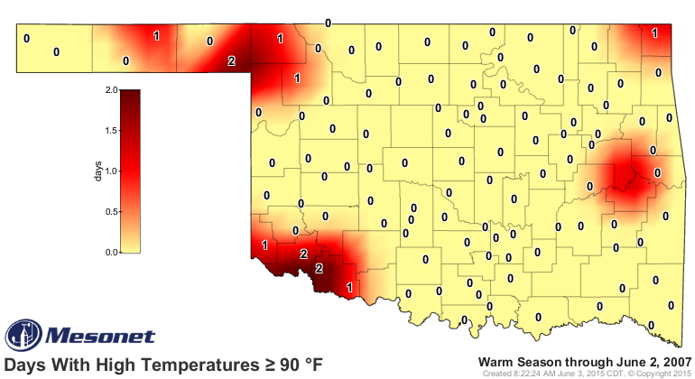
Some years have had less...1997 sets the low mark with only 7 (7!!!) 90s between
the beginning of the year and June 2.
http://ticker.mesonet.org/archive/20150603/2007-90s.png
Seven? Really?
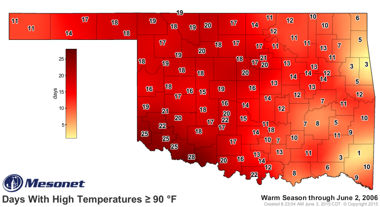
And then there was the same period in 2006 when the Mesonet had recorded 1353
90s across all its stations.
http://ticker.mesonet.org/archive/20150603/2006-90s.png
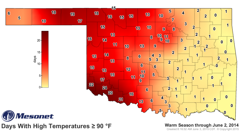
Heck, even last year we had seen 686 90s by now.
http://ticker.mesonet.org/archive/20150603/2014-90s.png
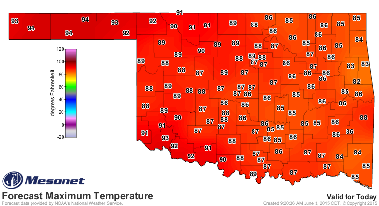
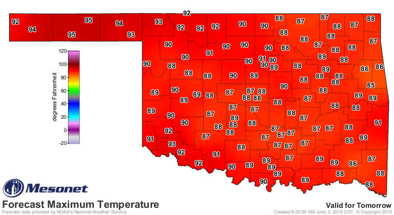
And we can expect more 90s on the way this week and into next.
http://ticker.mesonet.org/archive/20150603/todays-forecast-highs.png
http://ticker.mesonet.org/archive/20150603/thursdays-highs.png
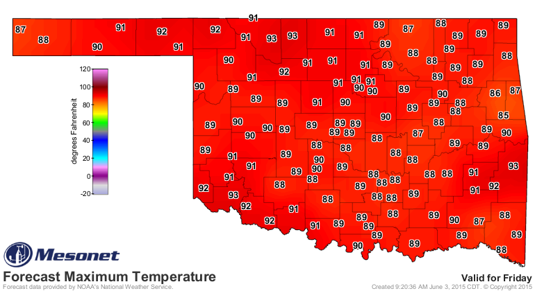
http://ticker.mesonet.org/archive/20150603/fridays-highs.png
http://ticker.mesonet.org/archive/20150603/saturdays-highs.png
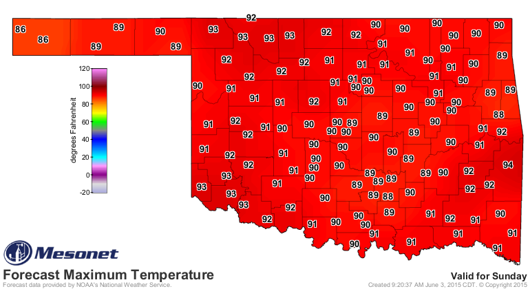
http://ticker.mesonet.org/archive/20150603/sundays-highs.png
Some of those numbers would probably be a bit higher if not for all the rain,
which brought lots of soil moisture and green vegetation to the state. The sun's
energy is being absorbed by all those dark green plants and also being used to
evaporate that soil moisture, both of which act as cooling processes. That
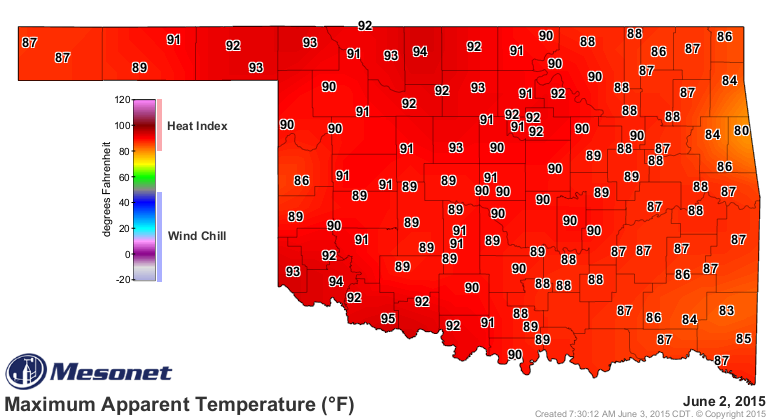
doesn't mean it could be hotter, you'll just feel it a bit differently as a
bit higher heat index. Check out yesterday's heat index map. Yikes! Lots more
90s in there than the regular air temperature map.
http://ticker.mesonet.org/archive/20150603/yesterdays-heat-index-max.png
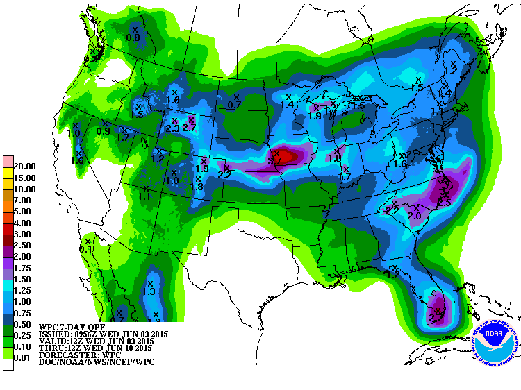
The rains are gone for now, to return who knows when.
http://ticker.mesonet.org/archive/20150603/7day-rainfall-forecast.gif
Climatological summer starts on June 1st. Apparently Mother Nature timed it
pretty well this year.
Let the heat begin!
Gary McManus
State Climatologist
Oklahoma Mesonet
Oklahoma Climatological Survey
(405) 325-2253
gmcmanus@mesonet.org
==================================================
The OCS/Mesonet Ticker
https://ticker.mesonet.org/
To subscribe or unsubscribe from the Ticker
or for questions about the Ticker or its content
Phone or Email the Ticker Manager at OCS
Phone: 405-325-2253 Email: ticker@mesonet.org
---------------------------------------------------
-C- Copyright 2024 Oklahoma Climatological Survey
===================================================
|


 Tweet
Tweet