Ticker for June 4, 2015
MESONET TICKER ... MESONET TICKER ... MESONET TICKER ... MESONET TICKER ...
June 4, 2015 June 4, 2015 June 4, 2015 June 4, 2015
Ain't it sweet!

(by the way, if you're too young to understand what a test pattern is...get a
haircut and go find a job!)
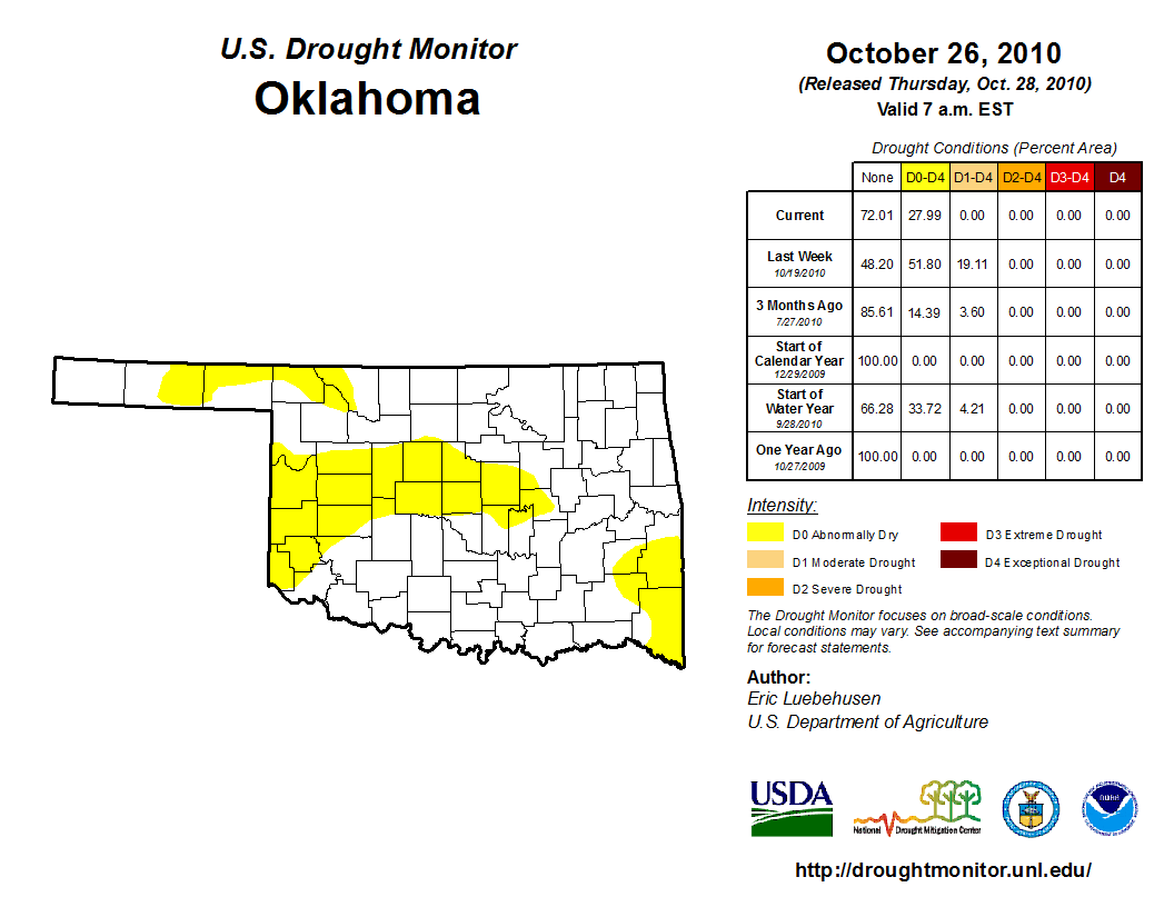
This is the Emergency Drought Broadcasting System. Due to the complete lack of
drought in the state of Oklahoma
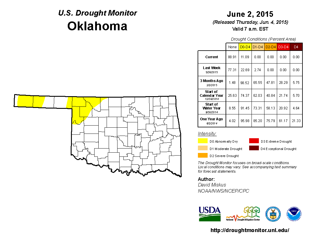
we will be signing off from this station until we are needed again. It's been a
long haul, with 239 straight weeks of having at least D1 (Moderate) drought
somewhere within the state of Oklahoma's borders, all the way back to October 26,
2010, some 1673 days ago.
Sure, there's still so D0 (Abnormally Dry) conditions out there in the NW, and you
can see why when you look at the rainfall maps. Those areas in the far NW and
western Panhandle just haven't gotten quite the same amounts as other parts of the
state

but they've gotten enough to eradicate the more detrimental short- and long-term
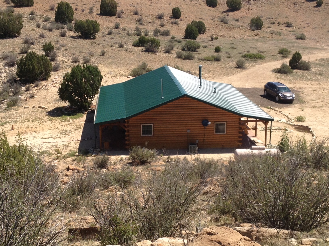
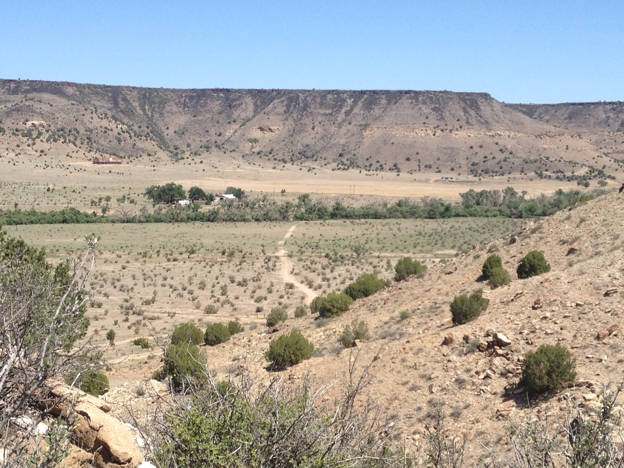
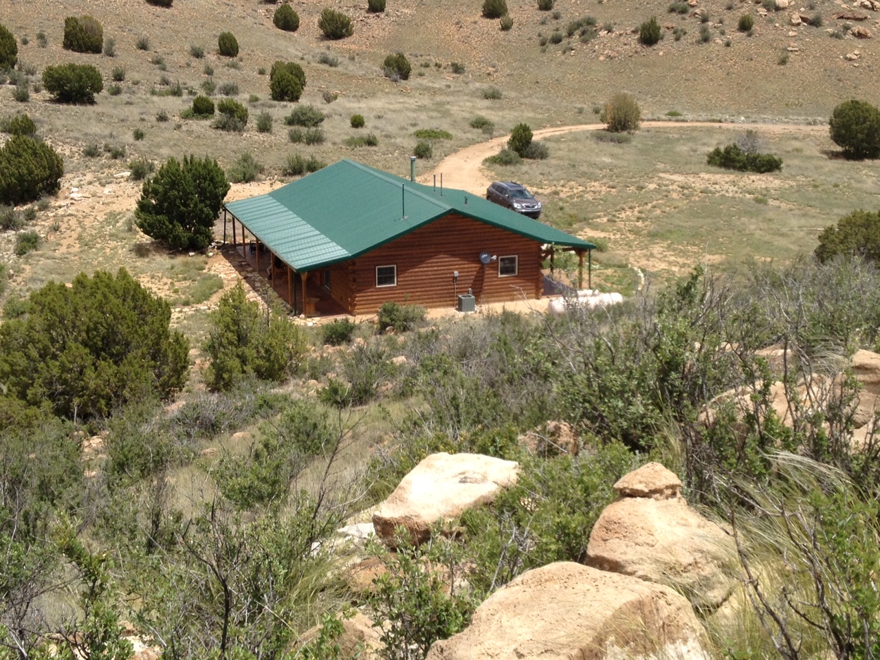
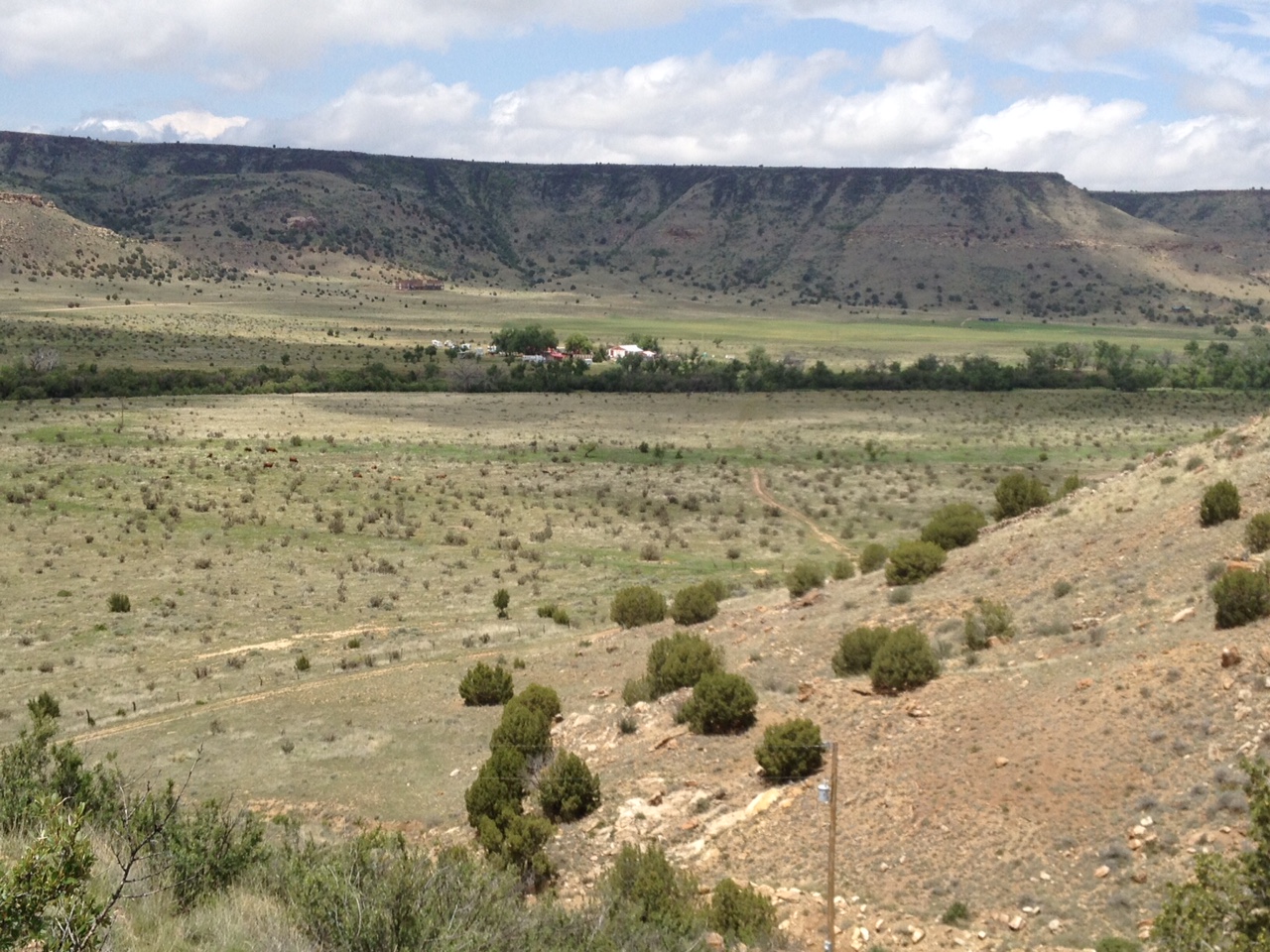
drought impacts. Here are a few pics from out in Cimarron County in the far
western Panhandle sent to us from a reader. No color re-touches here...it is a
weird shade of green for that part of the state. Here you'll see the before and
after pics showing the change from May 2013 vs. May 2015.
I will admit I have gotten a bit alarmed by the abrupt end of the rain after I
have gushed so much about how El Nino is upon us (even though its influence
starts to die out pretty quickly as we enter summer) and I think THIS round
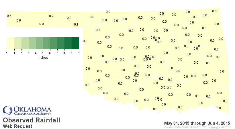
of relief is different than others. The rainfall maps since May 31 are a bit
bleak, after all. That's only 5 days, but that's sort of unusual for this part
of spring, especially after the pattern we just exited from.
BUT...the 7-day rainfall forecast is starting to light us up again.
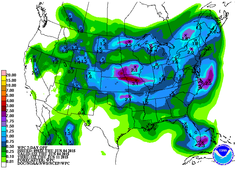
This looks more like a middle-of-next-week sort of deal, but it doesn't appear
to be the deluges of May either. But enough to give us some reinforcements from
that rain. Other than that, it's just gonna be plain old hot, with high
temperatures 5- to sometimes more than 10-degrees above normal. Humid, too, so
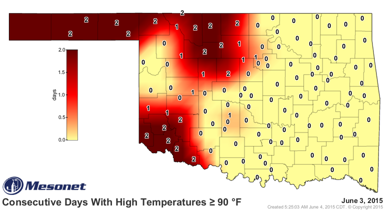
it will obviously feel a bit muggy out there. We are up to 2 straight days
with highs at or above 90 across western Oklahoma, so I guess we can watch this
map's numbers go higher and higher for a bit longer.
So that's it. Welcome to the doldrums (for awhile). Nothing exciting to talk
about today, like drought or flooding or tornadoes or hail or severe winds or...
Ain't it sweet!
Gary McManus
State Climatologist
Oklahoma Mesonet
Oklahoma Climatological Survey
(405) 325-2253
gmcmanus@mesonet.org
June 4 in Mesonet History
| Record | Value | Station | Year |
|---|---|---|---|
| Maximum Temperature | 107°F | GRA2 | 2014 |
| Minimum Temperature | 45°F | BOIS | 2009 |
| Maximum Rainfall | 8.23″ | GRAN | 1995 |
Mesonet records begin in 1994.
Search by Date
If you're a bit off, don't worry, because just like horseshoes, “almost” counts on the Ticker website!