MESONET TICKER ... MESONET TICKER ... MESONET TICKER ... MESONET TICKER ...
May 12, 2014 May 12, 2014 May 12, 2014 May 12, 2014
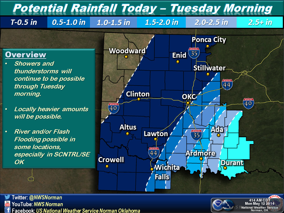
What happened to the Kaboom?
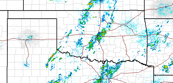
Well, our widespread heavy rain event scheduled for last night into this morning
was apparently yet another in a long line of duds, at least for most. There was
a blob of over an inch down in Beckham and Roger Mills counties, and a few other
streaks of a half-inch or so across NW OK, but other than that, a while lotta
nothing (although it is still raining in some areas, but it doesn't look like
western Oklahoma is going to get much more).
http://ticker.mesonet.org/archive/20140512/rainrfc.24hr.png
http://ticker.mesonet.org/archive/20140512/current-radar.png
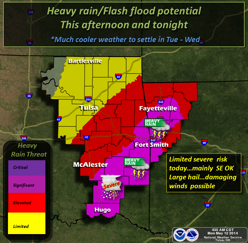
There is a chance for that line of storms to fill in as the front moves through
(but it had better giddy-up!).
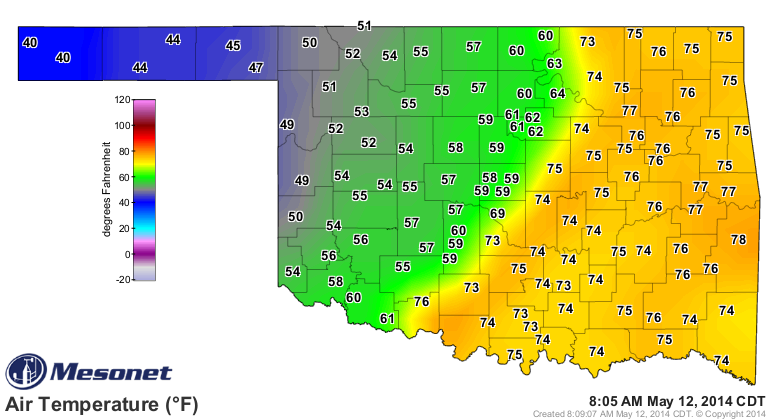
http://ticker.mesonet.org/archive/20140512/current.TAIR.png
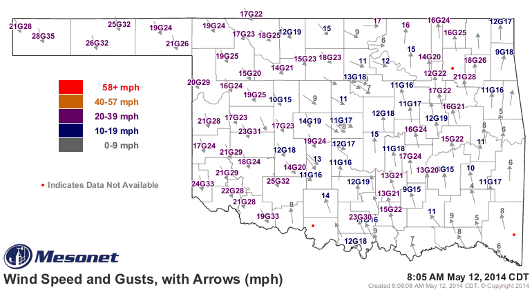
http://ticker.mesonet.org/archive/20140512/current.gustarrows.gif
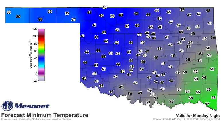
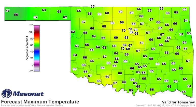
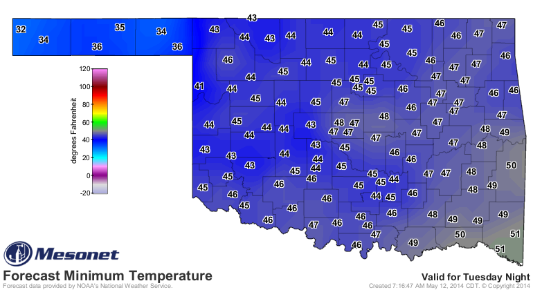
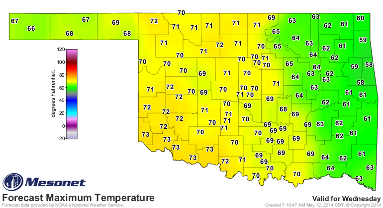
After the front passes, we go back to more of March-April type weather for a
couple of days with highs in the 60s and lows in the 40s.
http://ticker.mesonet.org/archive/20140512/tuesday-morning-lows.png
http://ticker.mesonet.org/archive/20140512/tuesday-highs.png
http://ticker.mesonet.org/archive/20140512/wednesday-morning-lows.png
http://ticker.mesonet.org/archive/20140512/wednseday-highs.png
At least central and eastern Oklahoma still has a chance for some decent (to
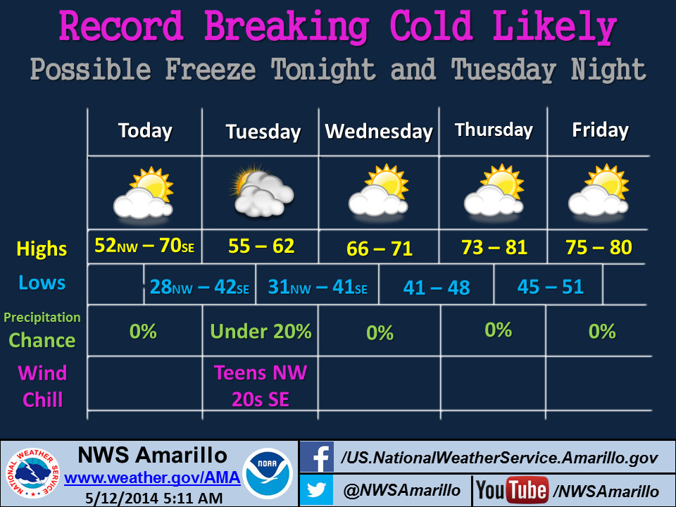
whopping, possibly) totals that could still be drought-denters. For western
Oklahoma, a cold, chilly dry mid-May day that will just see further damage to
Oklahoma's wheat and canola crops.
http://ticker.mesonet.org/archive/20140512/nws-amarillo.jpg
http://ticker.mesonet.org/archive/20140512/nws-norman.jpg
http://ticker.mesonet.org/archive/20140512/nws-tulsa.png
As for May thus far, at least through this morning, Dudsville for most. And
following this system, we can expect another long period without rain chances
... at least until the weekend, apparently, but nothing major showing up there,
either.
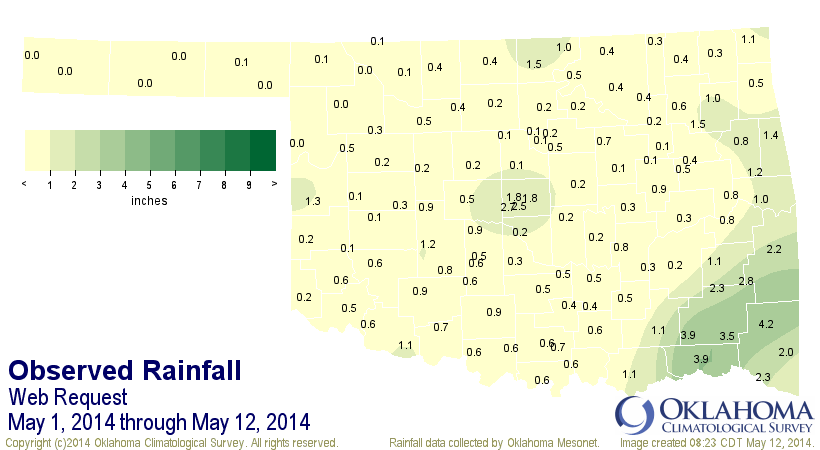
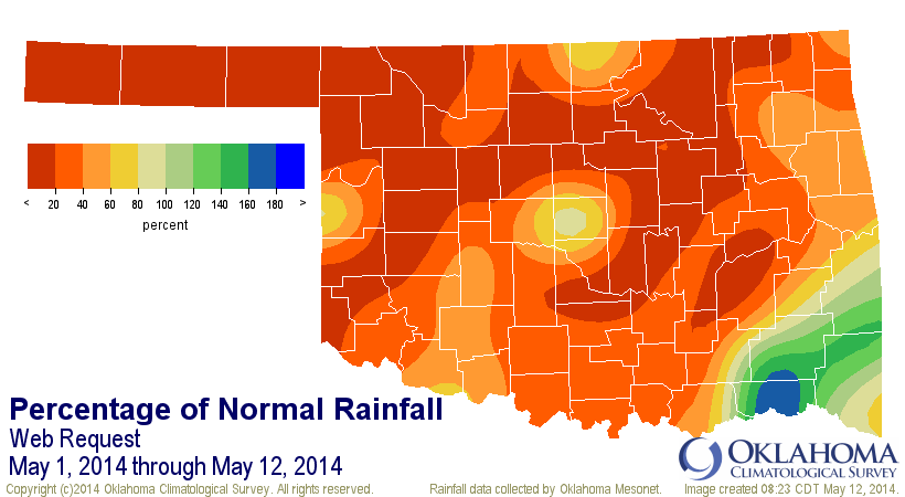
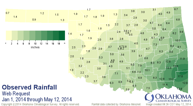
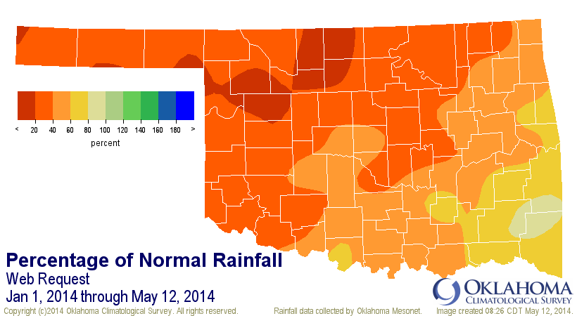
Here are the Mesonet rainfall maps for May thus far, and also for the year-to-
date thus far. Remember, eastern Oklahoma might see some pretty hefty totals
that could change these maps, but western Oklahoma's appear to to locked in
for awhile longer. The Panhandle has seen an average of 0.02" of rain so far
this May.
Wow.
http://ticker.mesonet.org/archive/20140512/may1-12-totals.png
http://ticker.mesonet.org/archive/20140512/may1-12-pct.png
http://ticker.mesonet.org/archive/20140512/jan1-may12-totals.png
http://ticker.mesonet.org/archive/20140512/jan1-may12-pct.png
The cold front is actually a blessing in disguise since it will help slow down
the drought's acceleration across the northwestern half of the state.
But, what happened to the Kaboom? No idea, but I'm pretty sure the fuse wasn't
put out by any rainfall. There's about a month left in our normal rainy season.
After that, the Kaboom will be the sun going all 2011 summer on us.
Gary McManus
State Climatologist
Oklahoma Mesonet
Oklahoma Climatological Survey
(405) 325-2253
gmcmanus@mesonet.org
==================================================
The OCS/Mesonet Ticker
https://ticker.mesonet.org/
To subscribe or unsubscribe from the Ticker
or for questions about the Ticker or its content
Phone or Email the Ticker Manager at OCS
Phone: 405-325-2253 Email: ticker@mesonet.org
---------------------------------------------------
-C- Copyright 2024 Oklahoma Climatological Survey
===================================================
|


 Tweet
Tweet