MESONET TICKER ... MESONET TICKER ... MESONET TICKER ... MESONET TICKER ...
April 8, 2010 April 8, 2010 April 8, 2010 April 8, 2010
Fe Fi Fo Freeze
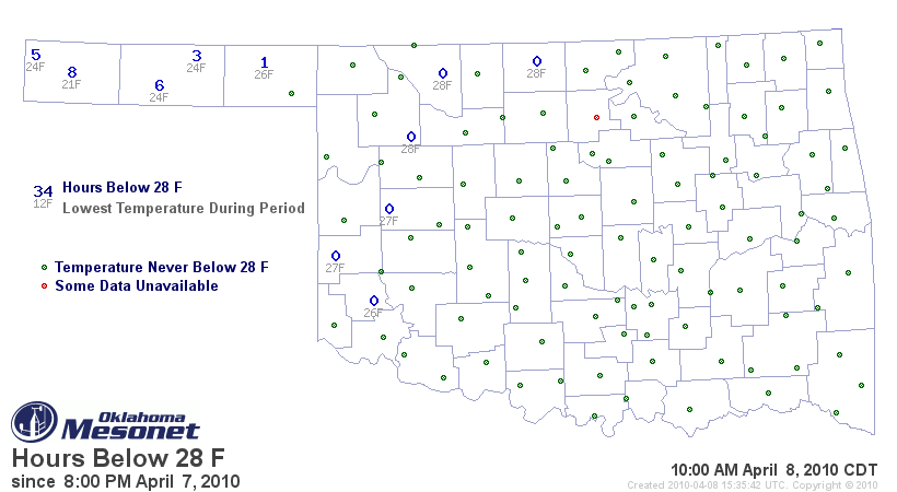
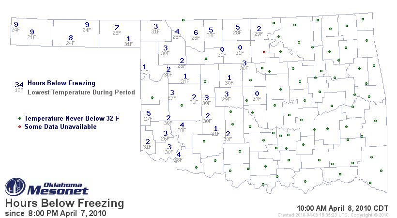
The lack of a significant hard freeze should keep our greens green. While the
western half of the state did see below-freezing temperatures for a few hours,
most of those areas escaped without much time spent below 28 degrees:
http://ticker.mesonet.org/archive/20100408/hours_below_28.png
http://ticker.mesonet.org/archive/20100408/hours_below_32.png
Southerly breezes should return tonight and keep most of the state above
freezing. Perhaps much of the state has had its last freeze?
El Nino continues to weaken
The current El Nino episode, which reached "strong" status this winter, has begun
to weaken in the equatorial pacific. If it continues to weaken as expected, its
effects on our weather (and points south) will continue to diminish. As stated
previously, we are normally not significantly affected by ENSO episodes, but the
current El Nino was strong enough to increase rainfall in the southern half of
the state and contribute to lower temperatures (especially maximum temperatures).
Keep in mind these events tend to have some momentum with them, so the effects
can linger even as the event wanes.
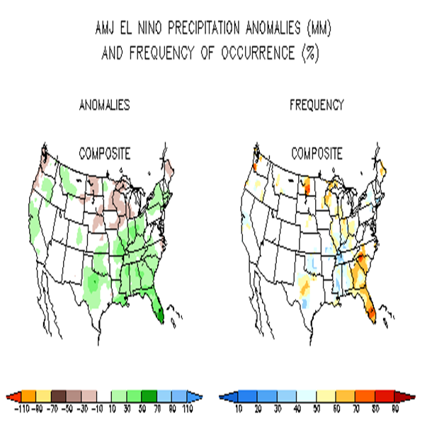
Take a look at the April-May-June precipitation anomalies and the frequency
that the anomalies occurred during El Nino events. You can see that while there
has been a tendency for above normal precipitation across the western two-
thirds of the state, the frequency of occurrence of those anomalies is extremely
low.
http://ticker.mesonet.org/archive/20100408/el_nino_precip.png
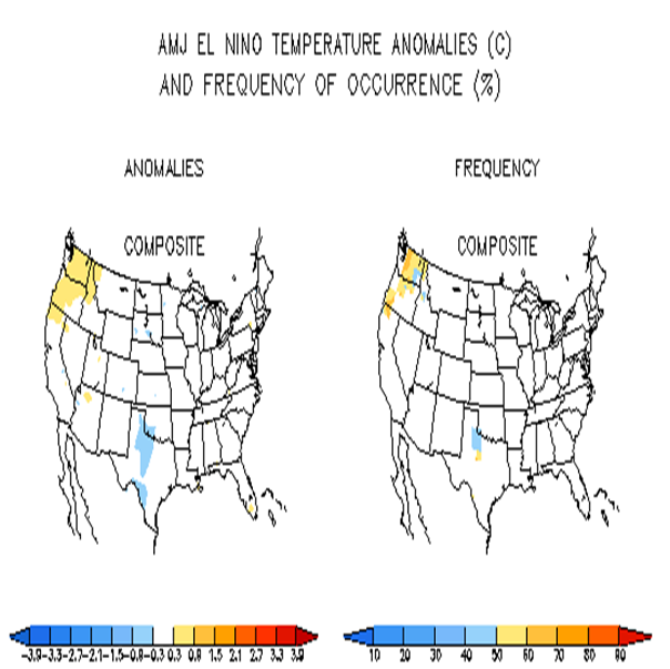
The temperature anomalies show that El Nino events generally don't affect our
temperatures in Oklahoma during April-May-June.
http://ticker.mesonet.org/archive/20100408/el_nino_temps.png
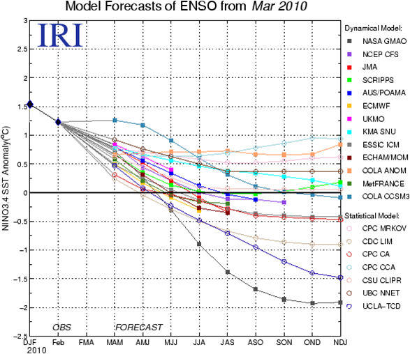
Finally, more and more models are forecasting a transition through summer and
fall from ENSO-neutral conditions into a La Nina event. A few models keep the
current El Nino event in place into next winter, however (more negative numbers
mean La Nina, more positive numbers mean El Nino ... ENSO Neutral conditions
live in between the two).
http://ticker.mesonet.org/archive/20100408/enso_outlooks.png
And remember, a La Nina event CAN mean drier and warmer cold-season weather
for us in Oklahoma. But again, the effects of La Nina and El Nino are generally
more significant farther to the south.
Gary McManus
Associate State Climatologist
Oklahoma Climatological Survey
(405) 325-2253
==================================================
The OCS/Mesonet Ticker
https://ticker.mesonet.org/
To subscribe or unsubscribe from the Ticker
or for questions about the Ticker or its content
Phone or Email the Ticker Manager at OCS
Phone: 405-325-2253 Email: ticker@mesonet.org
---------------------------------------------------
-C- Copyright 2024 Oklahoma Climatological Survey
===================================================
|


 Tweet
Tweet