Ticker for April 12, 2010
MESONET TICKER ... MESONET TICKER ... MESONET TICKER ... MESONET TICKER ...
April 12, 2010 April 12, 2010 April 12, 2010 April 12, 2010
Heat Burst!
A long-time weather observer and enthusiast noticed (probably by the wind
howling outside his window) one of our favorite weather phenomena contained
within the Mesonet data from Sunday night ... the heat burst. This is an event
that was previously thought to be pretty rare, but the advent of the Oklahoma
Mesonet has proven that to be false (at least in Oklahoma).
Heat bursts are a special form of downburst when a lot of suspended
precipitation descends rapidly from a dying thunderstorm. Under certain
atmospheric conditions, a bit of evaporational cooling leads to compressional
warming which in the end results in a burst of windy, hot air (which describes
most of my Tickers). Often this occurs at night when the environment has
already begun to occur. When midnight feels like 4 p.m., it can certainly be a
shock to the system.
You can see this heat burst in a meteogram from the Cheyenne site:
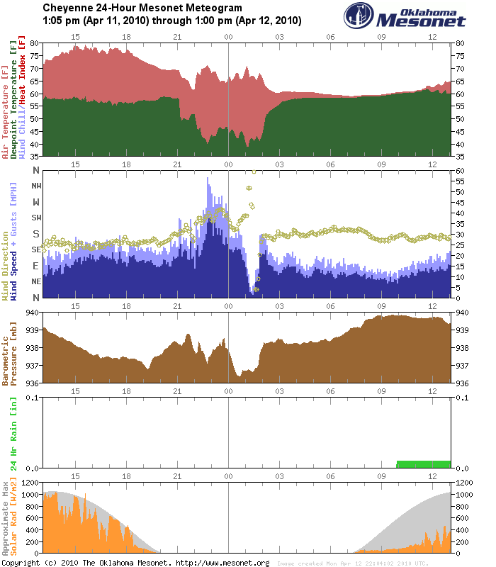
The meteogram says it all around 10 p.m., with a rapid rise in temperature, a
rapid increase in wind speed and gusts, and a rapid increase in pressure. The
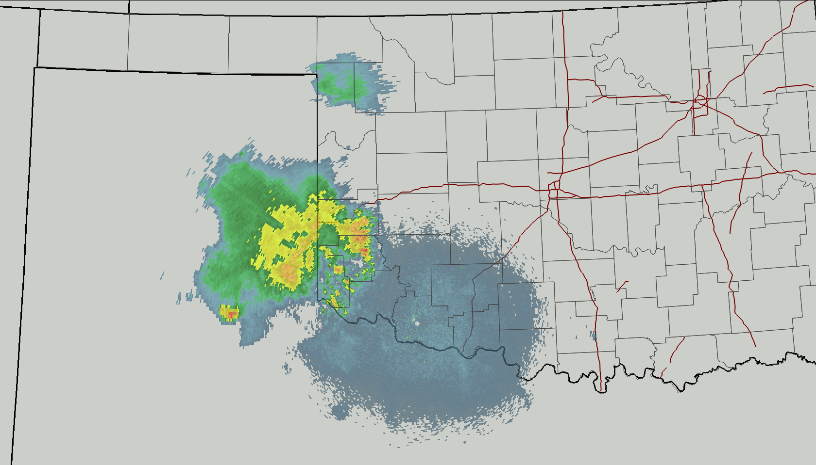
culprit, a decaying storm, can be found in this radar image in Beckham County:
Many thanks to Pete for cluing us into this bit of Atmospheric/Mesonet magic!
Gary McManus
Associate State Climatologist
Oklahoma Climatological Survey
(405) 325-2253
April 12 in Mesonet History
| Record | Value | Station | Year |
|---|---|---|---|
| Maximum Temperature | 102°F | MANG | 2018 |
| Minimum Temperature | 14°F | BOIS | 1997 |
| Maximum Rainfall | 3.14″ | CHEY | 2015 |
Mesonet records begin in 1994.
Search by Date
If you're a bit off, don't worry, because just like horseshoes, “almost” counts on the Ticker website!