MESONET TICKER ... MESONET TICKER ... MESONET TICKER ... MESONET TICKER ...
February 11, 2017 February 11, 2017 February 11, 2017 February 11, 2017
Julruary
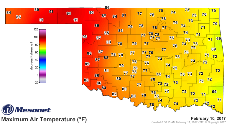
Yesterday's high temperature of 94 degrees at the Beaver Mesonet site broke the
record for the highest temperature ever recorded for this early in the year.
http://ticker.mesonet.org/archive/20170211/yesterdays-highs.png
That previous mark was held by the NWS cooperative observing stations at Cloud
Chief and Guthrie reaching 93 degrees on Feb. 1, 1911. The airport at Gage, a
non-Mesonet station, also hit 94 degrees yesterday to share Beaver's record mark.
But to heck with breaking "earliest to ever be this hot." How about we go for the
whole danged shooting match?
Today we'll go for:
1. Earliest to ever be this hot
2. Highest readings ever during climatological winter (Dec-Feb)
3. Highest readings ever during February.
2 and 3 might be switched around, but when you're talking about heat like this,
I think all bets are off. Most Februaries she goes to 10. This one goes to 11.
I hope some of you get that reference so I don't feel so old.
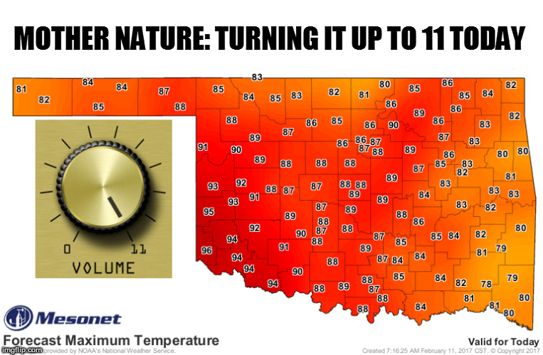
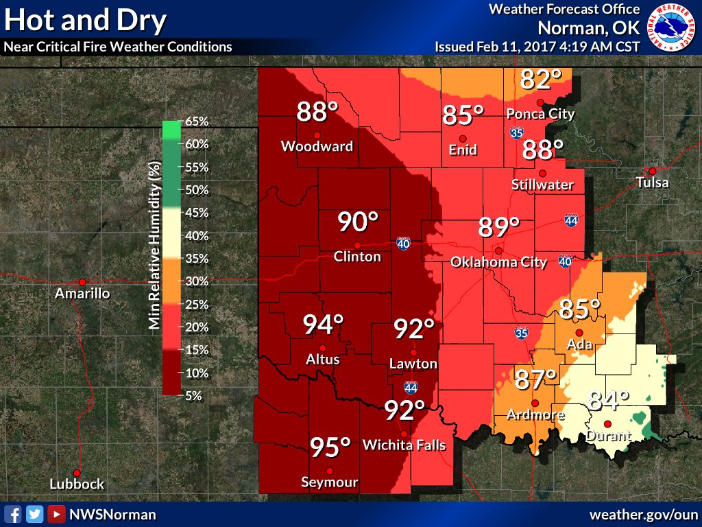
http://ticker.mesonet.org/archive/20170211/todays-forecast-highs.jpg
That 96 down at Hollis in far SW OK could very well turn into 100...not
necessarily in Hollis, but somewhere down there. Turns out for #2 and #3 above,
it's the same reading. The highest temperature ever recorded in Oklahoma during
February or winter is 99 degrees at Arapaho way back on Feb. 24, 1918. The way
the temperatures soared yesterday, it's certainly in the realm of possibility
today. The Panhandle had the benefit of downslope winds yesterday, so as those
westerly winds came down off the lee of the Rockies, they helped heat the air
due to compression.
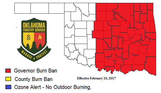
All this really means is more fire danger for the state today, which is also
why the Governor implemented a burn ban for the eastern half or so of the state.
http://ticker.mesonet.org/archive/20170211/GovernorBurnBanMap021017.png
http://ticker.mesonet.org/archive/20170211/latest.oklahoma.fire.gif
http://ticker.mesonet.org/archive/20170211/nws-ama-fire.png
http://ticker.mesonet.org/archive/20170211/nws-norman-fire.png
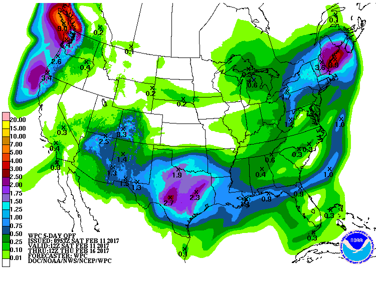
Rain chances are still looking good for the state early next week, especially
across southern Oklahoma. An inch or two anywhere would certainly be welcome!
http://ticker.mesonet.org/archive/20170211/5day-precip-forecast.gif
If it's gonna be hot, might as well set records? Be careful what you ask for,
I guess.
Gary McManus
State Climatologist
Oklahoma Mesonet
Oklahoma Climatological Survey
(405) 325-2253
gmcmanus@mesonet.org
==================================================
The OCS/Mesonet Ticker
https://ticker.mesonet.org/
To subscribe or unsubscribe from the Ticker
or for questions about the Ticker or its content
Phone or Email the Ticker Manager at OCS
Phone: 405-325-2253 Email: ticker@mesonet.org
---------------------------------------------------
-C- Copyright 2024 Oklahoma Climatological Survey
===================================================
|


 Tweet
Tweet