MESONET TICKER ... MESONET TICKER ... MESONET TICKER ... MESONET TICKER ...
February 7, 2017 February 7, 2017 February 7, 2017 February 7, 2017
Ring of fire?
http://ticker.mesonet.org/archive/20170207/ring-of-fire.jpg
This February (in Oklahoma), is a burning thing
And it makes a fiery ring.
Hmmm, not quite up to Johnny's standards, but you work with the lyrics Mother
Nature gives ya. I'm digging the warm weather, I must admit, but I'm not into
the fire danger and intensifying drought that's coming with it. And warm it was,
with records shattered all over the state. Yesterday's highs were off the charts,
in some cases 30 degrees above normal.
http://ticker.mesonet.org/archive/20170207/yesterdays-highs.png
And we're going to try it again today. Not quite as hot, but hot enough to make
things worse. And we will approach record highs in some areas.
http://ticker.mesonet.org/archive/20170207/todays-forecast-highs.png
http://ticker.mesonet.org/archive/20170207/feb7-record-highs.png
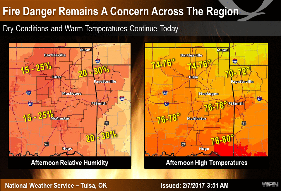
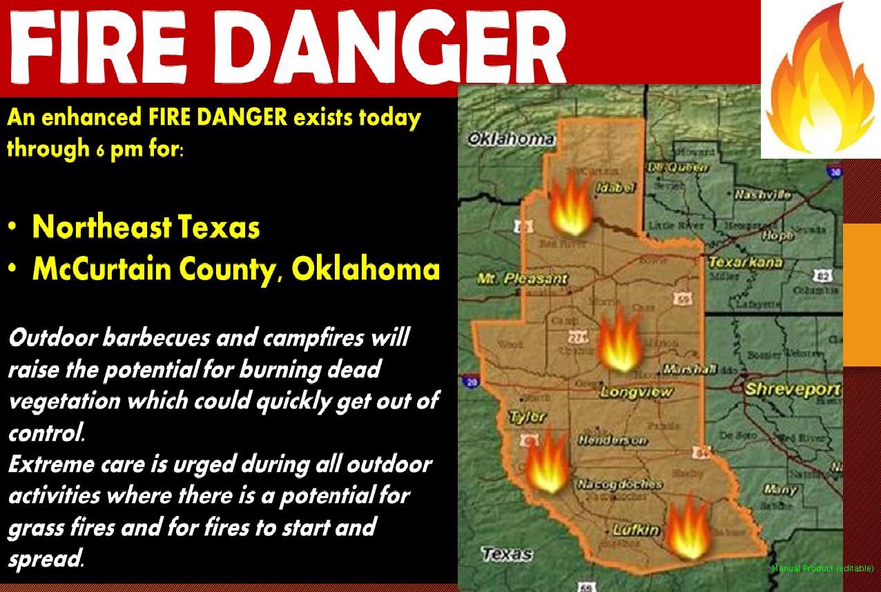
The good news is that winds won't be quite as high today, so we're able to avoid
any Red Flag fire warnings and things of that nature. But make no mistake about
it, if a fire starts today, it will burn just about anything that used to be
green.
http://ticker.mesonet.org/archive/20170207/nws-tulsa-fire.danger.png
http://ticker.mesonet.org/archive/20170207/nws-shreve-fire.danger.jpg
And while we will see a break for a couple of days with an approaching cold
front cooling things down, watch out for the weekend. We will see possibly the
warmest weather of the young year thus far, and if winds should kick up...
yikes!
http://ticker.mesonet.org/archive/20170207/saturday-forecast-highs.png
http://ticker.mesonet.org/archive/20170207/nws-norman-fire.planner.png
http://ticker.mesonet.org/archive/20170207/nws-ama-fire.planner.png
And remember, those that do choose to burn during these periods should be aware
of any burn bans put in place by your local officials. There are nine counties
with active burn bans in place at this time.
http://ticker.mesonet.org/archive/20170207/BurnBanMap02617B.png
Some help is possible as we get past the weekend as another south-diving upper-
level system tracks across the Desert Southwest approaching our area. The
questions is, will it dive farther south and impact Texas, leaving us with
leftovers? Will it come up over Oklahoma? The forecast models are just too
inconsistent right now, but as we get closer (and we get hotter), things should
start to come into better focus. For now, we'll just how the 7-day precip map
that teases next week's rain. And then the 8-14 day precip outlook shows that
possible southerly track to this storm.
http://ticker.mesonet.org/archive/20170207/7day-rain-forecast.gif
If you're looking for the next big February blizzard, might want to wait awhile,
or go to Dairy Queen (sorry Braum's).
http://ticker.mesonet.org/archive/20170207/feb14-20-temp-outlook.gif
Oh well, if it snowed anytime soon it would just sizzle and evaporate away.
Maybe next year (or after a couple of weeks).
Gary McManus
State Climatologist
Oklahoma Mesonet
Oklahoma Climatological survey
(405) 325-2253
gmcmanus@mesonet.org
==================================================
The OCS/Mesonet Ticker
https://ticker.mesonet.org/
To subscribe or unsubscribe from the Ticker
or for questions about the Ticker or its content
Phone or Email the Ticker Manager at OCS
Phone: 405-325-2253 Email: ticker@mesonet.org
---------------------------------------------------
-C- Copyright 2024 Oklahoma Climatological Survey
===================================================
|


 Tweet
Tweet