MESONET TICKER ... MESONET TICKER ... MESONET TICKER ... MESONET TICKER ...
February 6, 2013 February 6, 2013 February 6, 2013 February 6, 2013
Blimey!
It's very London-esque today in Oklahoma, with the fog and whatnot. I had the
urge to give some street urchins a couple of shillings, even. A couple of
problems with that:
1. Great Britain doesn't use the shilling anymore
2. I was too busy listening to the wireless in my horseless carriage to bother
looking for any street urchins
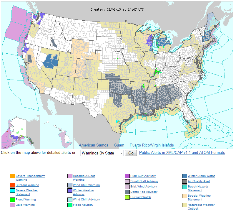
Oklahoma's not the only place impacted by fog. States from Kansas to Georgia are
driving with their lights on and their knuckles cracking on steering wheels.
http://ticker.mesonet.org/archive/20130206/nws-densefog-advisories.png
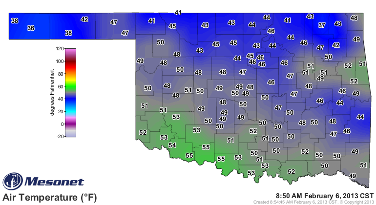
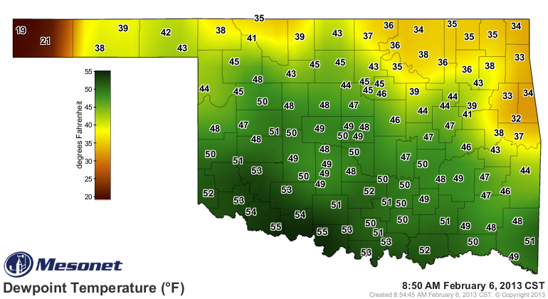
I welcome the fog. It gives other folks a good feel for how my brain operates on
a full-time basis. The Oklahoma Mesonet picks up the fog quite well. Fog forms
when the air temperature reaches the dewpoint temperature. At that point, water
vapor begins to condense (and heat is released, which is why the dewpoint is
normally a good predictor of low temperatures in these cases) and clouds begin
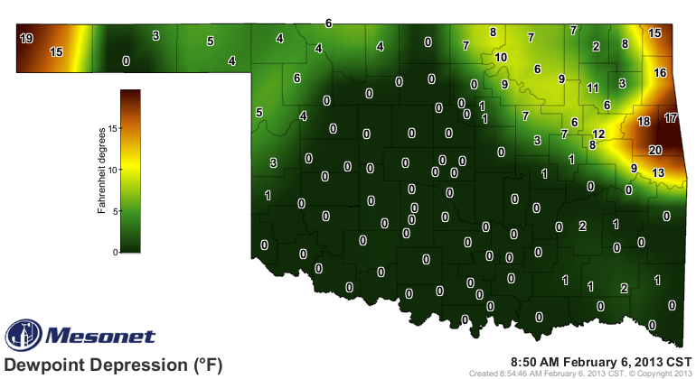
to form. Those clouds just happen to be close to the surface. A look at the
Mesonet's "dewpoint depression map tells the story. The dewpoint depression is
pretty simple ... it's the difference between the air temperature and the dewpoint
temperature. When the dewpoint depression reaches zero, you're gonna have fog
in most cases. Now if you're air temperature is below zero, that's when you
get freezing fog. No problems this morning though.
http://ticker.mesonet.org/archive/20130206/air-temp.png
http://ticker.mesonet.org/archive/20130206/dewpoint-temp.png
http://ticker.mesonet.org/archive/20130206/dewpoint-depression.png
From the dewpoint depression map, looks like the far western Panhandle is in
the clear, as well as northeastern Oklahoma. Now all this moisture is good news
since we have a couple of storm systems lined up, ready to make use of it.
Tonight into tomorrow and then the weekend look wet for drought-parched
Oklahoma. Better yet, it looks like convection is in order, meaning somebody
will possibly get lots of rain. I know those come with unfortunate accessories,
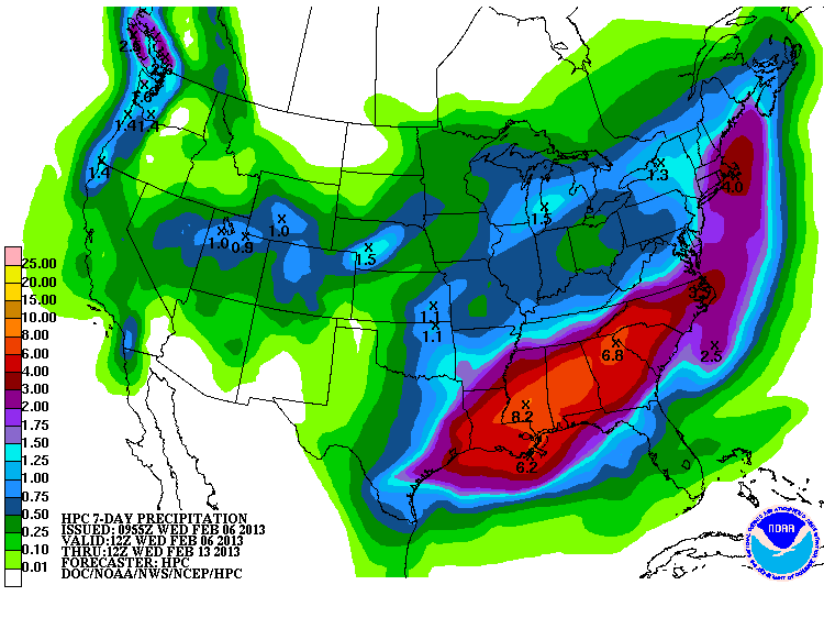
but that's the nature of our best rains. Here's the 7-day rainfall forecast.
http://ticker.mesonet.org/archive/20130206/7day-rain.gif
Not a shock, but the best rains look to be east of I35. We'll see if we can
get some training thunderstorms to form in western Oklahoma and surprise some
folks, however. After that, it appears some cooler air will move into place for
a time.
So I guess all that's left to do now is enjoy the grey (gray for you Yanks)
skies, put another shrimp on the barbie (hey, it's a former colony!) and read
some Dickens:
"Now, just sit right back and you'll hear a tale, a tale of a fateful trip ..."
I'm from Buffalo. We always substituted "Gilligan's Island" for the recommended
reading material. Far be it from me to break tradition.
Gary McManus
Associate State Climatologist
Oklahoma Climatological Survey
(405) 325-2253
gmcmanus@mesonet.org
==================================================
The OCS/Mesonet Ticker
https://ticker.mesonet.org/
To subscribe or unsubscribe from the Ticker
or for questions about the Ticker or its content
Phone or Email the Ticker Manager at OCS
Phone: 405-325-2253 Email: ticker@mesonet.org
---------------------------------------------------
-C- Copyright 2024 Oklahoma Climatological Survey
===================================================
|


 Tweet
Tweet