MESONET TICKER ... MESONET TICKER ... MESONET TICKER ... MESONET TICKER ...
January 31, 2011 January 31, 2011 January 31, 2011 January 31, 2011
Wind, ice...never the twain should meet
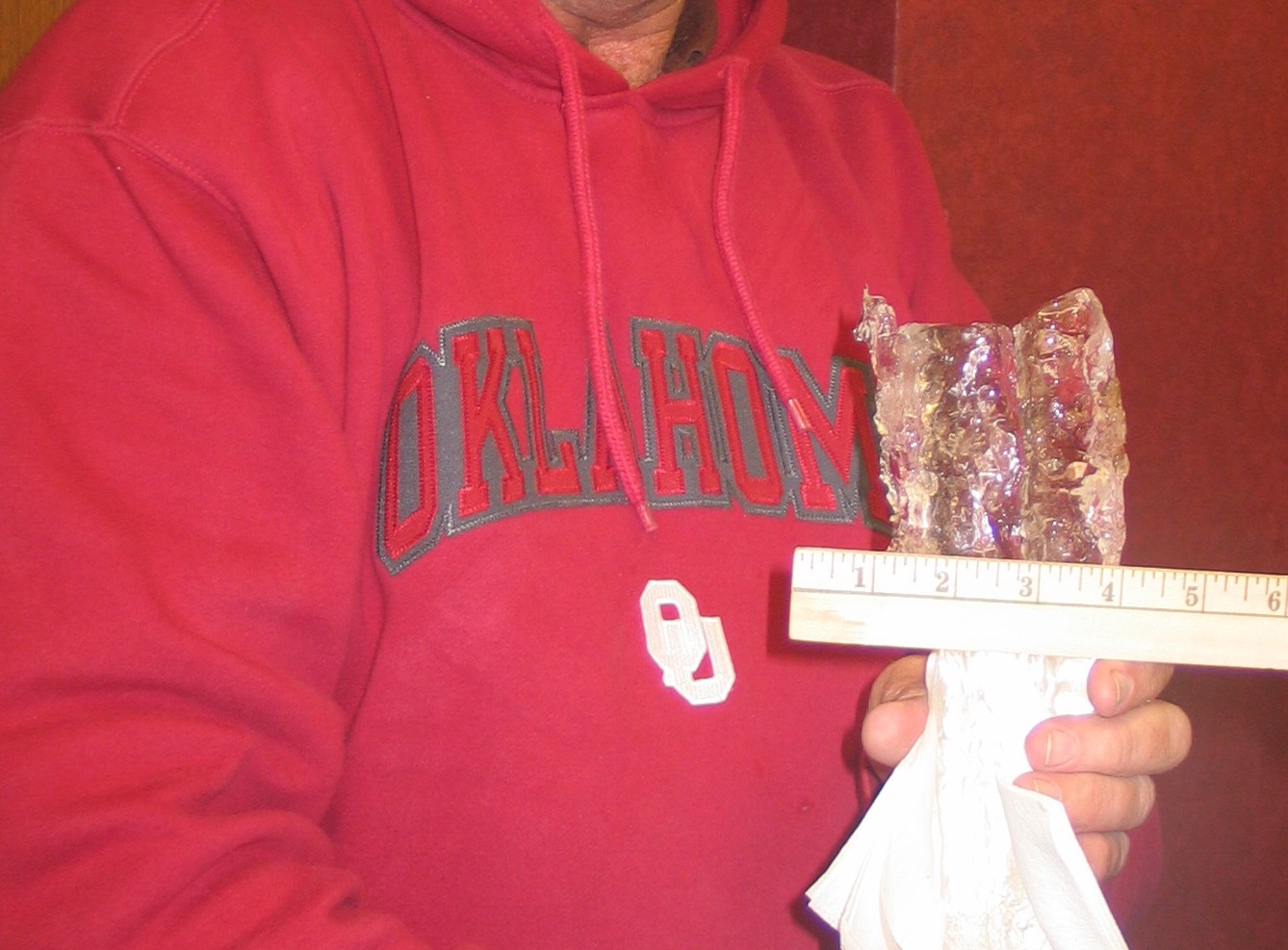
Just a reminder as the big storm draws near. Even though ice accumulations are
not forecast (for now) to be as significant as we've seen in some past winter
storms around here (pause for dramatic picture, ice accumulation on a powerline
from Altus during last January's ice storm)
http://ticker.mesonet.org/archive/20110131/ice.jpg
it's not only the ice that can create mayhem with the power utility
infrastructure. Winds are also forecast to be gusting at over 25 mph. According
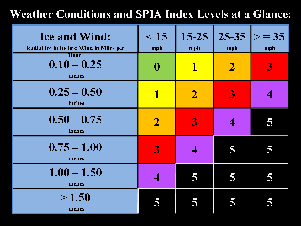
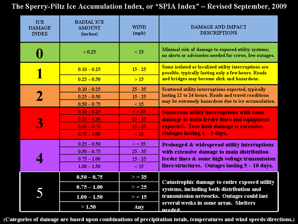
to the Sperry-Piltz Ice Accumulation Index (SPIA), it doesn't take much to cause
plenty of damage and leave folks without electrical power for days:
http://ticker.mesonet.org/archive/20110131/spiaTable.png
http://ticker.mesonet.org/archive/20110131/spiaTable2.png
If you can follow along on the algorithm diagrams, a quarter-inch of ice with
wind gusts of 25-35 mph can lead to an Ice Damage Index of 3:
"Numerous utility interruptions with some damage to main feeder lines and
equipment expected. Tree limb damage is excessive. Outages lasting 1-5 days."
Those ice damage estimates are based on the experiences of Sid Sperry of the
Oklahoma Association of Electric Cooperatives over the last decade. Over that
period, Oklahoma has seen just about every type of ice storm damage imaginable,
totaling over $2 billion and leaving close to 1.5 million customers (many more
actual people) without power for varying lengths of time.
And should a quarter-inch of ice still be on power lines (or trees!) when the
forecasted 40-50 mph winds hit the following couple of days ... well, you can
look at the grim outcomes on the diagrams themselves.
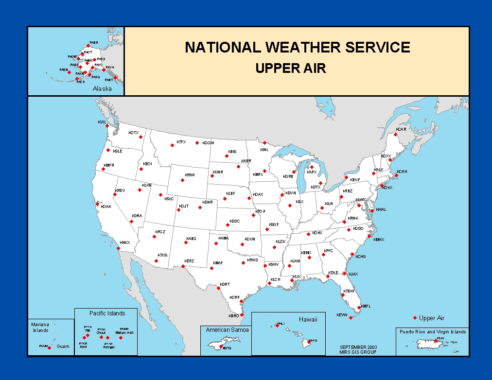
As a final note, here's a look behind the curtain: winter precipitation type
is difficult to forecast. So much is dependent on the vertical structure of the
atmosphere, and the sites that gather that information are not exactly a
Mesonet as you can see from this map of weather balloon launch sites:
http://ticker.mesonet.org/archive/20110131/upper_air.jpg
A slight change in the temperature profile as you go up into the atmosphere
makes all the difference in whether you get rain, freezing rain, sleet or snow.
So for the most part, rain-sleet-snow are good. Falling snow-laden tree limbs
can cause some havoc, but nothing compared to the destruction and misery caused
by freezing rain. While most are glued to what their possible snow totals will be,
working with Sid and the fine folks at the electric cooperatives has caused me
to keep an eye on the ice accumulation forecasts.
Blizzards are much more pleasant when you have power.
Gary McManus
Associate State Climatologist
Oklahoma Climatological Survey
405-325-2253
==================================================
The OCS/Mesonet Ticker
https://ticker.mesonet.org/
To subscribe or unsubscribe from the Ticker
or for questions about the Ticker or its content
Phone or Email the Ticker Manager at OCS
Phone: 405-325-2253 Email: ticker@mesonet.org
---------------------------------------------------
-C- Copyright 2024 Oklahoma Climatological Survey
===================================================
|


 Tweet
Tweet