MESONET TICKER ... MESONET TICKER ... MESONET TICKER ... MESONET TICKER ...
January 6, 2020 January 6, 2020 January 6, 2020 January 6, 2020
Potpourri
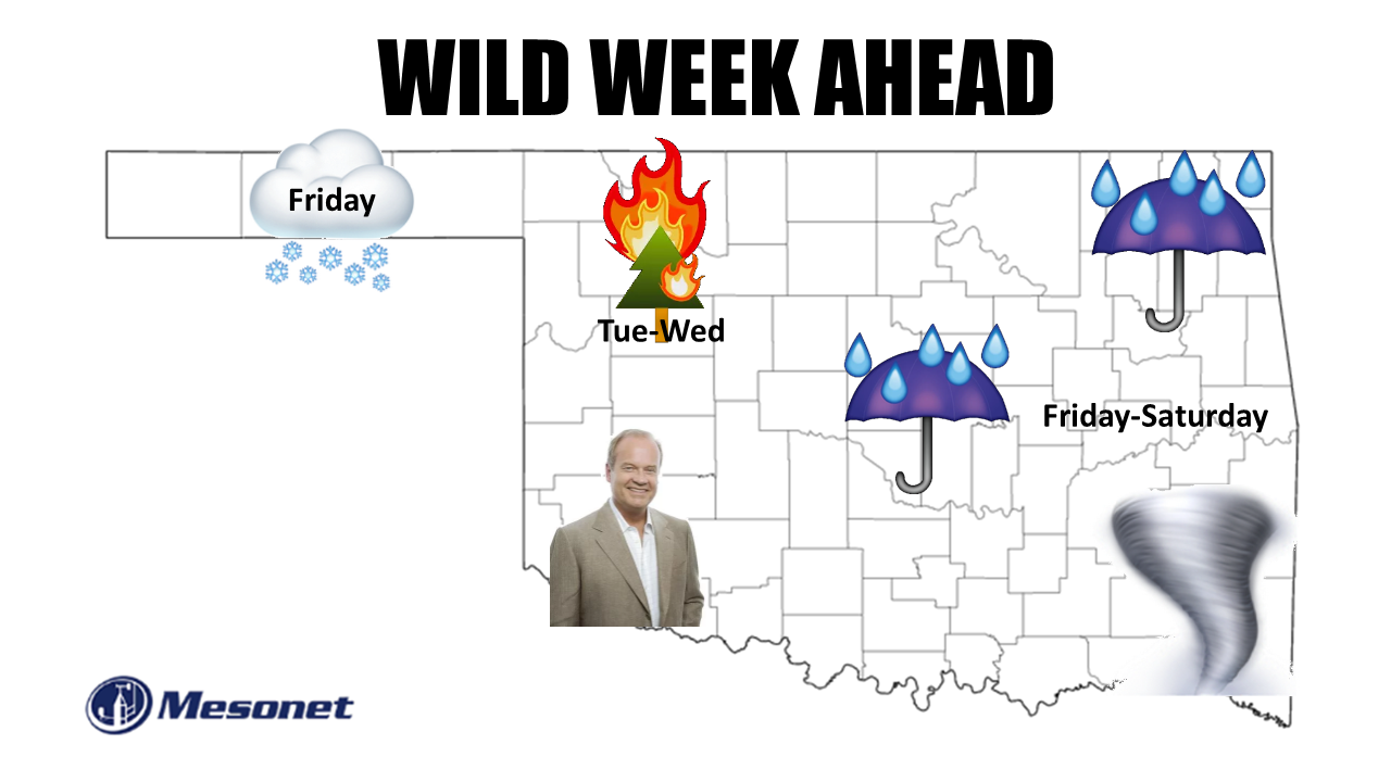
http://ticker.mesonet.org/archive/20200106/wild.week.png
Ugh, the first few weeks of January in Oklahoma. Let's face it, not exactly the
prime time for exciting weather normally. Lots of brown/yellow vegetation, blue
skies, blah temperatures (really cold mornings, not-so-cold afternoons), etc.
Every once in awhile, maybe a snowstorm or two. But you need storm systems for
that, and return moisture from the Gulf, and a good deep cold air mass either in
place or arriving. Well, we're going to have *SOME* of that this weekend, it would
appear, with a chance of some frozen precipitation in the northwest, rain to the
east, and maybe some wild springlike weather in the southeast. The festivities
should start on Friday...maybe late Thursday in the Panhandle. At any rate, the
storm system that is forecast to move over us is still out over the ocean, and
we've already gone over what challenges that provides. Here are a few graphics
from our friends at the local NWS offices to give you a better idea of what
to expect.
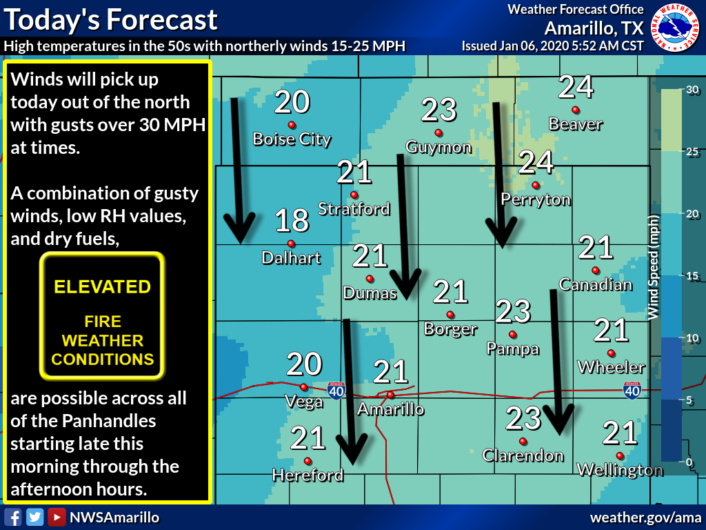
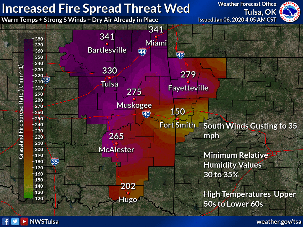
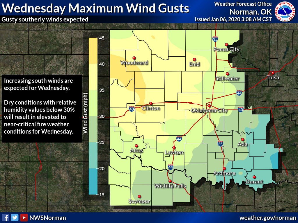
Oh yeah, as the storm system approaches, expect wind to kick up. With the
mild/warm weather, dead/dormant vegetation and dry air, that means fire danger;
primarily on Tuesday and Wednesday.
http://ticker.mesonet.org/archive/20200106/nws-amarillo-fire-danger.png
http://ticker.mesonet.org/archive/20200106/nws-tulsa-fire.danger.png
http://ticker.mesonet.org/archive/20200106/nws-norman-wed-winds.png
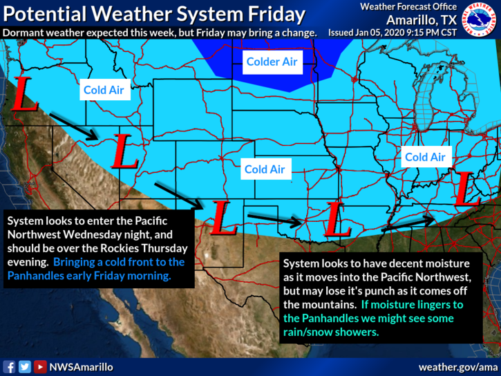
Then we get into our weekend storm system with a chance of just about
everything.
http://ticker.mesonet.org/archive/20200106/nws-amarillo-weekend.scene.png
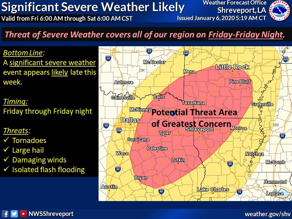
http://ticker.mesonet.org/archive/20200106/nws-shreve-severe-threat.jpg
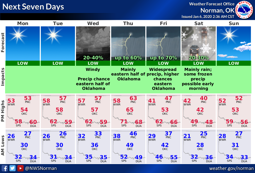
http://ticker.mesonet.org/archive/20200106/nws-norman-7day-planner.png
That graphic from the Shreveport NWS office is a bit scary...here's their
explanation that accompanies it.
"A potentially significant severe weather event looks increasingly
likely by the end of this week as a powerful storm system enters
the region. All modes of severe weather appear to be in play with
this system, including the threat of tornadoes in addition to large
hail and damaging winds. Isolated flash flooding also cannot be
ruled out as rainfall amounts could exceed 2-3 inches in some areas."
Obviously, this weather pattern is gonna need watched, and you're gonna have to
stay weather aware this week. Check into your local NWS office and favorite
media weather source early and often to stay ahead of any hazards.
Now, why the threat of Kelsey Grammar, seemingly all week?
Because why not, that's why.
Gary McManus
State Climatologist
Oklahoma Mesonet
Oklahoma Climatological Survey
(405) 325-2253
gmcmanus@mesonet.org
==================================================
The OCS/Mesonet Ticker
https://ticker.mesonet.org/
To subscribe or unsubscribe from the Ticker
or for questions about the Ticker or its content
Phone or Email the Ticker Manager at OCS
Phone: 405-325-2253 Email: ticker@mesonet.org
---------------------------------------------------
-C- Copyright 2024 Oklahoma Climatological Survey
===================================================
|


 Tweet
Tweet