Ticker for August 19, 2024
MESONET TICKER ... MESONET TICKER ... MESONET TICKER ... MESONET TICKER ...
August 19, 2024 August 19, 2024 August 19, 2024 August 19, 2024
Nasty
It was so hot yesterday I saw a funeral procession pull into Sonic at 2:30pm to
take advantage of happy hour.
Out of bounds? Hey, YOU'RE out of bounds! The heat was out of bounds! This
summer has gotten out of bounds!
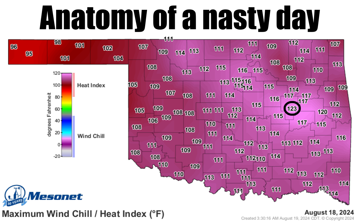
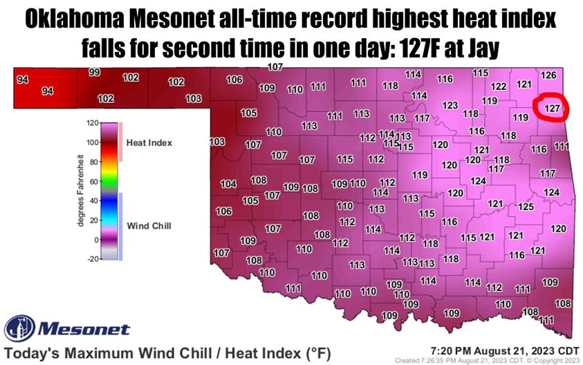
I yearn for a dry heat. You know, the kind where we don't come within 4 degrees
of the all-time Mesonet record heat index. Amember this from last year when Miami
the record at 126 degrees, then Jay said "Hold my hot beer," and hit 127?
Okmulgee tried its darndest with a disgusting dewpoint (some folks call it "dew
point," I says "dewpoint") of 83 degrees, to go along with an actual air temp
of 97 degrees.
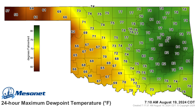

Okmulgee actually had a high of 101 degrees yesterday, but the dewpoint wasn't
as high at that time or they could have challenged that 127. At least they
won't get that chance today as our backdoor cold front (and we all know just
how painful that can be) has settled into the northeastern half of the state,
bringing with it some milder air, and also drier air. It will still be hot in
that part of the state, just closer to normal. For the rest of the state,
STILL HOT!
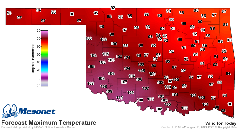
I'm afraid this "cool down," if that's what we're gonna call it when we go from
ridiculously hot to "kinda hot," is gonna be a half-n-half type of deal where
SW OK gets to remain in the coals all week.

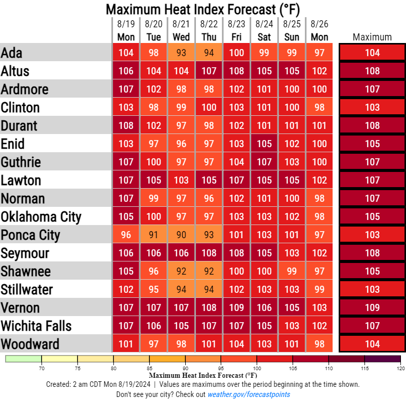
Also notice that it doesn't last long, but hopefully we won't go back to the
ridiculously hot weather of this weekend, but just to "wow, it's hot" weather
via the actual air temps. Yesterday did claim the prize as the hottest day of
the year thus far with a statewide average of 103.2 degrees, topping August 7's
101.9 degrees.
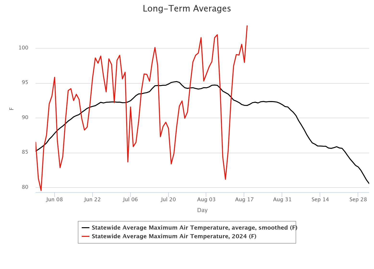
The good news that you can tell from that graph is that we're on the proverbial
"downward slide" for our average temps. That means with each successive week,
our "above normal" temperatures are operating from a lower base temperature. So
above normal next week might mean 99 degrees instead of 103 degrees. Then the
following week, maybe 96 degrees instead of 99 degrees, and so on and so forth.
It's okay, summer fans...I've been on the downward slide for years and I'm still
here.
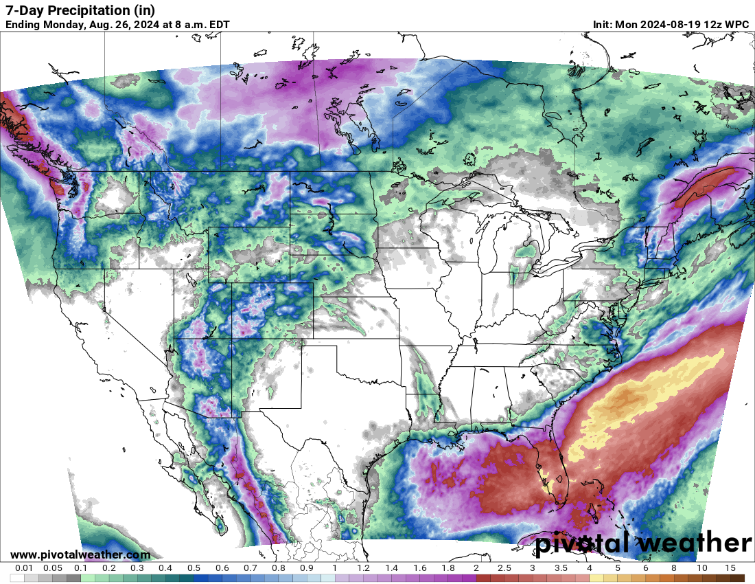
How about rain?
How about no?
Ugh. It was so hot I saw a couple of fire hydrants fighting over a dog.
Gary McManus
State Climatologist
Oklahoma Mesonet
Oklahoma Climatological Survey
gmcmanus@ou.edu
August 19 in Mesonet History
| Record | Value | Station | Year |
|---|---|---|---|
| Maximum Temperature | 111°F | GRA2 | 2024 |
| Minimum Temperature | 51°F | ELRE | 2015 |
| Maximum Rainfall | 8.55 inches | OKMU | 2007 |
Mesonet records begin in 1994.
Search by Date
If you're a bit off, don't worry, because just like horseshoes, “almost” counts on the Ticker website!