Ticker for August 16, 2024
MESONET TICKER ... MESONET TICKER ... MESONET TICKER ... MESONET TICKER ...
August 16, 2024 August 16, 2024 August 16, 2024 August 16, 2024
Let's go again
Why not, because yesterday was SOOOOO much fun, right (unless you were in far
NW OK, but then you're having fun anyway since that's easily the best part of
Oklahoma)?
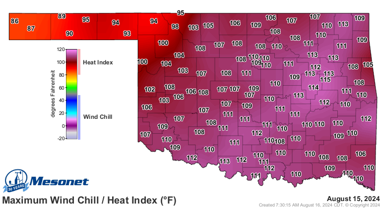
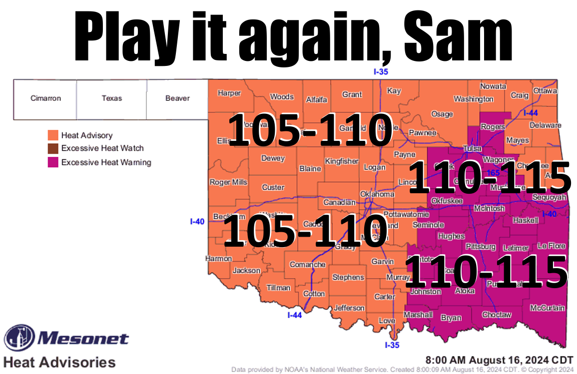
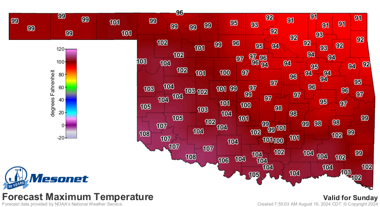
Dangerous heat again today, and again tomorrow before we start to see a
flattening of that heat dome as it retreats to the west, giving us a bit of
milder air from the northeast.
Think "not as hot" (which is what I think every morning when I look in the mirror).
Hey, how can a weatherperson in Oklahoma keep any self esteem?

Still, for parts of the state, the oven is still set to roast. And don't forget
there will still be dangerous heat the next couple of days for most of us.
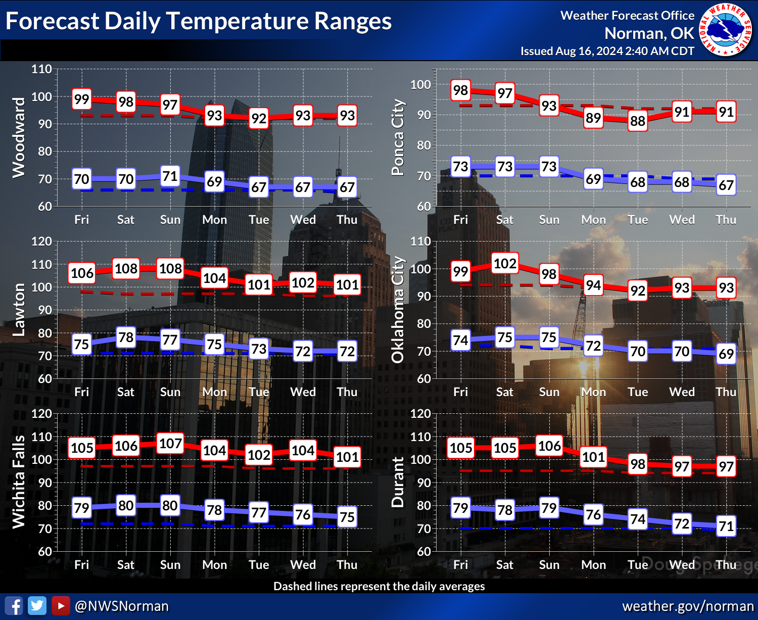
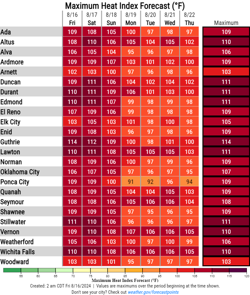
Those "cooler" temperatures are just close to normal though, not the type of
plunge into fall we saw last week. And then the heat looks to come back for
awhile.
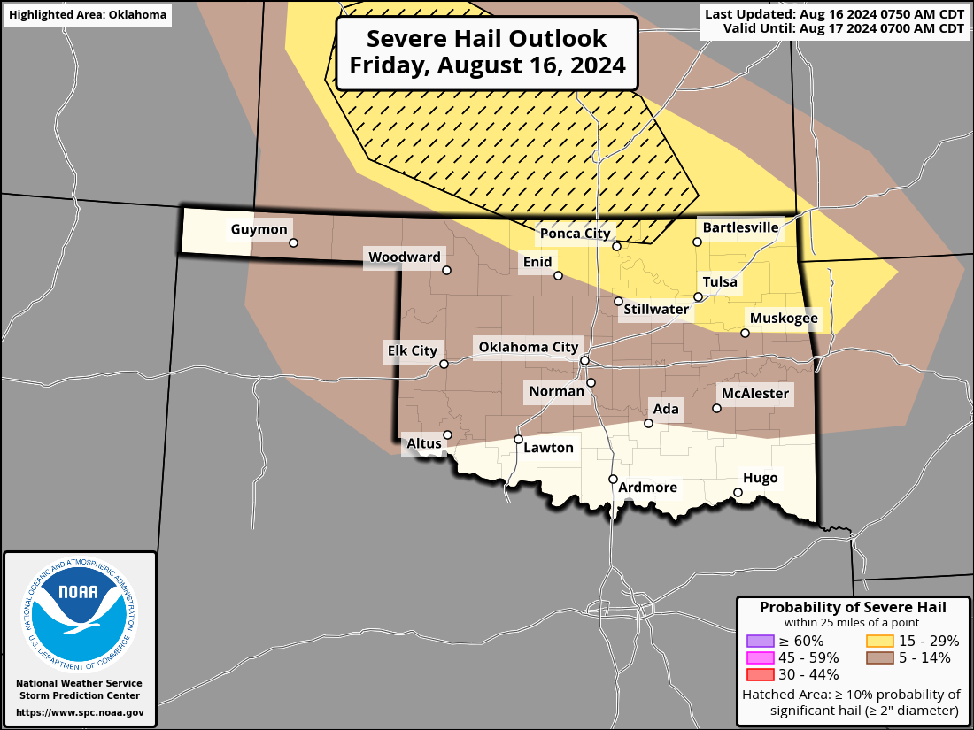
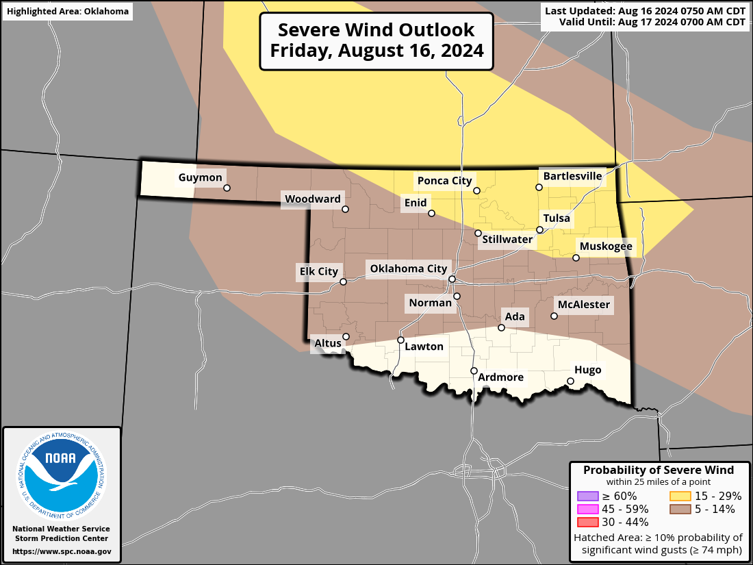
Watch out up north today...just like yesterday in parts of the state, there will
be a chance for significant severe weather. This go-round, there appears to be
a bit bigger risk for damaging hail in far northern OK, to go along with the
severe wind risk.
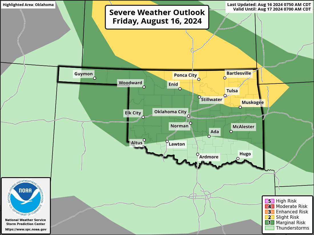
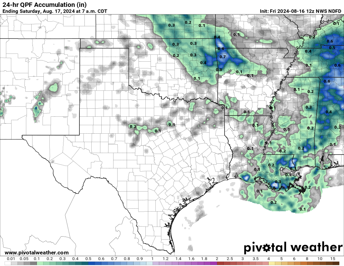
We'll take the rain, though!
Gary McManus
State Climatologist
Oklahoma Mesonet
Oklahoma Climate Survey
gmcmanus@ou.edu
August 16 in Mesonet History
| Record | Value | Station | Year |
|---|---|---|---|
| Maximum Temperature | 108°F | MANG | 2024 |
| Minimum Temperature | 53°F | BRIS | 2016 |
| Maximum Rainfall | 3.48 inches | KENT | 2010 |
Mesonet records begin in 1994.
Search by Date
If you're a bit off, don't worry, because just like horseshoes, “almost” counts on the Ticker website!