Ticker for April 17, 2019
MESONET TICKER ... MESONET TICKER ... MESONET TICKER ... MESONET TICKER ...
April 17, 2019 April 17, 2019 April 17, 2019 April 17, 2019
Wait for Netflix
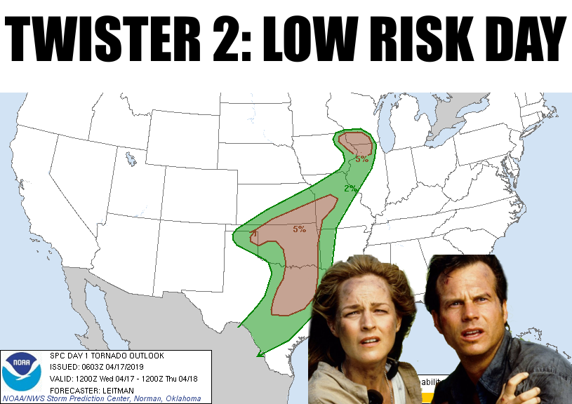
Okay, so it's a severe risk day. Lots in the offing, and as per usual, the
forecasts and outlooks this morning should serve as a notice to pay attention
to the forecasts and outlooks LATER today. Never hurts to lead with tornado risks,
since that's an attention grabber. Never bury the rotating column of air in
contact with the ground, my old editor (lie, I was never a reporter, but it
works here) used to say. And today's tornado risk is indeed low, but not zero.
And a lot will depend on how the atmosphere evolves throughout the day. Probably
easiest explained with some help from our friends at the Norman NWS office:
"Bottom line: The highest confidence for severe thunderstorms is
across northern Oklahoma. Confidence is a little lower across
south central into southeast Oklahoma and lowest across
central/southwest Oklahoma. If storms develop in these conditional
areas, they will have the potential to be supercells with the
threat for significant hail. The greatest relative tornado risk
will be with any discrete supercellular storms in the early
evening, which (currently) is most likely across south central
Oklahoma."
Lots of ifs, ands, and buts in there. The atmosphere will tell the story later
today. Here's some more from our friends (we claim them, not sure if they
claim us) at NWS Tulsa:
"Strong deep and low level shear and instability are in place, so
if storms develop late this afternoon, they will quickly become
strong to severe with the potential for very large hail and a
limited tornado risk. The more widespread precipitation will
likely hold off until the front enters northeast Oklahoma this
evening and spread into northwest Arkansas overnight. Those
storms along the front will also have a primary risk for hail and
damaging winds, and a limited threat for tornadoes."
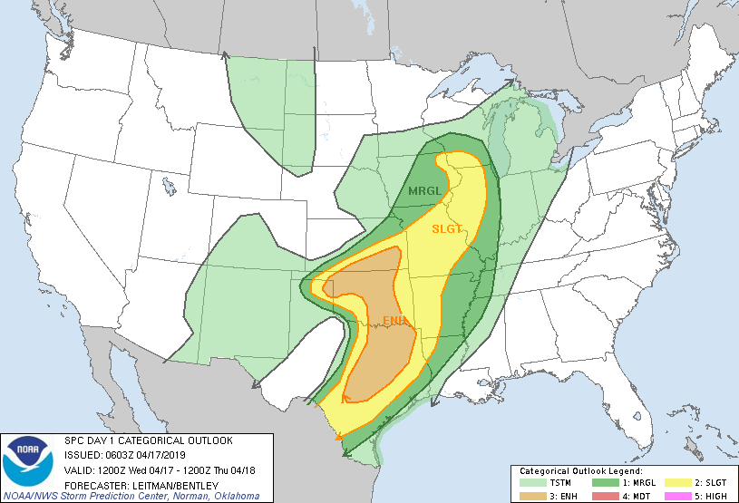
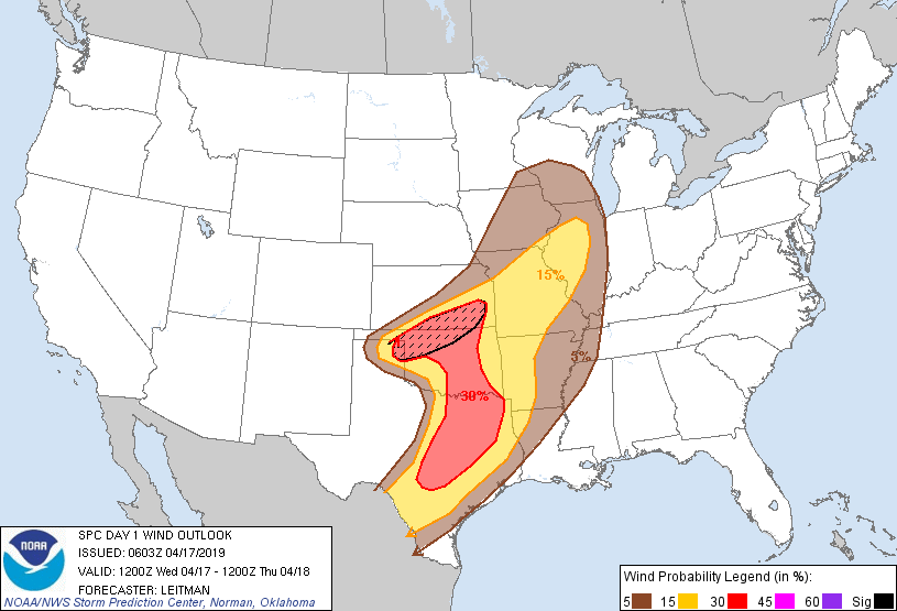
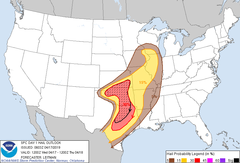
Here are the official outlooks from our acquaintances (we don't want to
overstep) at the Storm Prediction Center). Hail and wind appear to be the
primary threats this afternoon and evening, especially across northern Oklahoma
along the cold front.
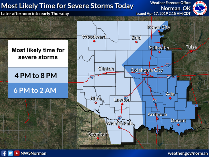
And for timing?
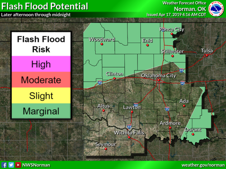
Plus, there could be lots of rain in a short amount of time. You know what that
means. No, not free ice cream. Flash flooding. Why would you think that would
get you free ice cream? Stay focused, people!
Pretty simple...your average severe risk day in Oklahoma. As per usual,
conditional on how the atmosphere evolves throughout the event, so the best
thing to do is stay weather aware. Stay tuned to your favorite media outlets
as you monitor the NWS forecasts and watches/warnings. Have a plan.
Let's hope for a box office dud...the most boring sequel since "Dances With
Prairie Dogs."
Gary McManus
State Climatologist
Oklahoma Mesonet
Oklahoma Climatological Survey
(405) 325-2253
gmcmanus@mesonet.org
April 17 in Mesonet History
| Record | Value | Station | Year |
|---|---|---|---|
| Maximum Temperature | 102°F | GRA2 | 2006 |
| Minimum Temperature | 22°F | BOIS | 2020 |
| Maximum Rainfall | 6.57 inches | MEDI | 2013 |
Mesonet records begin in 1994.
Search by Date
If you're a bit off, don't worry, because just like horseshoes, “almost” counts on the Ticker website!