Ticker for April 18, 2019
MESONET TICKER ... MESONET TICKER ... MESONET TICKER ... MESONET TICKER ...
April 18, 2019 April 18, 2019 April 18, 2019 April 18, 2019
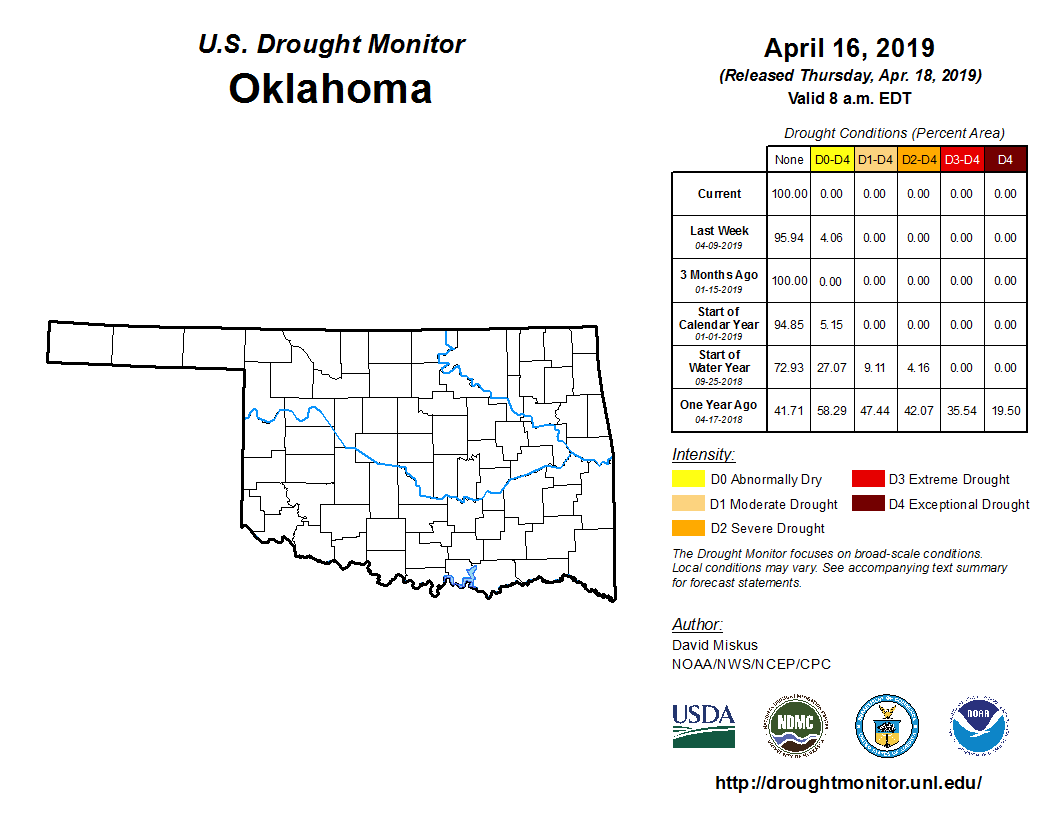
Two droughts end
Well, one was good and one was bad. Or one ending was good and the other ending
was bad, to be more precise (or is that "to be more accurate?"). At any rate,
the rainfall of the past week has managed to wipe our drought map clear once
again after a brief flirtation with dry conditions in the far SW and SE parts of
the state. So here's a very mundane, boring map for you to glory in.
Now the bad drought ending...Oklahoma saw its first official tornado last night
near Shattuck. Well, two tornadoes it sounds like, to be more accurate (or is that
"to be more precise?"). We also had hail up to the size of baseballs and lots of
other fun features of severe weather.

All in all, about what you'd expect for a mid-April severe weather event in
Oklahoma. Now we should start to see a bit more calm weather before we get into
the fizz again next week, setting us up for a beautiful Easter Sunday.
But it does look like we're going to be in a wet pattern after that, not only
for next week, but possibly into the summer.
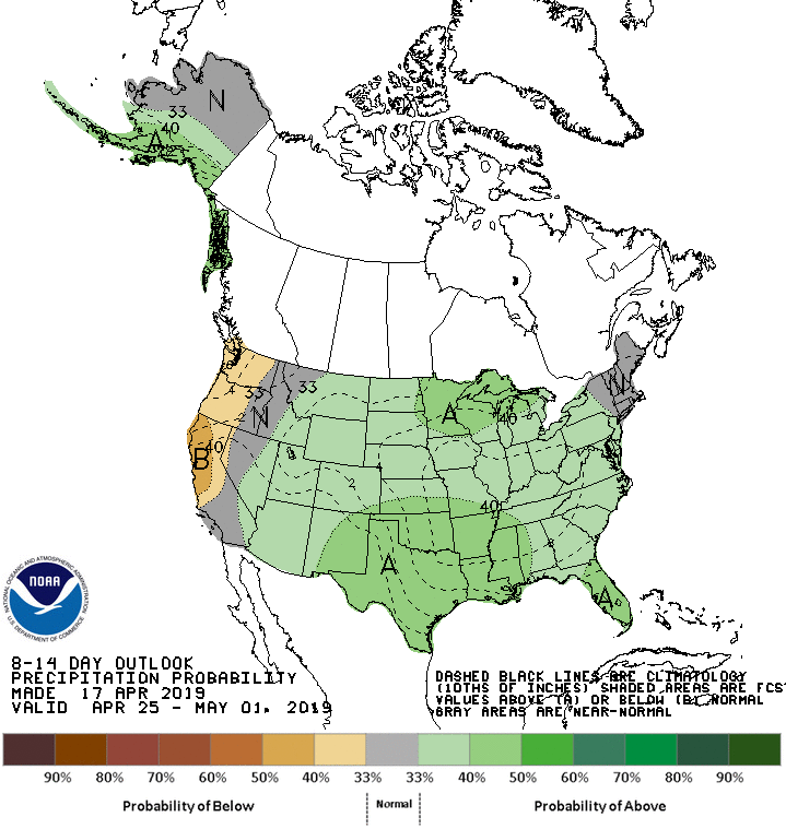
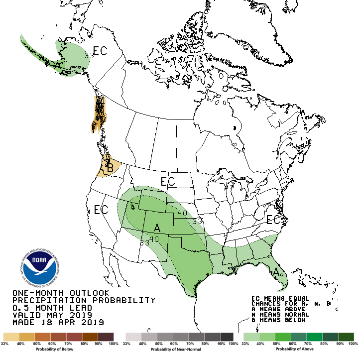
Now we start to see increased odds of above normal precipitation the last week
of April, then into May, and through the first part of summer. Perhaps
cooler than normal weather in part as well, a consequence of more rainfall and
abundant soil moisture from that rainfall. Remember, as the sun's rays evaporate
soil moisture, that's a cooling process. So more of the sun's energy goes
towards evaporating soil moisture instead of being converted into sensible
heat. Obviously, more rain signals the possibility of more clouds, another way
to keep temperatures down during the warm season.
Last week of April:
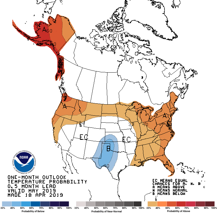
May temperature and rainfall outlooks:
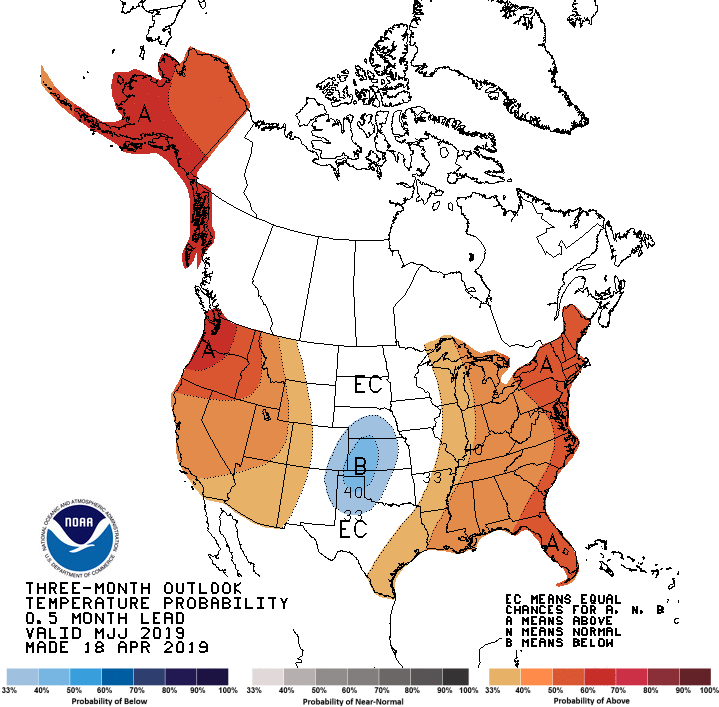
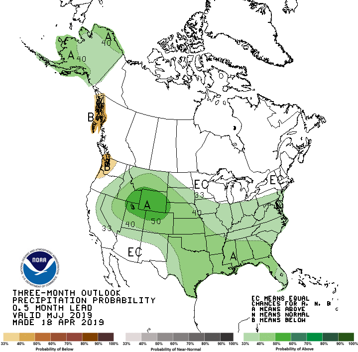
May-July temperature and rainfall outlooks:
So a wetter May. Yikes, right? Well, not so fast. That doesn't really tell us
everything we need to know for severe weather ingredients. We also see an outlook
for cooler than normal weather during May, which could negate an important
svr wx ingredient: heat. In actuality, this doesn't really say much at all
about the possibility of severe weather, since the day-to-day weather
conditions are much more important to determine those factors.
What we CAN see is little chance of drought development during the next 3 months
should these outlooks hold water. Get it? Never mind. Let's check out the
May-July drought outlook.
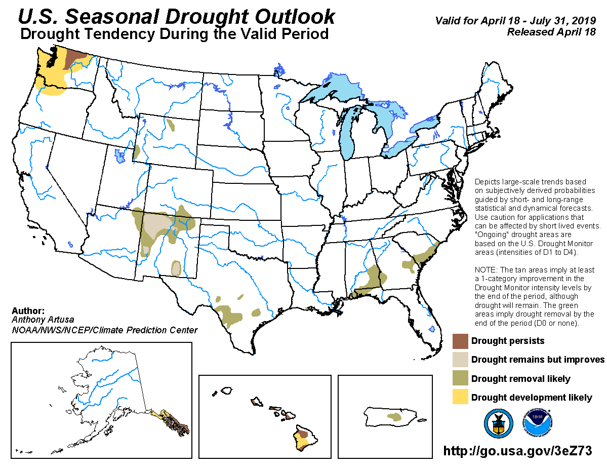
We'll take it! Enjoy your Easter weekend.
Gary McManus
State Climatologist
Oklahoma Mesonet
Oklahoma Climatological Survey
(405) 325-2253
gmcmanus@mesonet.org
April 18 in Mesonet History
| Record | Value | Station | Year |
|---|---|---|---|
| Maximum Temperature | 101°F | ALTU | 2011 |
| Minimum Temperature | 22°F | BOIS | 2013 |
| Maximum Rainfall | 3.17 inches | TAHL | 2009 |
Mesonet records begin in 1994.
Search by Date
If you're a bit off, don't worry, because just like horseshoes, “almost” counts on the Ticker website!