Ticker for August 9, 2023
MESONET TICKER ... MESONET TICKER ... MESONET TICKER ... MESONET TICKER ...
August 9, 2023 August 9, 2023 August 9, 2023 August 9, 2023
Let it ride
And I quote Rocky IV: "What started out as a joke has turned into a disaster!"
First off, Rocky IV (Roman to Okie numerals: 4) is wholly underrated, what with
its killer Stallone Russian gulag workout scenes, and cheap Gorbachev knockoff.
But hasn't this summer been underrated too? Because for most of it, it's been
pretty tame (126-degree heat index notwithstanding). Only in the last 2-3 weeks
has it turned nasty. Here's proof!
CUZ I SAID SO!
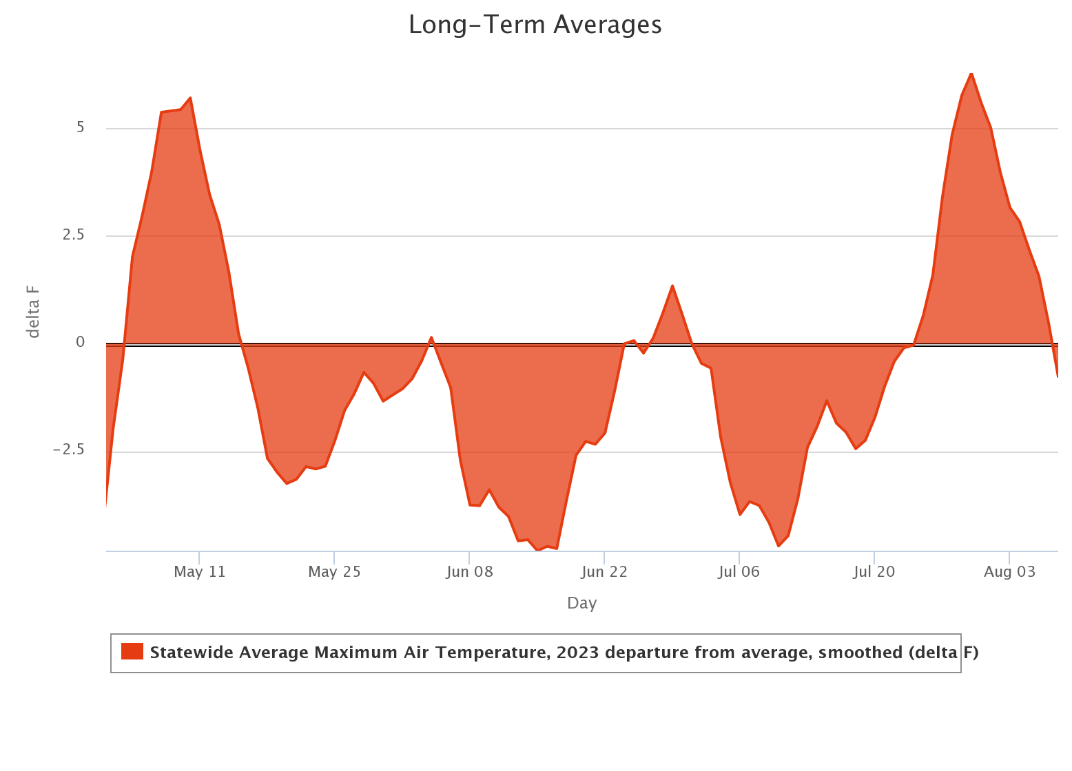
Oh, *actual* proof, over and above the word of your favorite (and since there's
only one...your least favorite) State Climatologist? Check out the statewide
average high temps departure from long-term average, as measured by the Oklahoma
Mesonet, for May 1 through yesterday. These are smoothed so as to show "periods
of certain weather" better; in this case, warmer or cooler than normal afternoons.
Now folks down in far SW OK might be saying "EXSQUEEZE ME??" right about now,
and they'd be right. Under the influence of that upper-level high pressure
ridge that has covered Texas most of the year, they've been on the edge of
that extreme heat a bit longer. And, oddly enough, when it's been cooler than
normal they've been MORE cooler than normal in the dry air down there. I threw
their graph on the previous graph, in blue, for comparison.
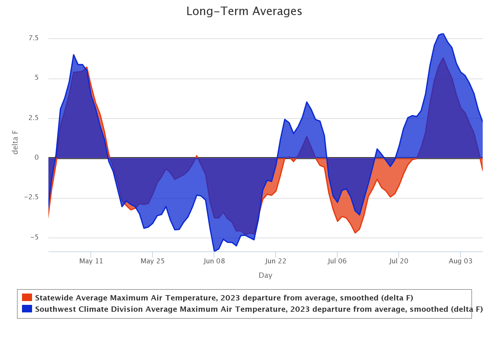
That graph is a bit tricky since it's departure from long-term average for each
corresponding area, so for the SW it's the departure from THEIR long-term
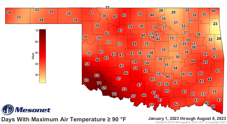
average, but you get the idea. This map will spell it out a bit more clearly,
or clearer, for redundancy's sake.
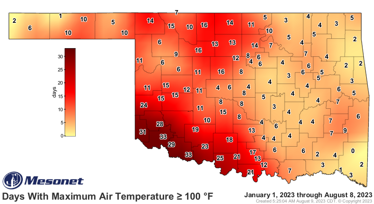
And this one.
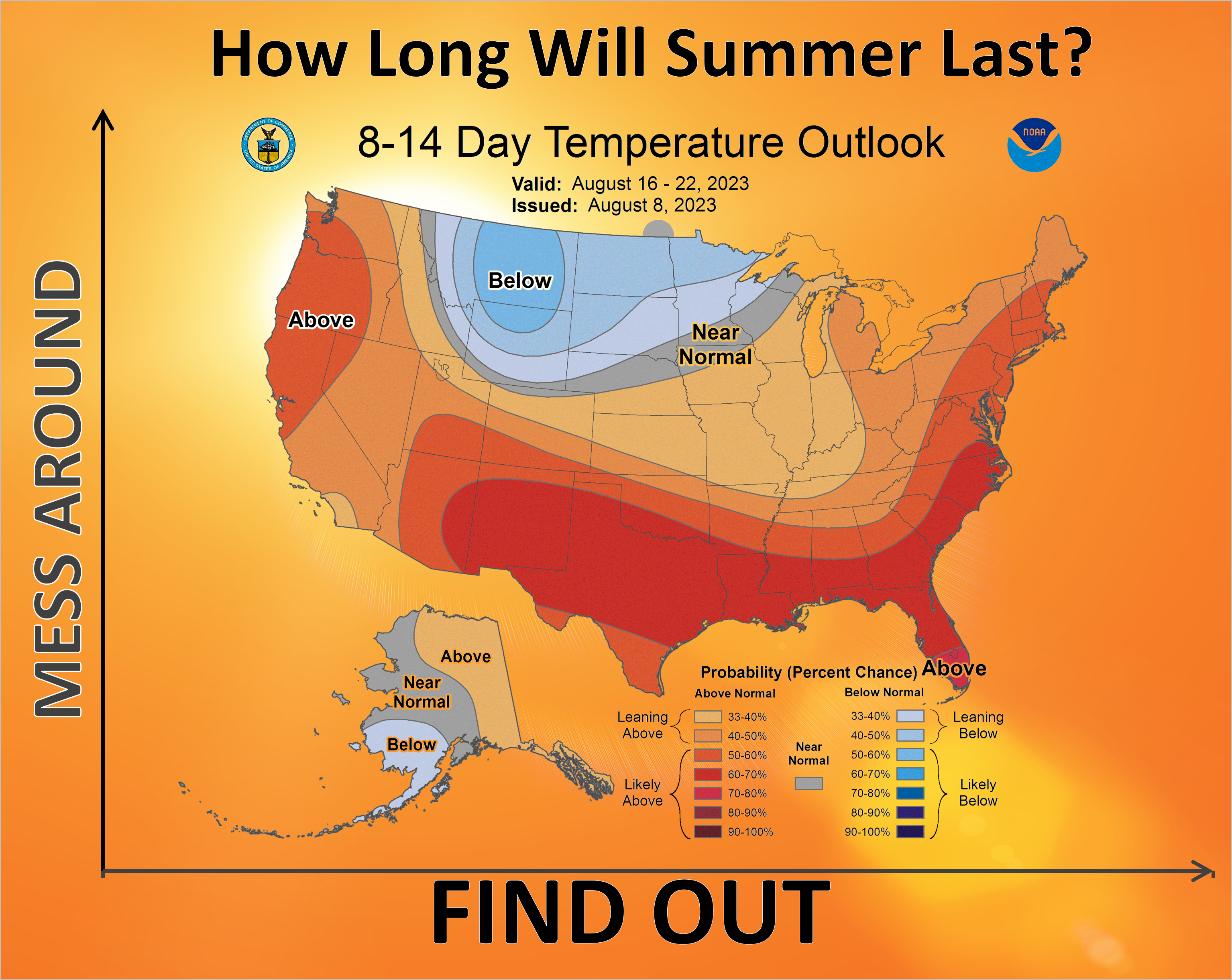
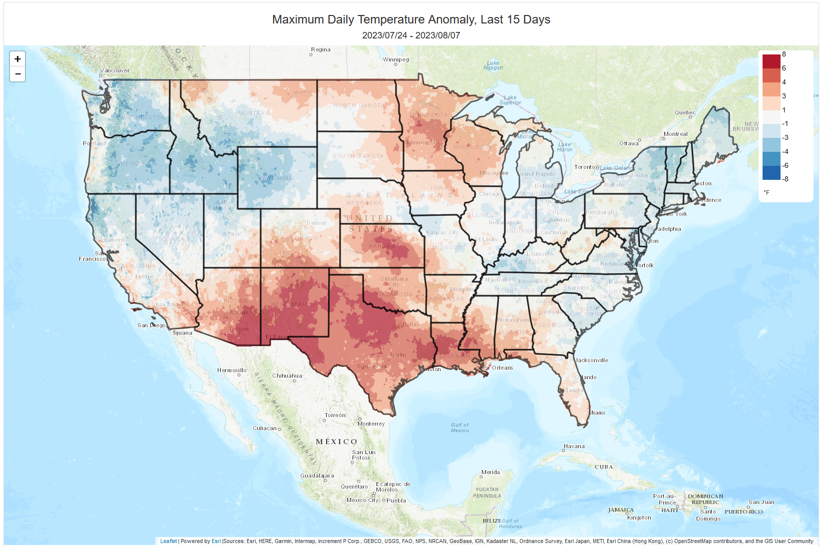
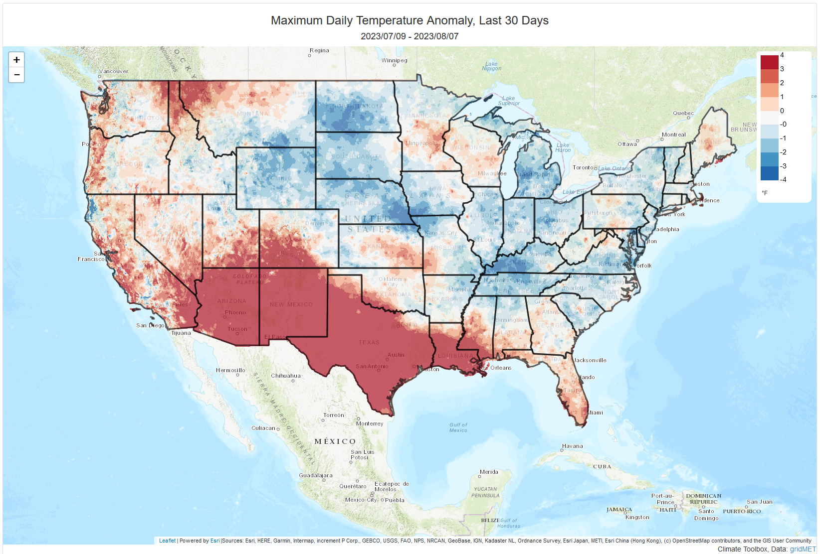
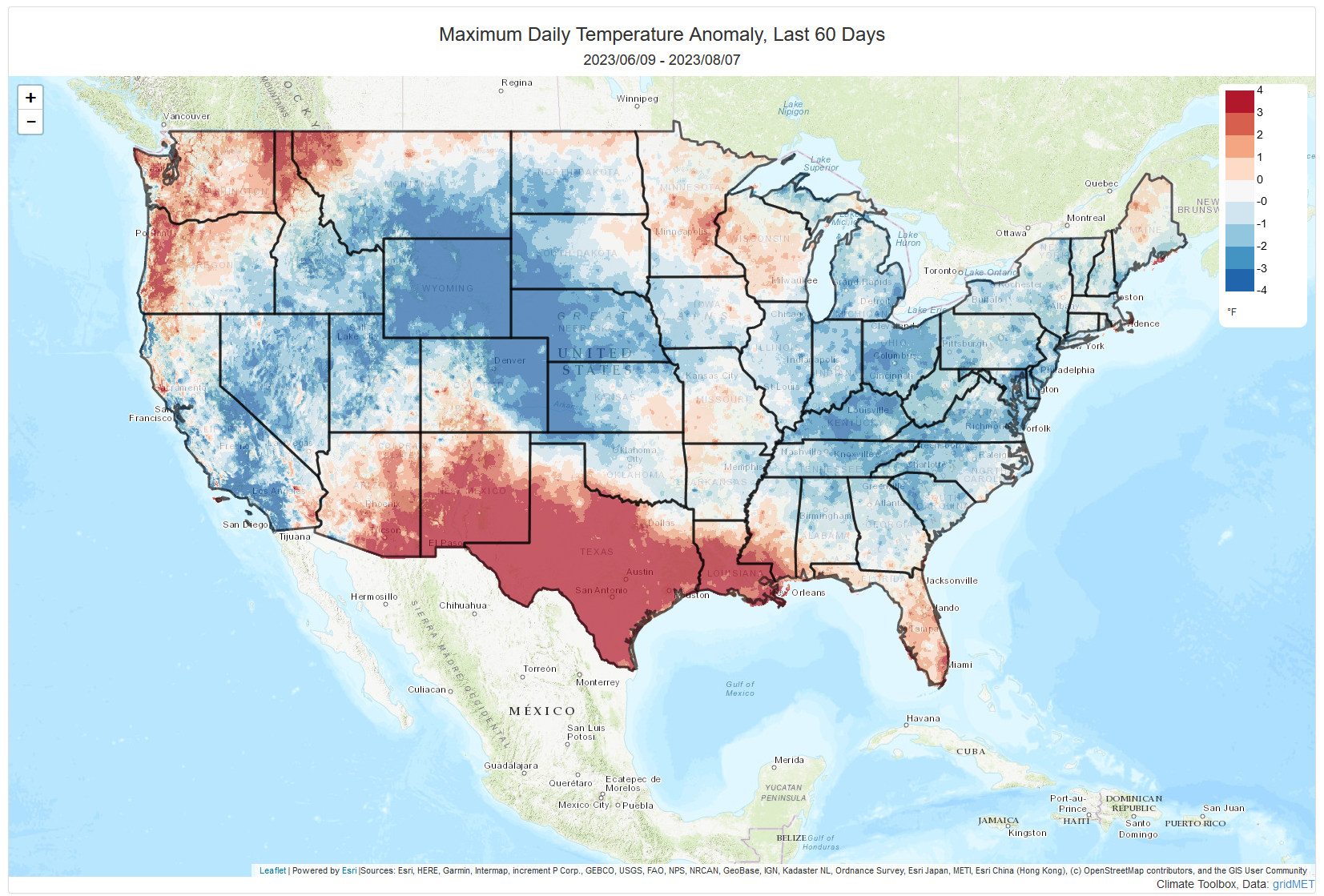
To show the broader picture, we can look at a national map. The last 15 days...
hot, but REALLY hot in Texas. Last 30 days, not nearly as hot, but still REALLY
hot in Texas. Last 60 days...quite cool, actually, but DREADFULLY hot in Texas.
And all along, SW OK just barely in that DREADFUL Texas heat, but enough where
their summer has been drastically different that much of the rest of the state.
Now I post all this to say that, unluckily enough, it appears that we're going
to remain in our more recent pattern vs. what we saw earlier in the summer,
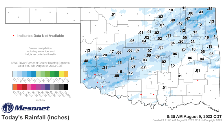
with all that rain and cooler weather. We've had a bit more recently (heck, it's
raining right now for crying out loud!)
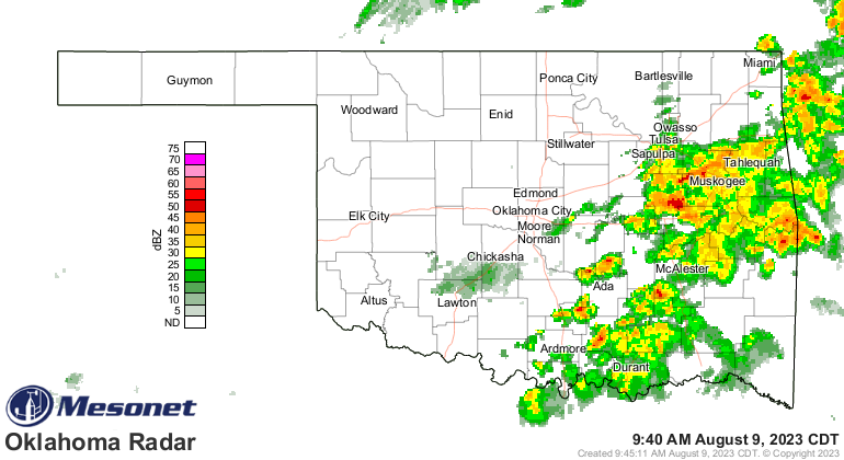
but the heat dome appears like it will return and remain over us for another
couple of weeks, it appears. So more like a NORMAL Oklahoma summer vs. what we
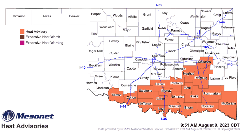
had previously. And the heat's back today for much of the southern half of the
state, and for all of us into the weekend and early next week. And beyond.
Gary McManus
State Climatologist
Oklahoma Mesonet
Oklahoma Climatological Survey
gmcmanus@mesonet.org
August 9 in Mesonet History
| Record | Value | Station | Year |
|---|---|---|---|
| Maximum Temperature | 112°F | WAUR | 2011 |
| Minimum Temperature | 53°F | EVAX | 2024 |
| Maximum Rainfall | 3.34″ | PRYO | 2008 |
Mesonet records begin in 1994.
Search by Date
If you're a bit off, don't worry, because just like horseshoes, “almost” counts on the Ticker website!