Ticker for April 7, 2015
MESONET TICKER ... MESONET TICKER ... MESONET TICKER ... MESONET TICKER ...
April 7, 2015 April 7, 2015 April 7, 2015 April 7, 2015
Summer arrives in Oklahoma!
I know all eyes pointing towards the sky are fearful/excited/anxious about
tornadoes and other forms of severe weather, and rightfully so, of course. With
a storm system approaching the state, a dryline in place and lots of moisture,
the instability is there to possibly generate severe storms over the next three
days. But speaking of that dryline, it gave us Oklahoma's hottest day of the year
thus far, and some pretty miserable conditions to go along with it. Check out
the high temperatures yesterday behind that dryline across western Oklahoma.
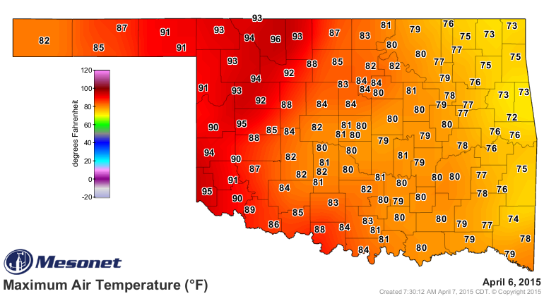
Wow, 96 degrees in Alva for the highest temperature of the year thus far, at least
measured by the Oklahoma Mesonet. Good enough to be tied for the 17th highest
recorded temperature for all April 6s dating back to the late 1880s in the state.
That's also the highest recorded temperature on the Mesonet since Waurika and
Grandfield hit 99 degrees on Oct. 7, 2014.
So it was hot indeed. Looking at just a sample of some winds and humidity values
from out that way yesterday, I guarantee you that Chap-Stik was in high demand
across far western Oklahoma and the Panhandle.
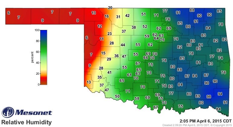
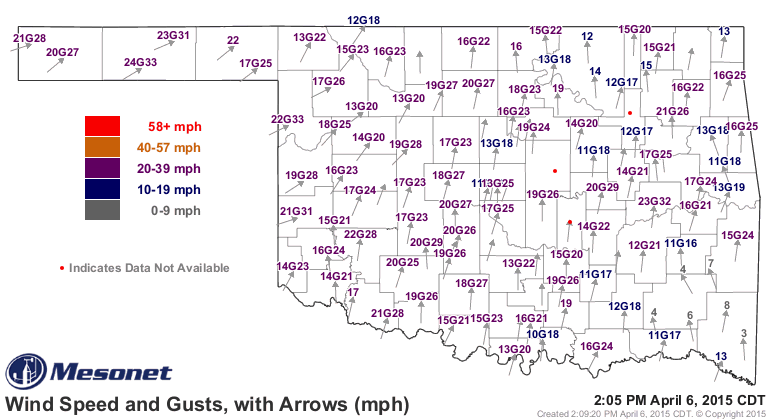
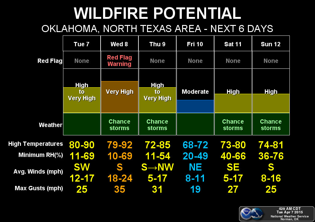
That's also prime wildfire weather, and that's gonna be the "other" focus
besides the threat of severe weather (although I'd call a wildfire pretty
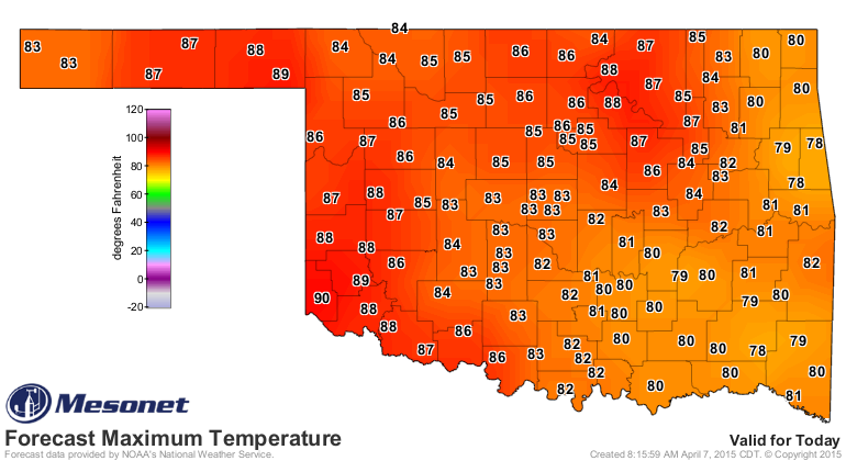
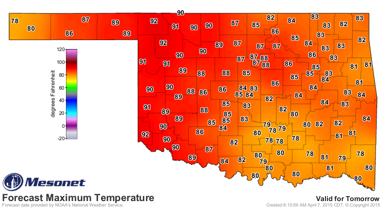
severe). The high temperatures won't be quite as bad today, but they'll jump
up there tomorrow again with winds gusting to over 40 mph and humidity down into
dessication territory as well.
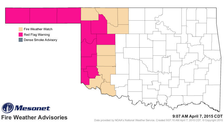
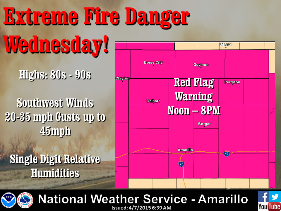
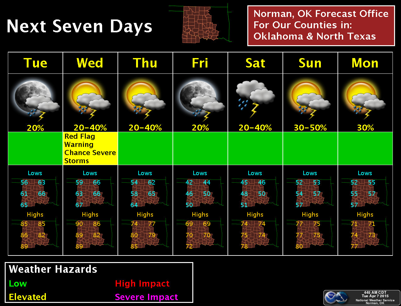
All those ingredients set us up for a Red Flag Fire warning for tomorrow across
far western Oklahoma, along with a Fire Weather watch in surrounding counties.
So those folks aren't worried about tornadoes, hail or even getting wet as
they run outside to tie down the trash cans. They're worried about ongoing
drought, which is going to accelerate even more rapidly with these conditions,
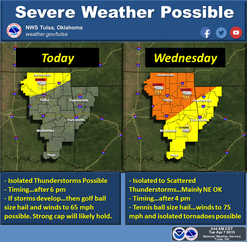
and wildfires. Now for points east, the possibility of severe weather still
exists, although it is still not looking like a widespread threat at this time
(ALTHOUGH THAT COULD STILL CHANGE, so stay weather aware with your favorite
NWS office/media source). It's all about the planning. From what I can gather
from all the experts here in the NWC, it's all about breaking that cap of warm
air above the surface that will let the updrafts grow into storms. But if
that cap is indeed broken, the storms that do go up have lots and lots of fuel
to work with and will go ballistic pretty quickly, with the possibility of
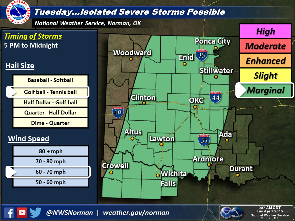
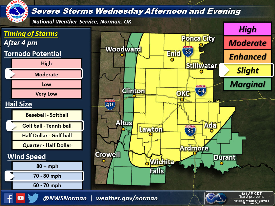
mostly hail and severe winds today and all the bad things storms can bring
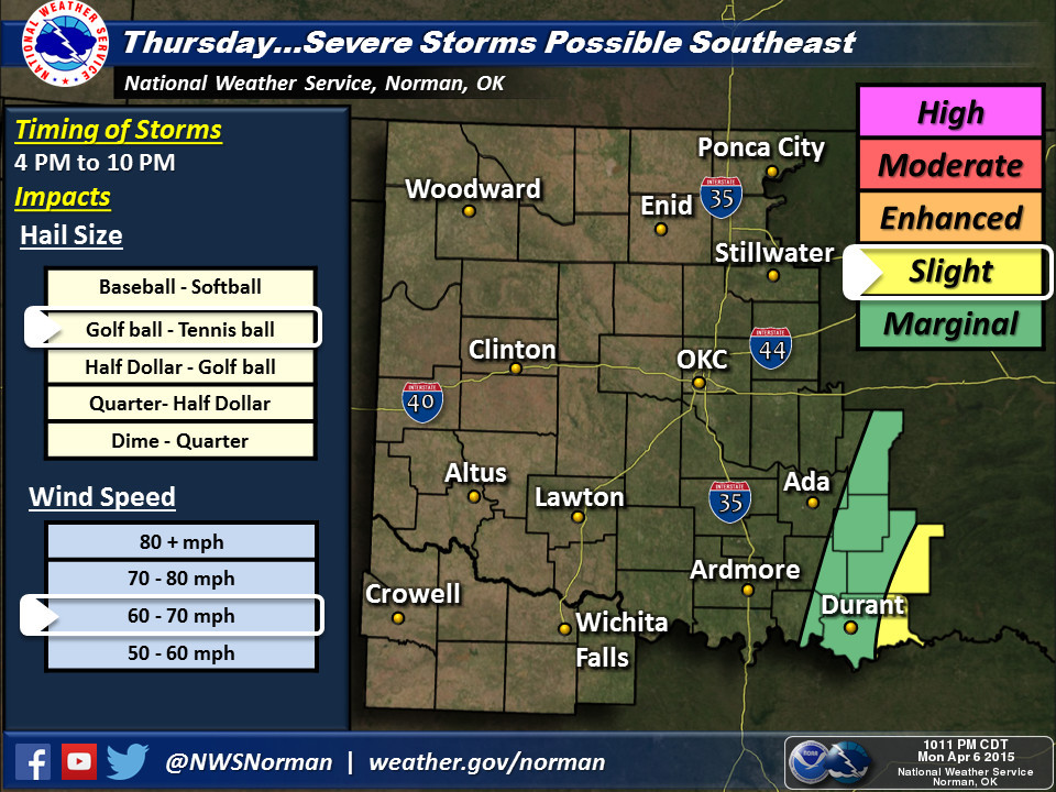
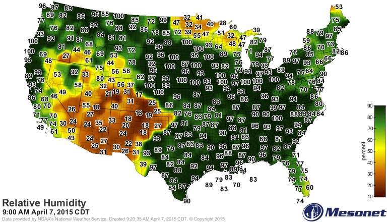
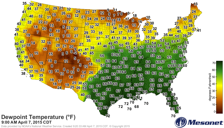
tomorrow. Here are some graphics telling you the story.
You can see that the Gulf of Mexico has flooded the eastern half of the country
with moisture, and the presence of that dryline out across the High Plains. With
the dewpoint map, the higher the wetter (i.e., dewpoints in the 60s means lots
of fuel for storms, should they form).
So to sum it all up, there is a storm system approaching along with a cold front
and a dryline in place. Far western Oklahoma has little hopes for rain and lots
of problems with fire danger. The eastern two-thirds of the state has a chance
of severe weather should storms form, especially on Wednesday, but it does
not look like there will be widespread coverage of storms across the state.
If storms do go up, especially on Wednesday, the environment into which they are
born give good odds they will grow into rotating supercells, making large hail,
severe winds and isolated tornadoes possible.
At least that's how I read it. And everything I said becomes more and more dated
after I send this. So keep checking in with the NWS and media for more up-to-date
information.
And then get ready to do it all over again this weekend.
Gary McManus
State Climatologist
Oklahoma Mesonet
Oklahoma Climatological Survey
(405) 325-2253
gmcmanus@mesonet.org
April 7 in Mesonet History
| Record | Value | Station | Year |
|---|---|---|---|
| Maximum Temperature | 96°F | HOLL | 2015 |
| Minimum Temperature | 16°F | CAMA | 2009 |
| Maximum Rainfall | 6.03 inches | ANTL | 2002 |
Mesonet records begin in 1994.
Search by Date
If you're a bit off, don't worry, because just like horseshoes, “almost” counts on the Ticker website!