Ticker for October 5, 2020
MESONET TICKER ... MESONET TICKER ... MESONET TICKER ... MESONET TICKER ...
October 5, 2020 October 5, 2020 October 5, 2020 October 5, 2020
Octember
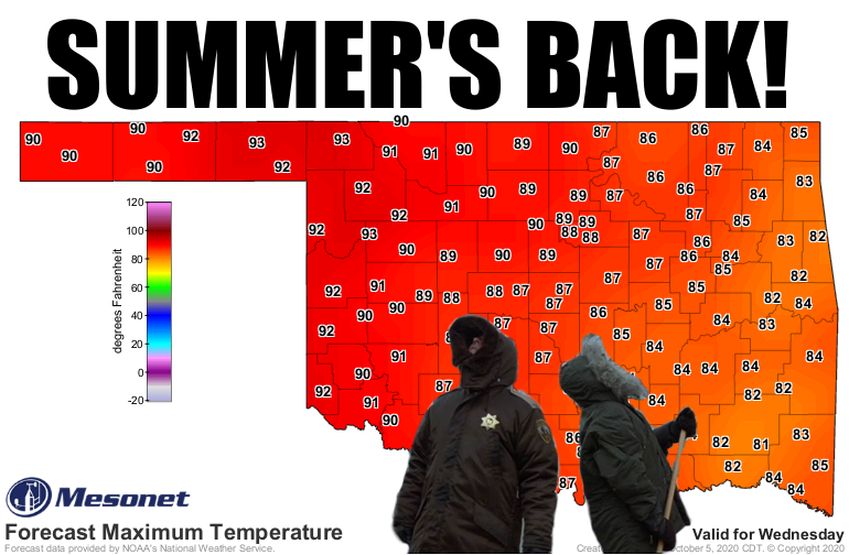
Octgust? Heck if I know, but we have problems right here in Drought City. A month
ago we were talking about the possible earliest freeze in state history (didn't
happen...but close), now we're talking about mid-90s in October? Yeah, that's not
even a 2020 deal, that's an Oklahoma weather deal. We've had a long stretch of
what most folks would call ideal weather; ideal if you're not trying to plant a
crop and actually have it germinate and take hold. And these summery high
temperatures, at least across the western half of the state, will not help
matters. We'll see a possible good cold front next week, but get ready for a
baking contest this week.
Oh by the way, here are the top-5 warmest Octobers on record for Oklahoma. Not
saying we'll need these numbers later (but I really am).
-***-
1963 69.6F
1947 68.4F
2016 67.1F
1938 67.0F
1931 66.4F
-****-
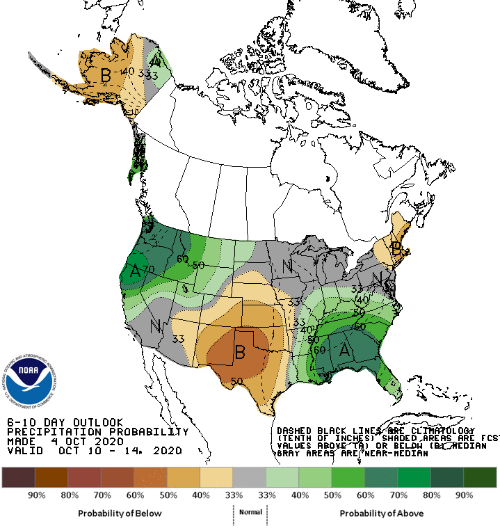
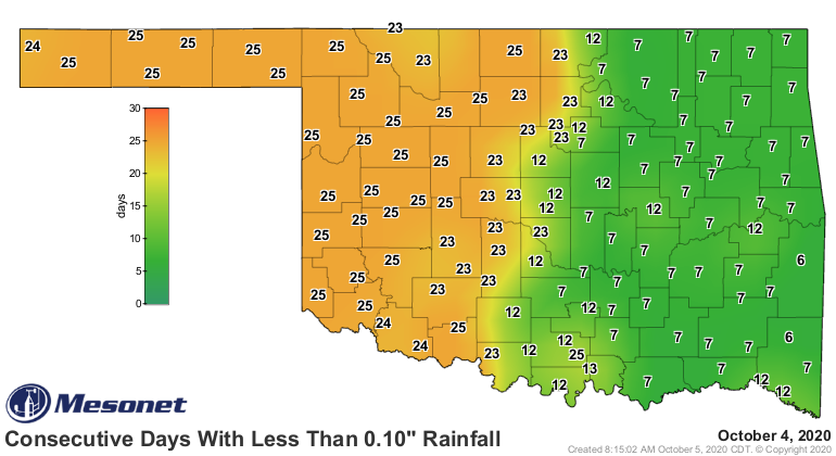
Okay, we've covered temperatures, now let's talk something even more troubling.
Even though it's only five days in, the first three weeks of October look bone
dry, and I'm talking dead-cow-bones-in-the-field-for-six-years dry. So far,
we've had a grand total of "you kidding me?"
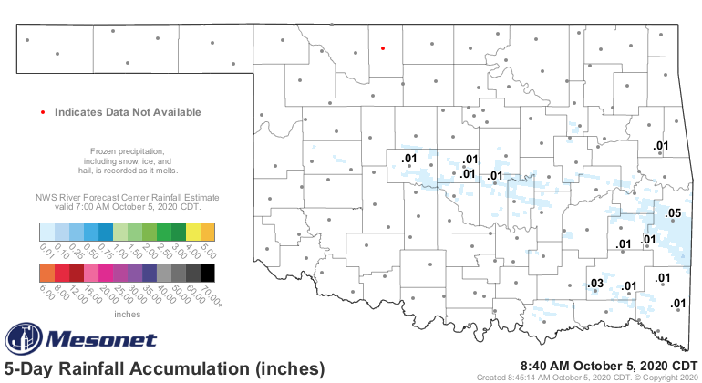
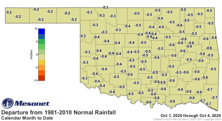
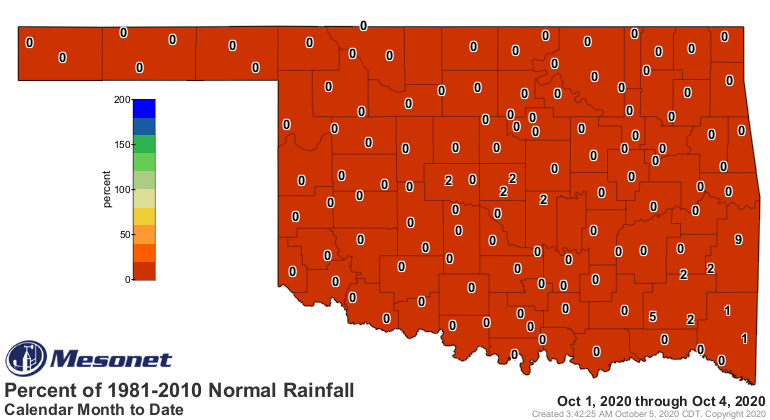
That's not enough to beat the rounding protocols, so consider that a grand
statewide average rainfall total thus far as Zero. Point. Zero. And those
deficits on the departure from normal map get bigger with each day, and the
percent of normal map stays at 0. And that's only the eighth driest first five
days of the year on record, too, at least statewide. For the Panhandle, NE,
west central, SW and south central sections, it is indeed the driest. For the
record, and I am worried we'll need these numbers later, the top-5 driest
Octobers on record for Oklahoma (going back to 1895, as with temperature):
-***-
1952 0.14"
1917 0.17"
1921 0.27"
1978 0.50"
1938: 0.55"
-****-
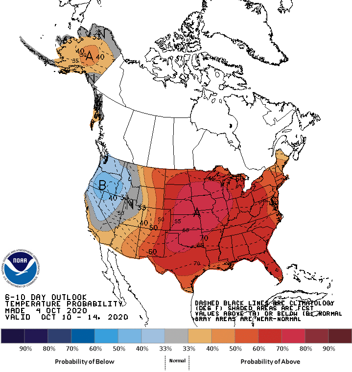
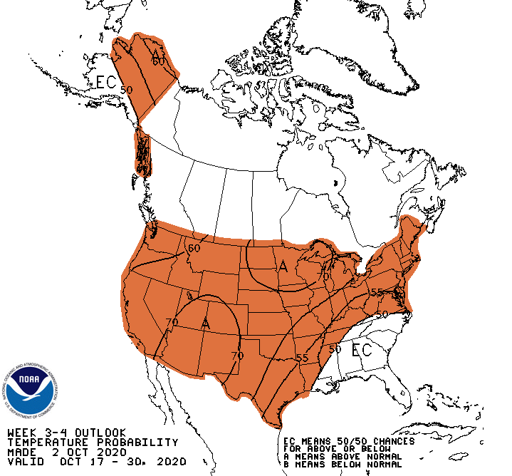
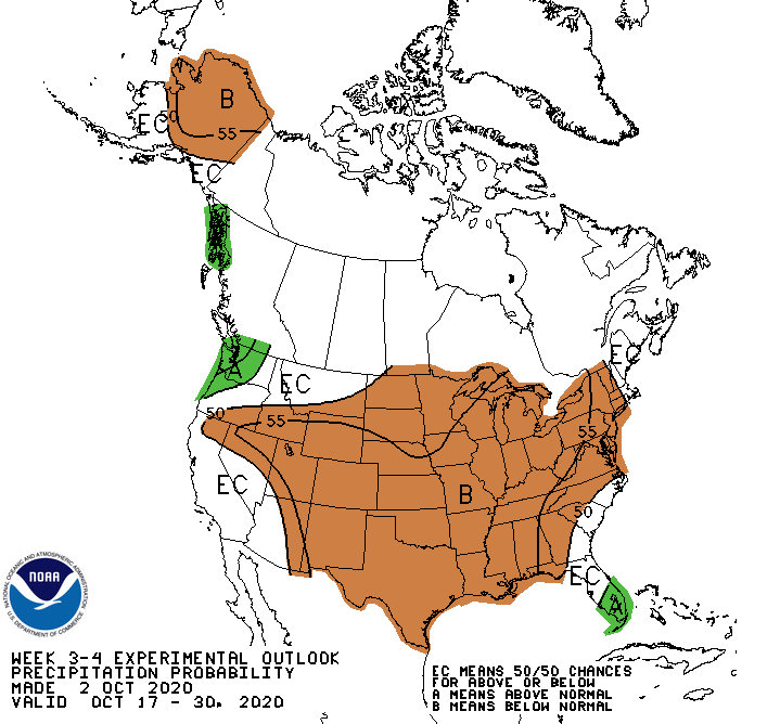
Forecasts are not looking good for relief, at least for the next couple of
weeks. I'll throw the temperature outlook as well.
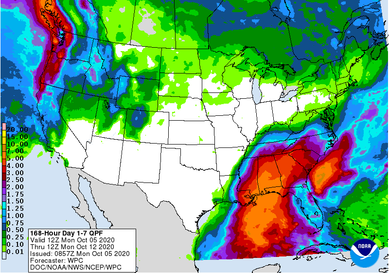
How about the chance at least an inch of rain accumulation across state, from
our Canadian friends?
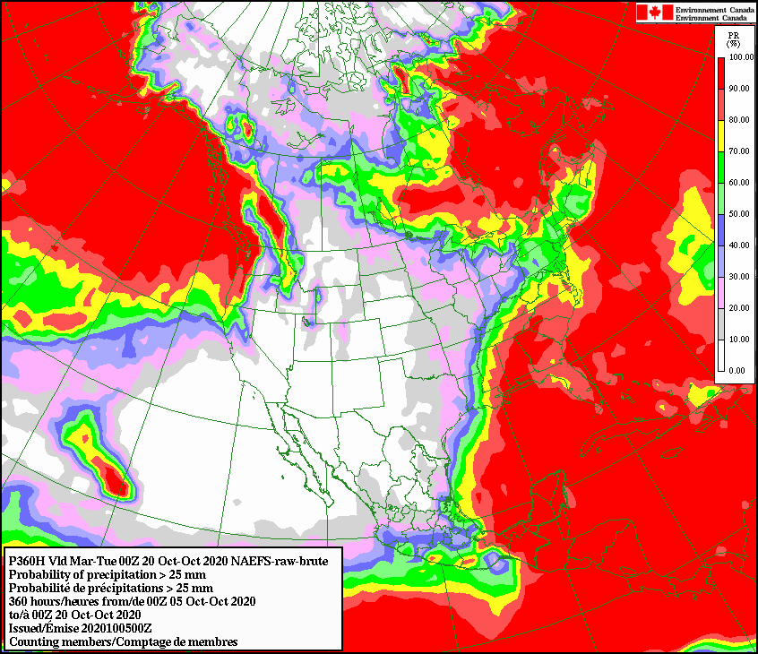
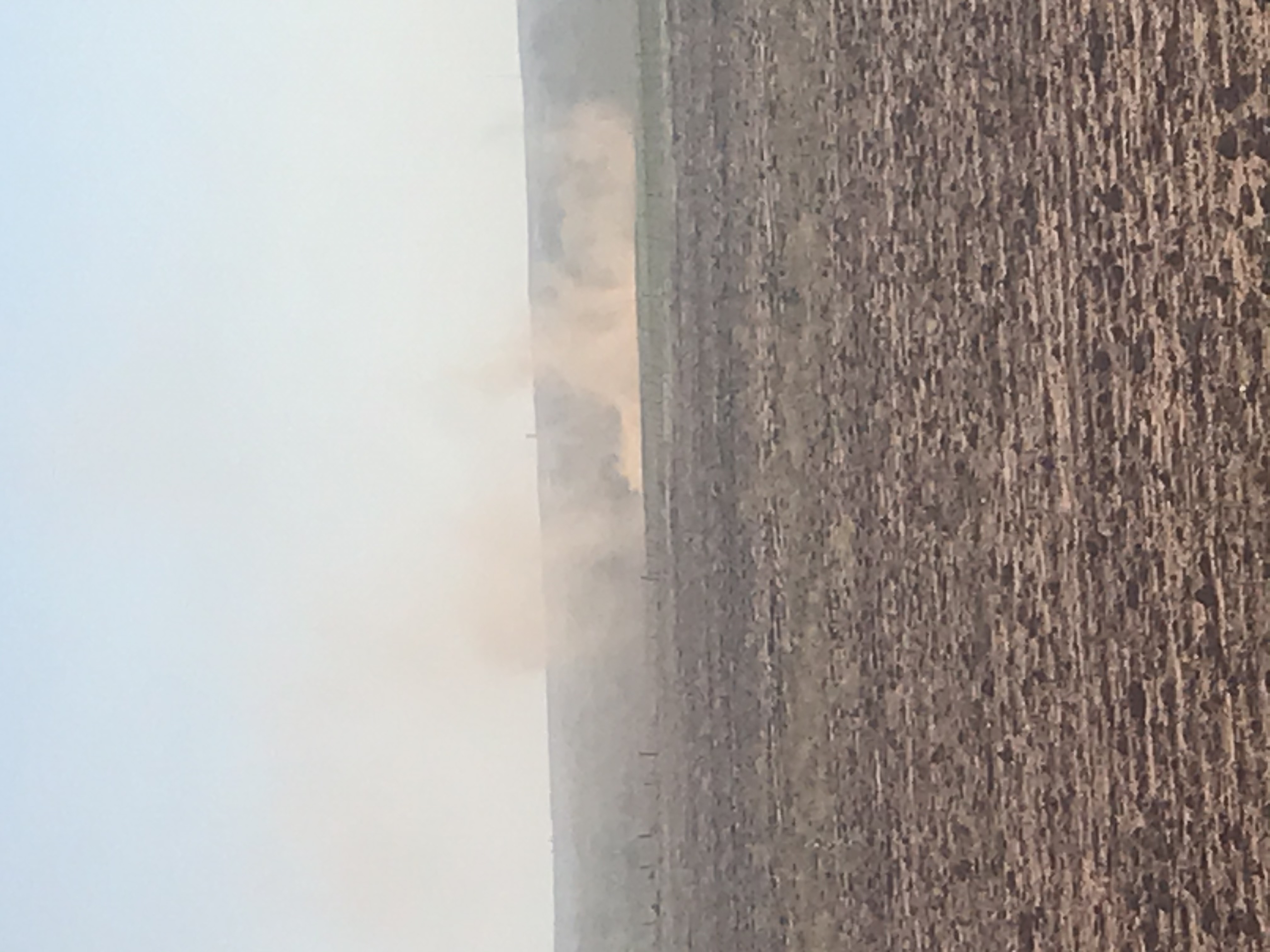
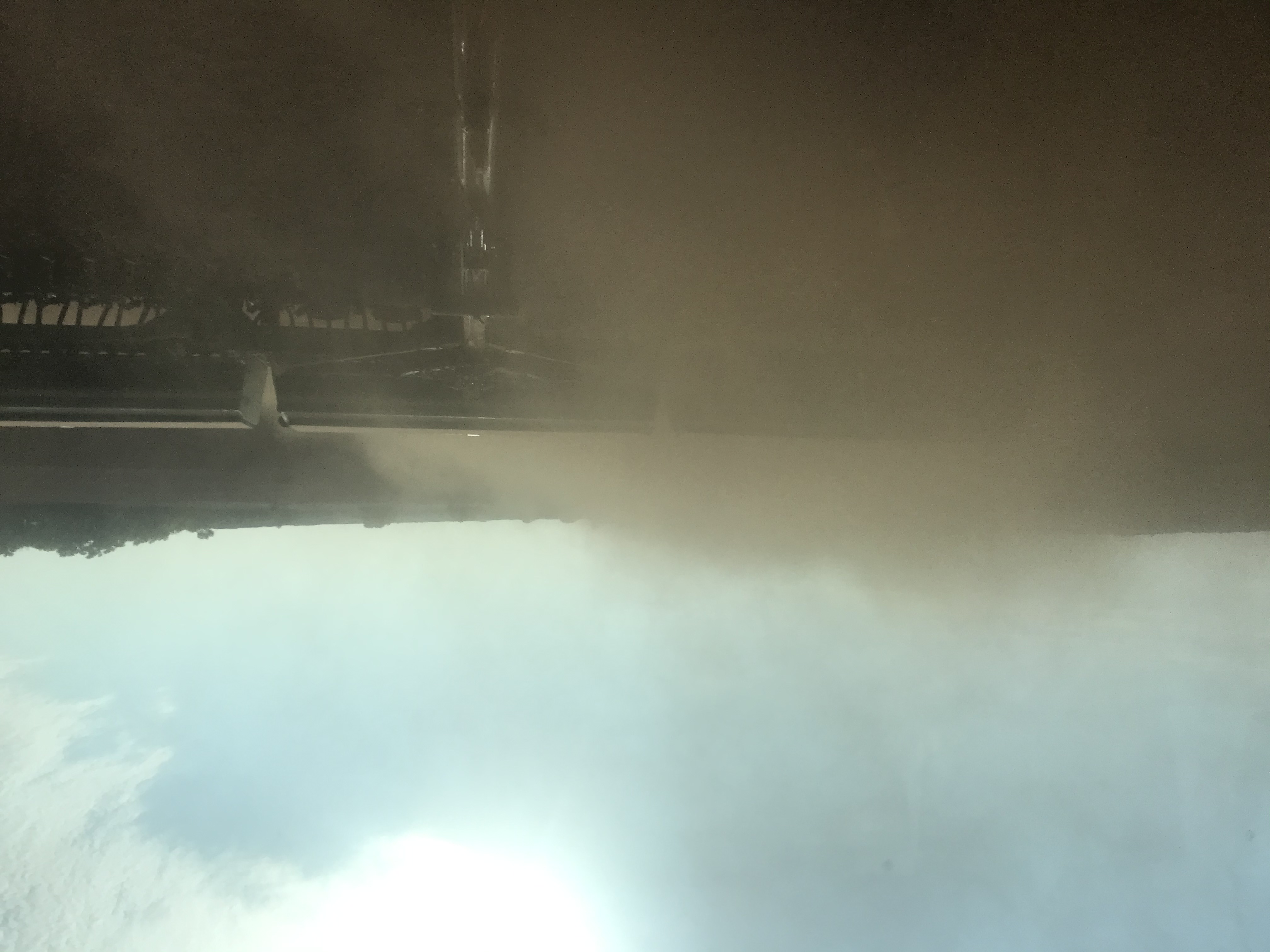
Yikes. In case you're wondering what this means for folks NOT just looking for
nice sunny skies and pleasant temperatures, here are some pics from a farmer in
Roger Mills County "dusting in" wheat. The dusting in part should be evident
from the picture. So there's not enough moisture in the soil to benefit the
seeds, obviously, so the hope is to throw it into the dry soil and pray for a
rain in the near future to rescue it.
If we could go back to the pre-Dust Bowl days when the railroads told people
that dust is actually good, it will hold the soil moisture in, all in an effort
to convince (i.e., "trick") people to move to the High Plains and farm, we'd
be in good shape. However, I'd be worried for that seed going into the ground.
The good news is the forecasts could be wrong, especially those longer-range
outlooks. The next good rain could be sneaking up beyond the ability of the
forecast models to catch. And we still have a very active tropical weather
season, so maybe we can sneak a tropical system remnant into the area in the
next few weeks.
That's the best dust-filled silver lining I can think of. Otherwise, prepare
for drought expansion across the parts of the state where rain is becoming a
distant memory.
Gary McManus
State Climatologist
Oklahoma Mesonet
Oklahoma Climatological Survey
(405) 325-2253
gmcmanus@mesonet.org
October 5 in Mesonet History
| Record | Value | Station | Year |
|---|---|---|---|
| Maximum Temperature | 96°F | HOOK | 2018 |
| Minimum Temperature | 31°F | KENT | 2016 |
| Maximum Rainfall | 5.92 inches | PRYO | 1998 |
Mesonet records begin in 1994.
Search by Date
If you're a bit off, don't worry, because just like horseshoes, “almost” counts on the Ticker website!