Ticker for October 7, 2020
MESONET TICKER ... MESONET TICKER ... MESONET TICKER ... MESONET TICKER ...
October 7, 2020 October 7, 2020 October 7, 2020 October 7, 2020
Once in a Blue moon
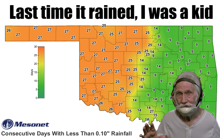
Dang it, Blue...you might have just jinxed any rain we were going to get. But I
can't stay mad at you, Blue. Let's direct our ire at Mother Nature. In providing
Drought Monitor input to the national author yesterday, I began to sense a great
disturbance in the for...no, wait, wrong movie. I began to sense a flashback to
2017 when this sort of pattern set up, just a month later. Another drought,
another meme.
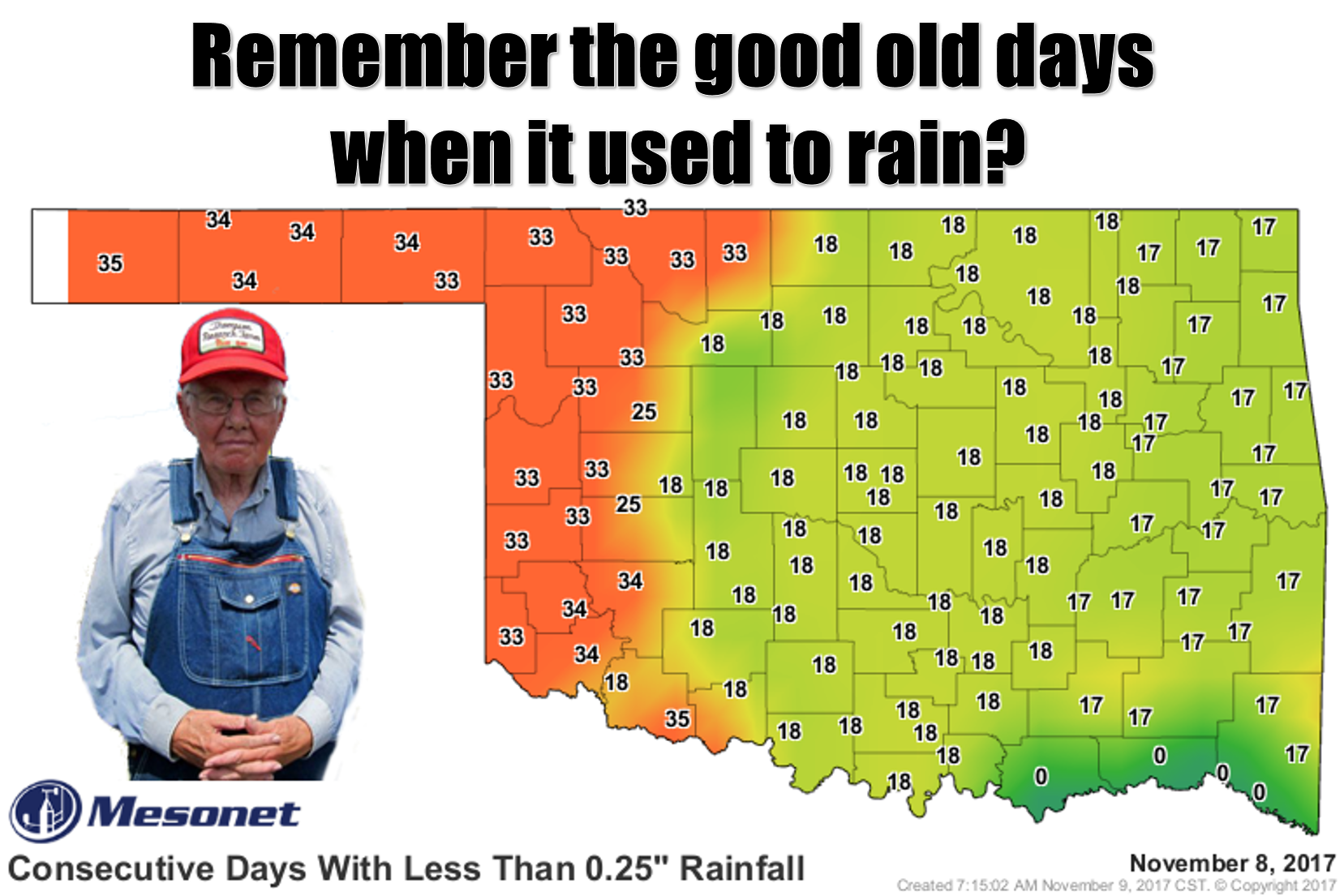
Drought was just getting started at this time back in 2017. This is what it
looked like at its peak.
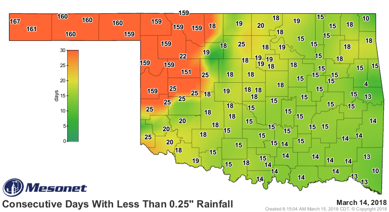
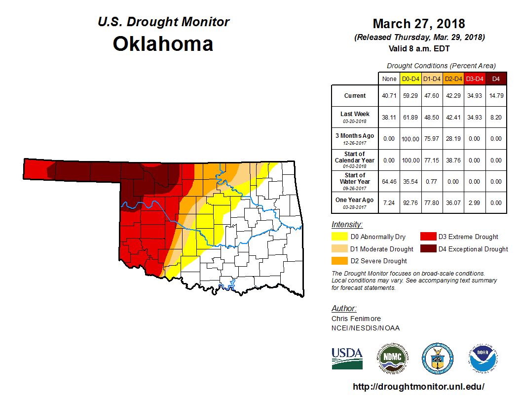
Now we can't say it's going to get THAT bad, but there are other similarities as
well. There was an active La Nina that cool season as well (reminder for this
episode):
http://ticker.mesonet.org/select.php?mo=09&da=16&yr=2020
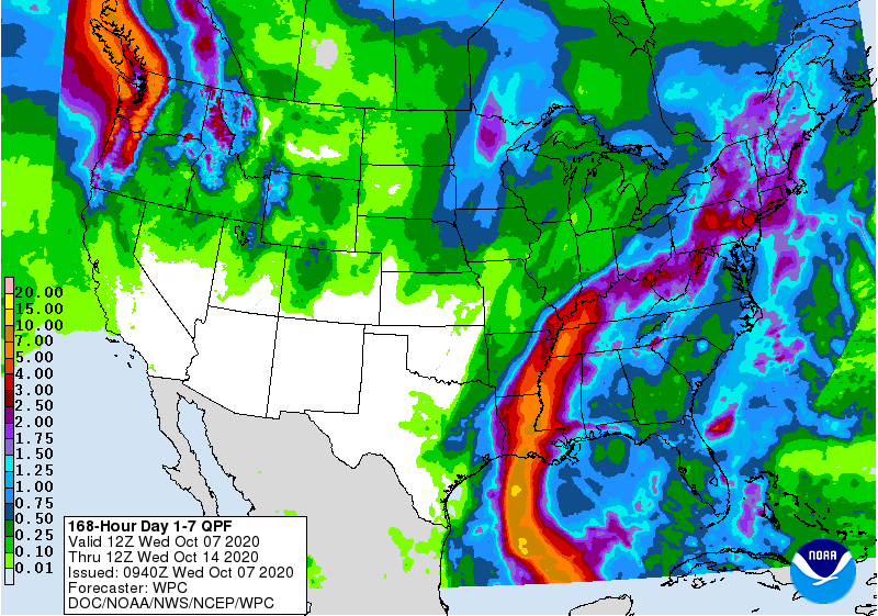
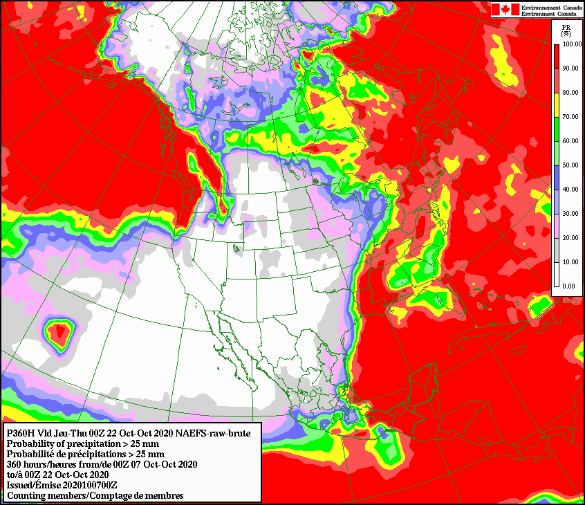
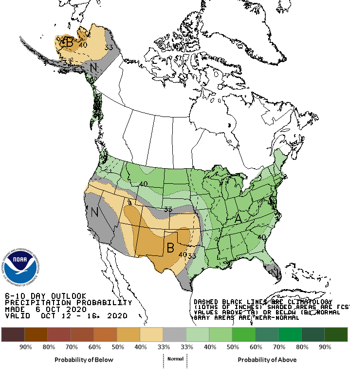
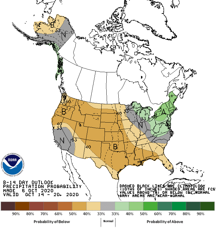
So we don't need to go all 2017-18 just yet, but it's definitely going to get
worse before it gets better. Take a gander (also good for the goose) at the
various rainfall forecasts and outlooks.
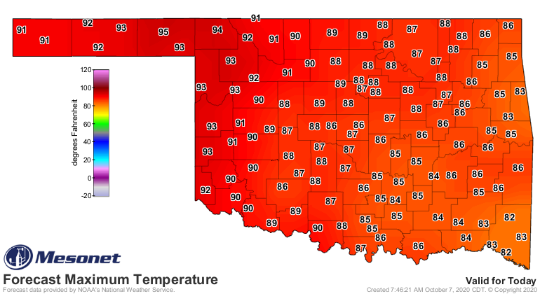
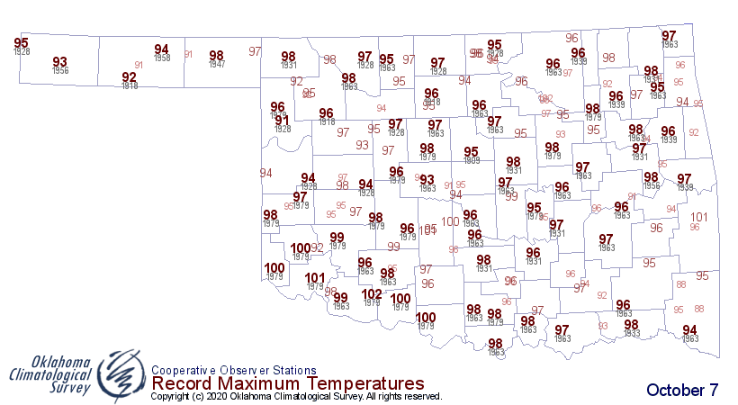
Hey, at least it's not hot, to speed that drying up, right? Oops. We'll be
flirting with record temps for the next couple of days at least.
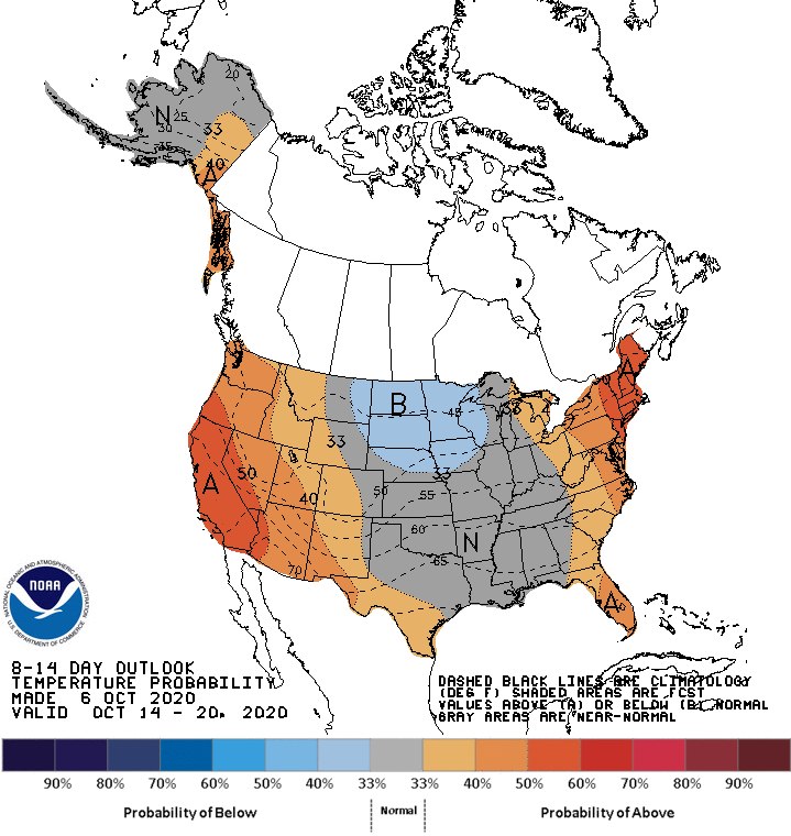
But the chance for more fall is certainly better than the chance for more rain!
We have a long time to go (back) to reach 2017-18 levels. But I'm concerned.
Gary McManus
State Climatologist
Oklahoma Mesonet
Oklahoma Climatological Survey
(405) 325-2253
gmcmanus@mesonet.org
October 7 in Mesonet History
| Record | Value | Station | Year |
|---|---|---|---|
| Maximum Temperature | 99°F | WAUR | 2014 |
| Minimum Temperature | 26°F | SEIL | 2012 |
| Maximum Rainfall | 5.79″ | HOBA | 2018 |
Mesonet records begin in 1994.
Search by Date
If you're a bit off, don't worry, because just like horseshoes, “almost” counts on the Ticker website!