Ticker for June 3, 2024
MESONET TICKER ... MESONET TICKER ... MESONET TICKER ... MESONET TICKER ...
June 3, 2024 June 3, 2024 June 3, 2024 June 3, 2024
BEGONE SPRING!
Are you ready? Hey are you ready for this? Are you hanging on the edge of your
seat? Out of the doorway the tornado numbers rip, to the sound of the beat,
yeah!
Hey, I ain't no Freddie Mercury...I'm not even Gary Venus or Mars. I'm just a
simple State Climatologist, spinning my...oh never mind. So from what I can
tell from the info published by the four local NWS offices that cover Oklahoma
(Amarillo, Norman, Tulsa, and Shreveport), the state's 2024 tornado count
reached 100 on May 30 when a large cone tornado touched down in Cimarron County
over open ground. Presumably an EF-U tornado (hey now, make your OWN jokes
there...I'd like to keep my job) since in doing no damage, it becomes an
"Unknown" on the Enhanced Fujita Scale. But that makes 2024 only the eighth
year since accurate tornado records began in 1950 that Oklahoma has reached
triple-digits in its twister count, and there's 7 more months to go,
unfortunately. Well, not unfortunate that there's 7 more months in 2024...I'd
hate to lose those. But unfortunate that the tornado count will continue to
go up, undoubtedly. And at 98 it's also the third highest January-May total on
record behind 2019's 127 and 1999's 116.
We have much more on the state's tornado stats below in our May press release,
so keep scrolling.
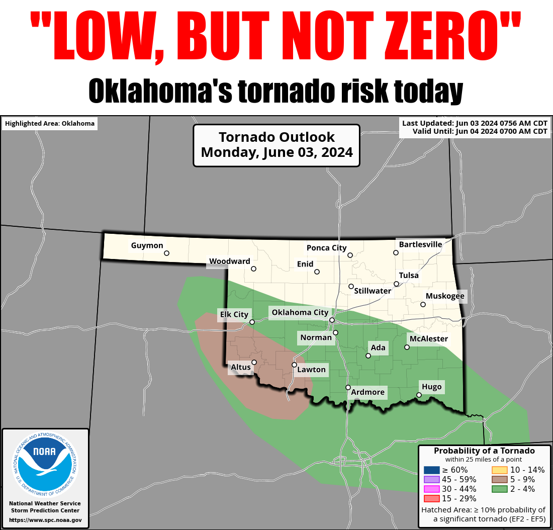
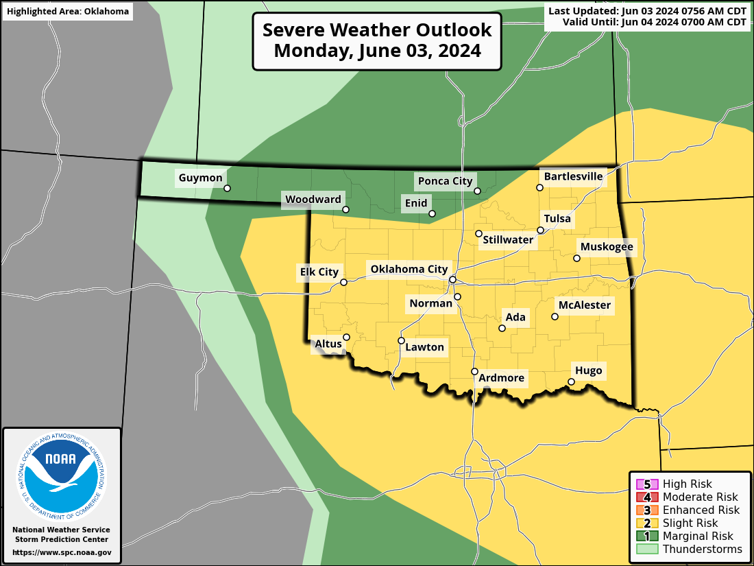
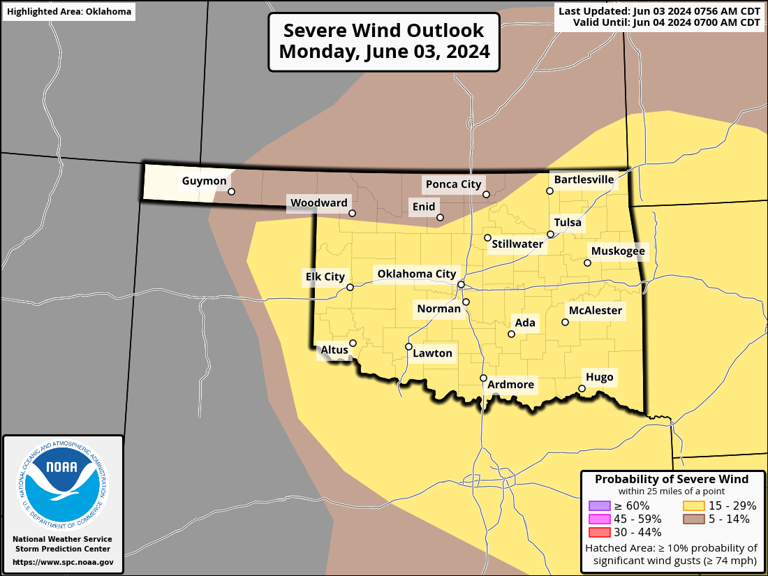
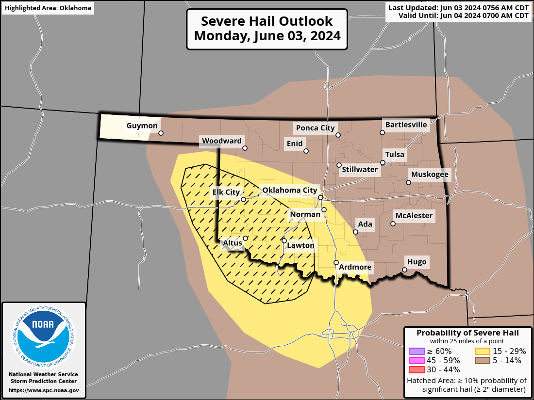
Unfortunately, those numbers could go up again today as severe storms continue
to barrel southeast through Oklahoma. After all, HECK, it's storming right now
for crying out loud!
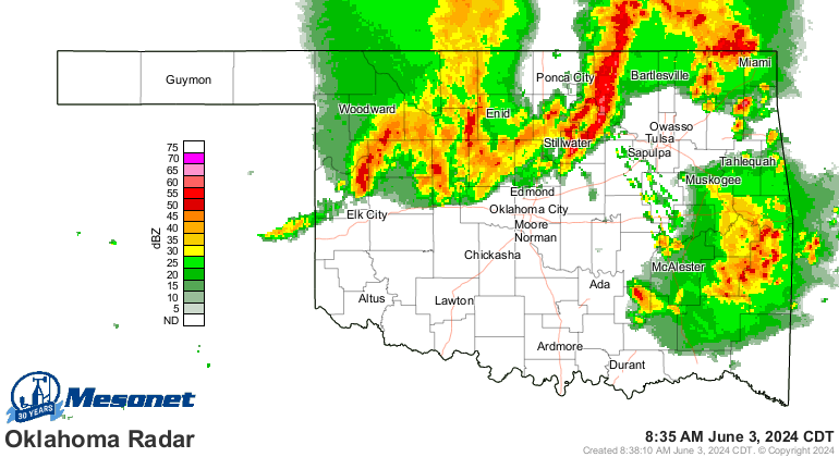
Those have a chance to pulse on and off severe, but it's the outflow boundary
from those storms that'll be left that could set off discrete supercells later
this afternoon that will come with the risk of all severe hazards. Hey, "Discrete
Supercells" was my band's name in OU Meteorology! Now if the tornadoes don't get
ya, the giant hail will put knots in your noggin faster'n you can rub 'em.
Are you happy, are you satisfied? How long can you stand the severe weather?
Out of the doorway the tornadoes rip To the sound of the beat, look out!
----------------------------------------------------------------------------------
Overachieving Severe Season Continues During May
June 3, 2024
Oklahoma continued to suffer from severe weather in May, marking an
exceptionally active spring storm season. The state recorded four more
storm-related fatalities in May, bringing the total to eight in 2024, along with
hundreds of injuries. At least 43 tornadoes touched down in May, following a
record-breaking 55 tornadoes in April, surpassing the previous high of 54 in
2012. With two additional tornadoes in March, the preliminary total for 2024
stands at 100, a number that may rise as National Weather Service personnel
continue to assess storm damage. The supercell thunderstorms that generated
these tornadoes also brought numerous reports of hail, severe winds, and flash
flooding. At times, the hail was larger than softballs, and damaging winds
reached speeds of nearly 100 mph. Overall, there was at least one severe storm
report collected by Oklahoma’s local NWS offices on 22 out of 31 days in May.
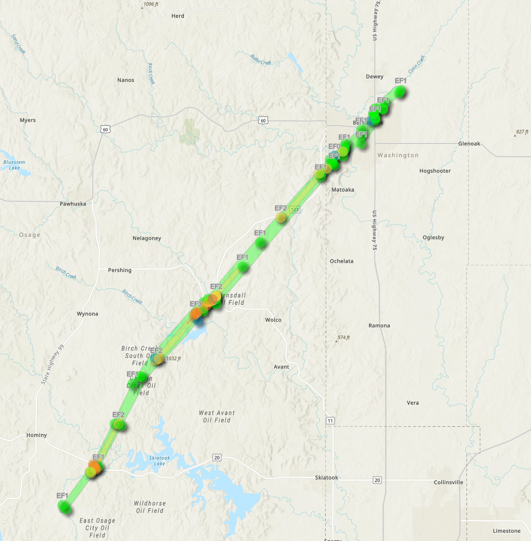
Two fatalities and 33 injuries occurred on May 6 with a long-track, violent EF4
tornado that started near Hominy on and plowed into Barnsdall in Osage County,
with estimated wind speeds of up to 175 mph. The tornado caused considerable
damage before moving northeast into Bartlesville, where it eventually
dissipated. This was the second EF4 tornado in Oklahoma in 2024, following the
April 27 Marietta tornado. This marks the first instance of multiple violent
EF4 or EF5 tornadoes in the state since 2013. The other two fatalities were
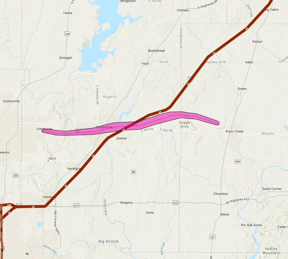
associated with a long-track EF3 tornado that developed northeast of Owasso in
Rogers County on May 25. It moved through Claremore, destroying numerous homes
and businesses, before tracking east into Mayes County. The tornado killed two
and injured four more in a mobile home near Pryor. At times, the tornado reached
over a mile wide, with estimated wind speeds of up to 155 mph.
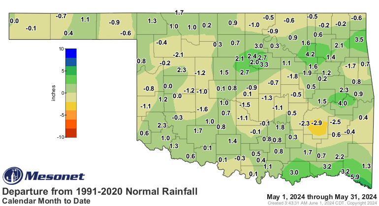
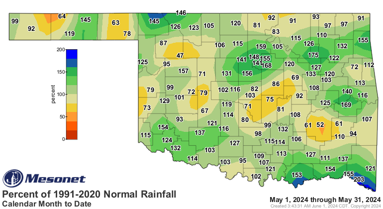
According to preliminary data from the Oklahoma Mesonet, the statewide average
rainfall total for May was 5.43 inches, 0.5 inches above normal, ranking as the
45th wettest May since records began in 1895. Due to the convective nature of
May’s precipitation, the rainfall pattern was a hodgepodge of deficits of about
an inch or less and surpluses of 2-4 inches. Idabel led all Mesonet sites with
a total of 11.65 inches, featuring a 6.1-inch surplus. Fifty of the Mesonet’s
120 sites recorded at least 6 inches of rainfall during May, and another 27
recorded at least 5 inches. Eva had the lowest total at 1.29 inches, joining
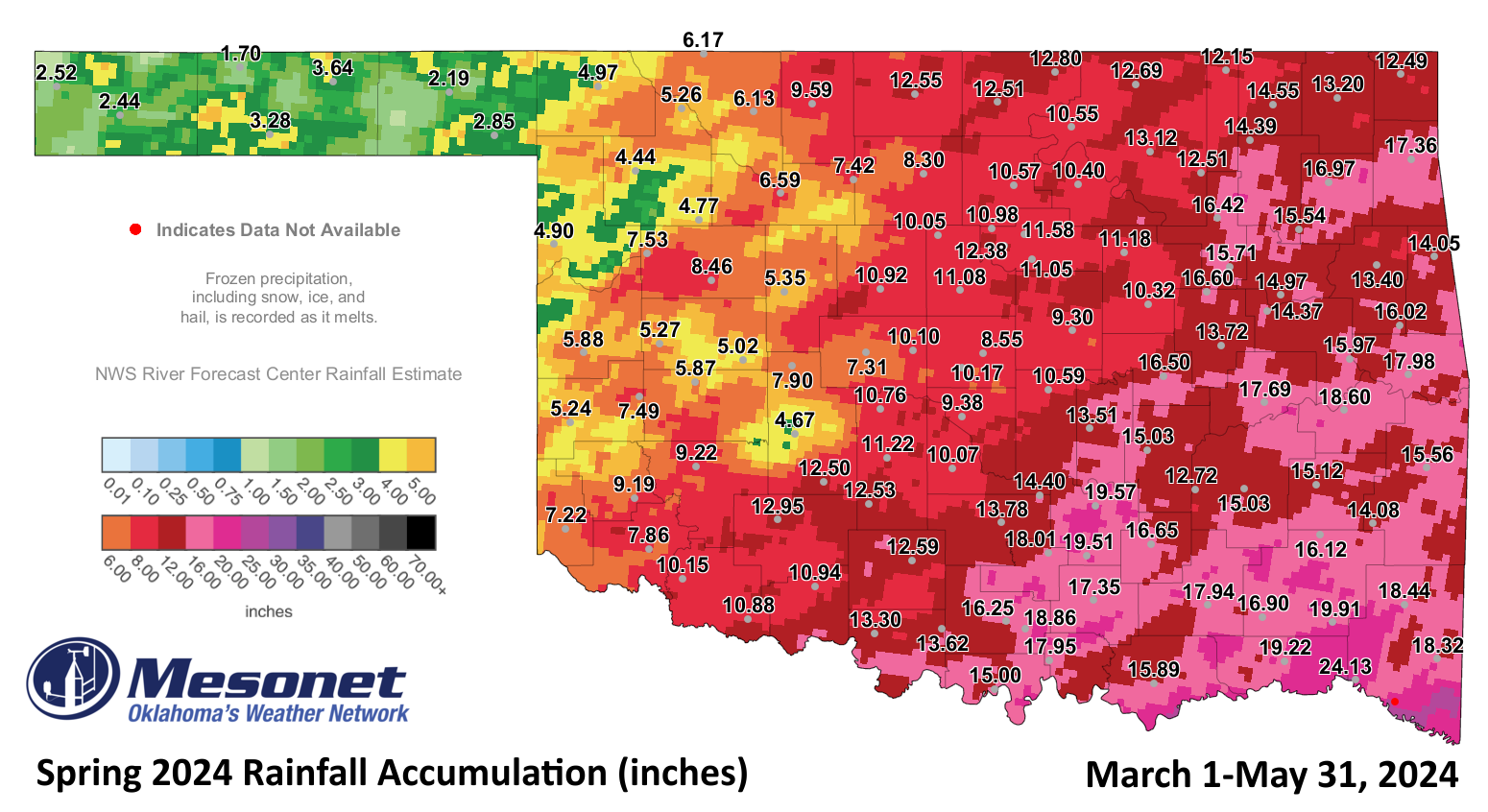
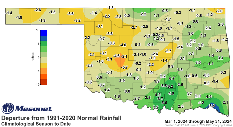
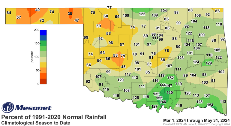
four other sites with less than 2 inches. Climatological spring, which runs
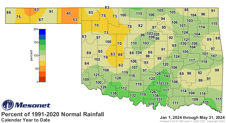
from March 1 through May 31, ended as the 47th wettest in Oklahoma with a
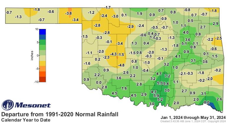
statewide average of 11.29 inches, matching the seasonal normal. Deficits of
2-5 inches were noted across the northwestern quarter of the state and from
central through northeastern Oklahoma. Meanwhile, widespread surpluses of 2-4
inches spread across much of southern and eastern Oklahoma. As in May, Idabel
led all sites with a spring total of 24.1 inches—8.6 inches above normal—while
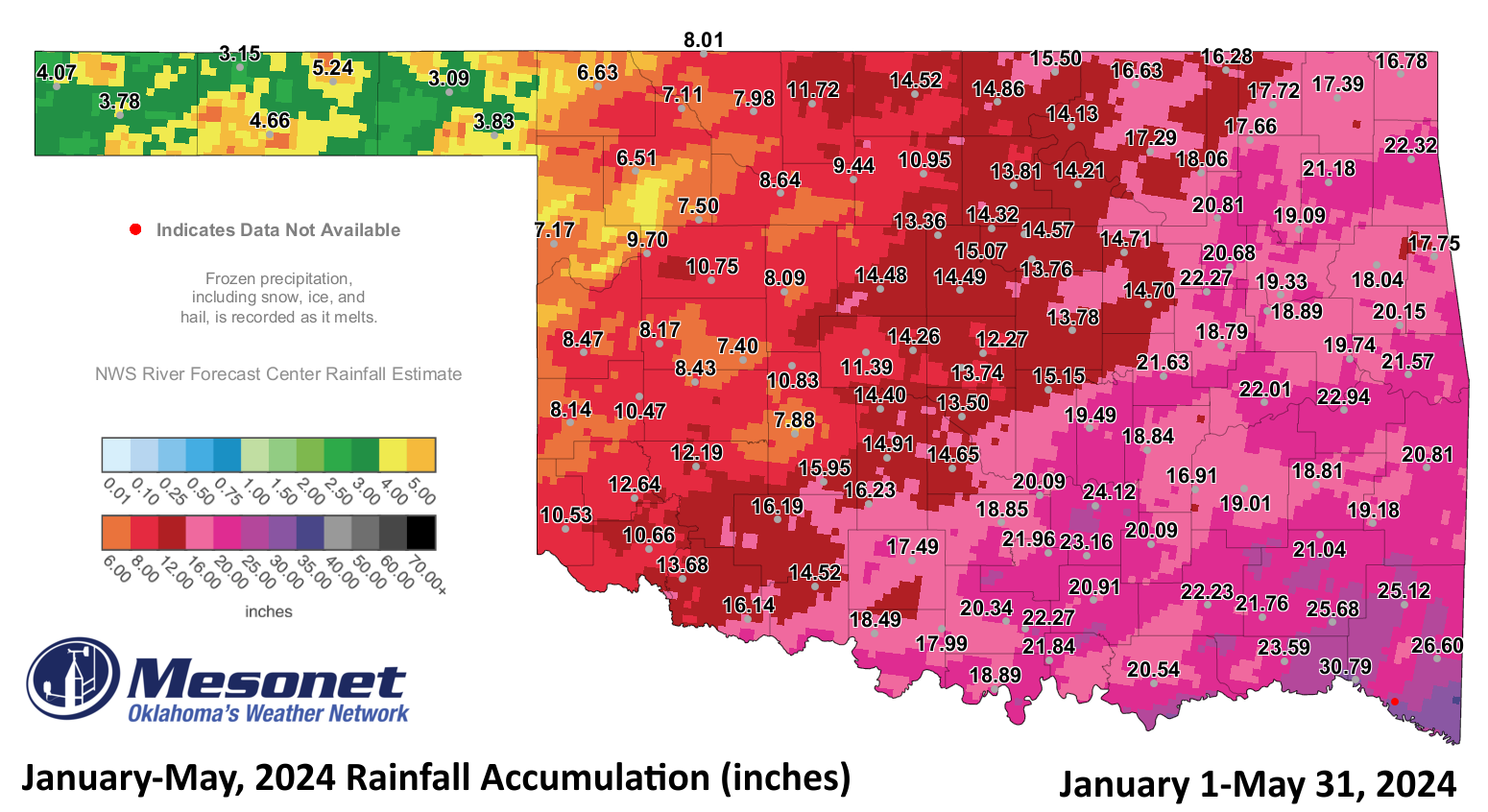
Eva recorded the lowest at 1.7 inches. The first five months of the year
finished with 14.93 inches, 0.38 inches above normal, ranking as the 45th
wettest January-May on record.

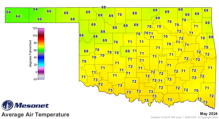
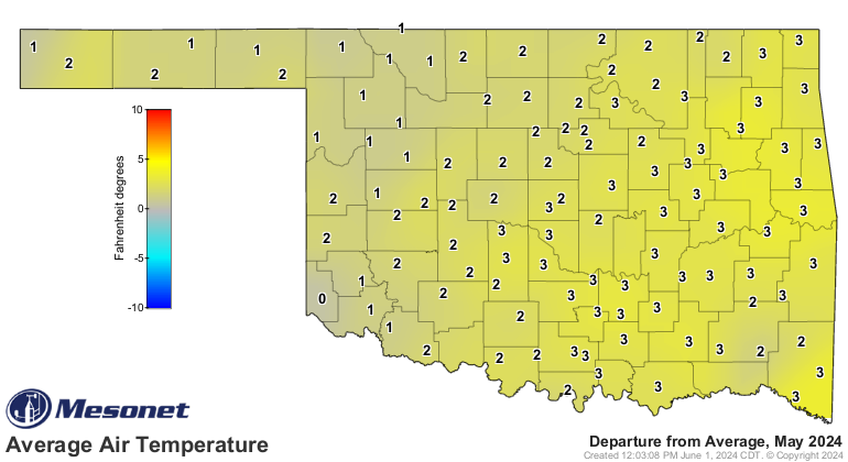
May was a warm month in Oklahoma. No locations reached the freezing mark during
the month, with the spring’s final freeze confirmed on April 22. The statewide
average temperature for May, as determined by Mesonet data, was 70.2 degrees,
1.8 degrees above normal, ranking as the 30th warmest May since records began
in 1895. Three sites reached triple digits on May 20, including Altus at 101
degrees, the highest temperature of the month. Hollis and Erick also reached
100 degrees that day. There were 39 readings of heat index values of 100 degrees
or greater, with the combination of heat and atmospheric moisture fueling the
month’s severe weather. Altus and Burneyville both reached 106 degrees on May
25 and 24, respectively. The lowest temperature was 36 degrees at Eva on May 8.
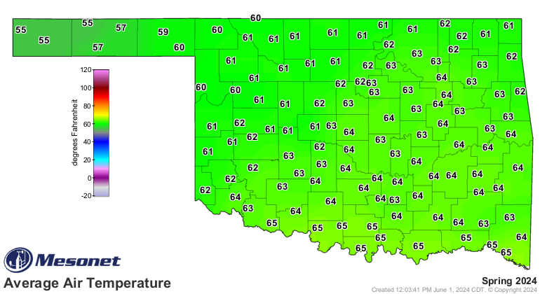
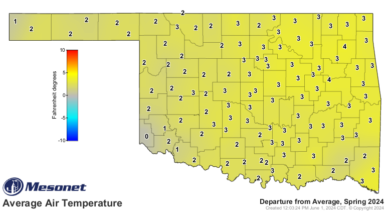
Climatological spring finished as the fifth-warmest on record at 62.5 degrees,
2.8 degrees above normal. The first five months of the year also ranked as the
fifth-warmest January-May at 54.3 degrees, 2.2 degrees above normal.
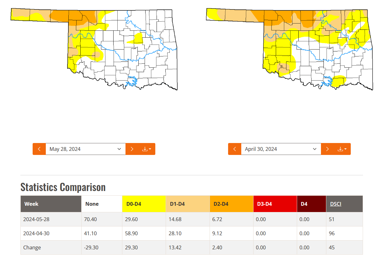
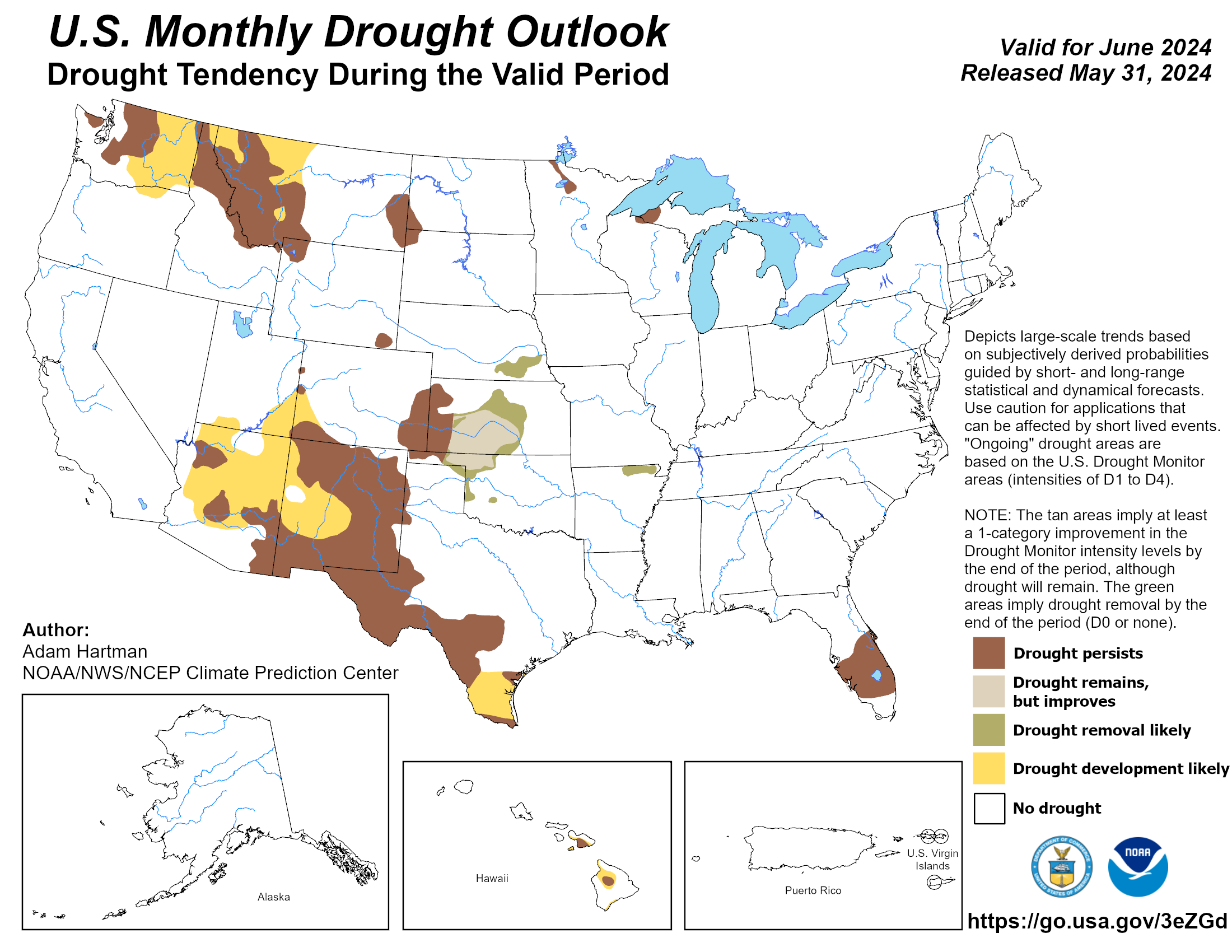
Drought diminished considerably through May, decreasing from around 28% of the
state at the end of April to less than 15% at the end of May. While drought had
disappeared throughout most of Oklahoma, it continued to spread west through
the Panhandle and south into far western areas of the state. The Climate
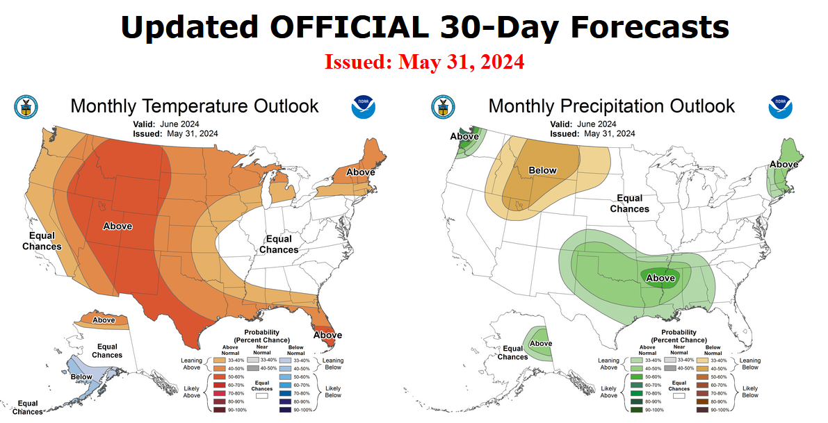
Prediction Center’s June drought outlook calls for most of the drought in the
state to improve through the month, except in the western half of the Panhandle.
The CPC’s June precipitation and temperature outlooks indicate increased odds
of both for the month.
###
Gary McManus
State Climatologist
Oklahoma Mesonet
Oklahoma Climatological Survey
gmcmanus@mesonet.org
June 3 in Mesonet History
| Record | Value | Station | Year |
|---|---|---|---|
| Maximum Temperature | 108°F | ALTU | 2008 |
| Minimum Temperature | 45°F | EVAX | 2018 |
| Maximum Rainfall | 5.20 inches | FTCB | 1995 |
Mesonet records begin in 1994.
Search by Date
If you're a bit off, don't worry, because just like horseshoes, “almost” counts on the Ticker website!