Ticker for May 30, 2024
MESONET TICKER ... MESONET TICKER ... MESONET TICKER ... MESONET TICKER ...
May 30, 2024 May 30, 2024 May 30, 2024 May 30, 2024
Ye Olde Drought Update
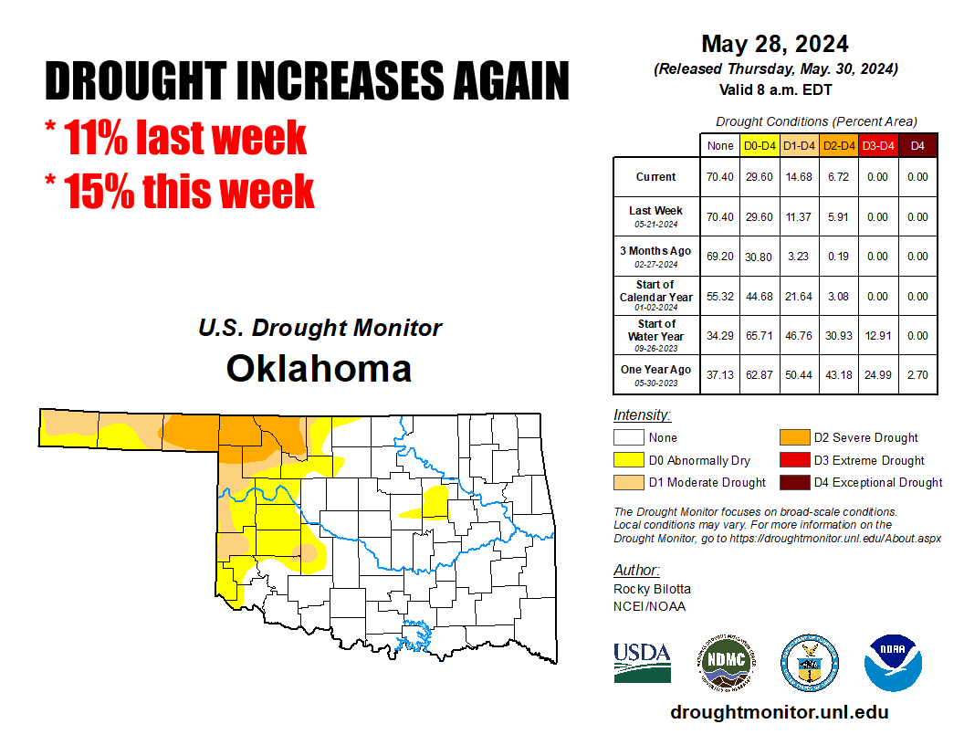
Now listen, I know what you're saying to yourself..."but Gary, how can drought
be going UP if rain is falling DOWN?"
First off, very clever. Secondly, YOU are not Gary. I know Gary. Gary is a friend
of mine. You are no Gary. So quit calling yourself Gary. And ask for help since
you're talking to yourself.
But about this drought deal, yes, it has rained. It has even rained where the
drought IS and where it IS going up. It just hasn't rained enough to relieve
drought, or stop its intensification. There are still deficits out there, even
over the last 30 days (lots of good rain too, though).
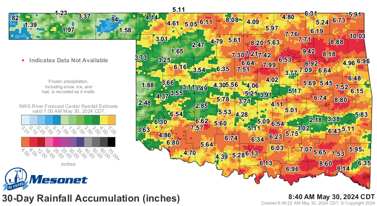
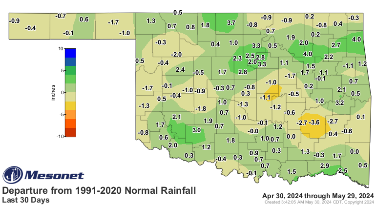
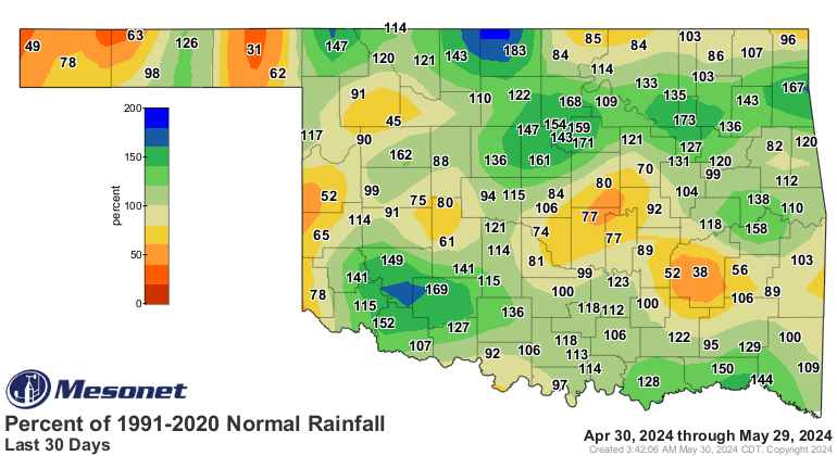
But compare that to the longer-term maps, which show why drought has such a
tough foothold up there in NW OK.
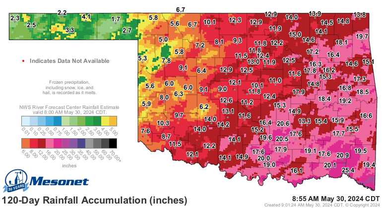
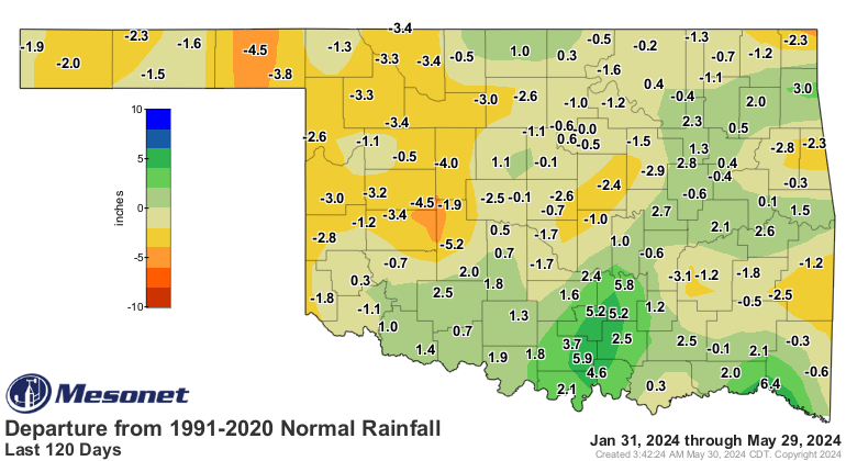
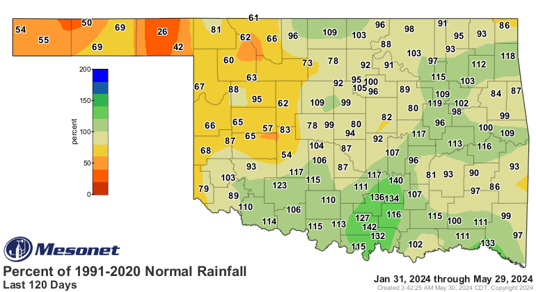
All the severe weather has drawn our eyes away from the less-sexy hazard that's
been with us all along. The worry is that we will enter the summer with drought
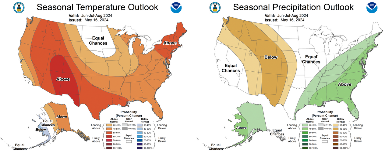
in place, and with the death of the strong El Nino, we'll see what we've seen
before in those summers post-El Nino. Hot and dry.
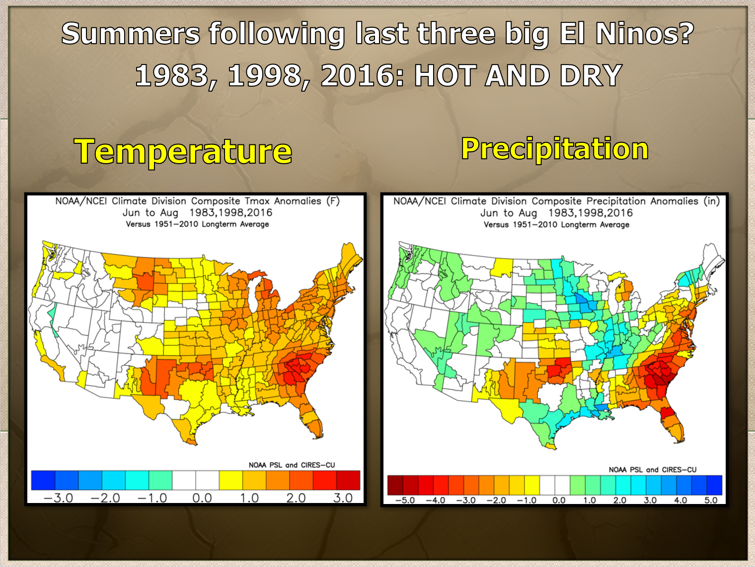
Now the good news there is that it's only 3 data points, so not a lot of years
to show us otherwise, but this is being picked up by the CPC long-range outlooks
for the summer, which climatologically speaking (trust me, it's not a language
you want to learn!), begins on Saturday, June 1.

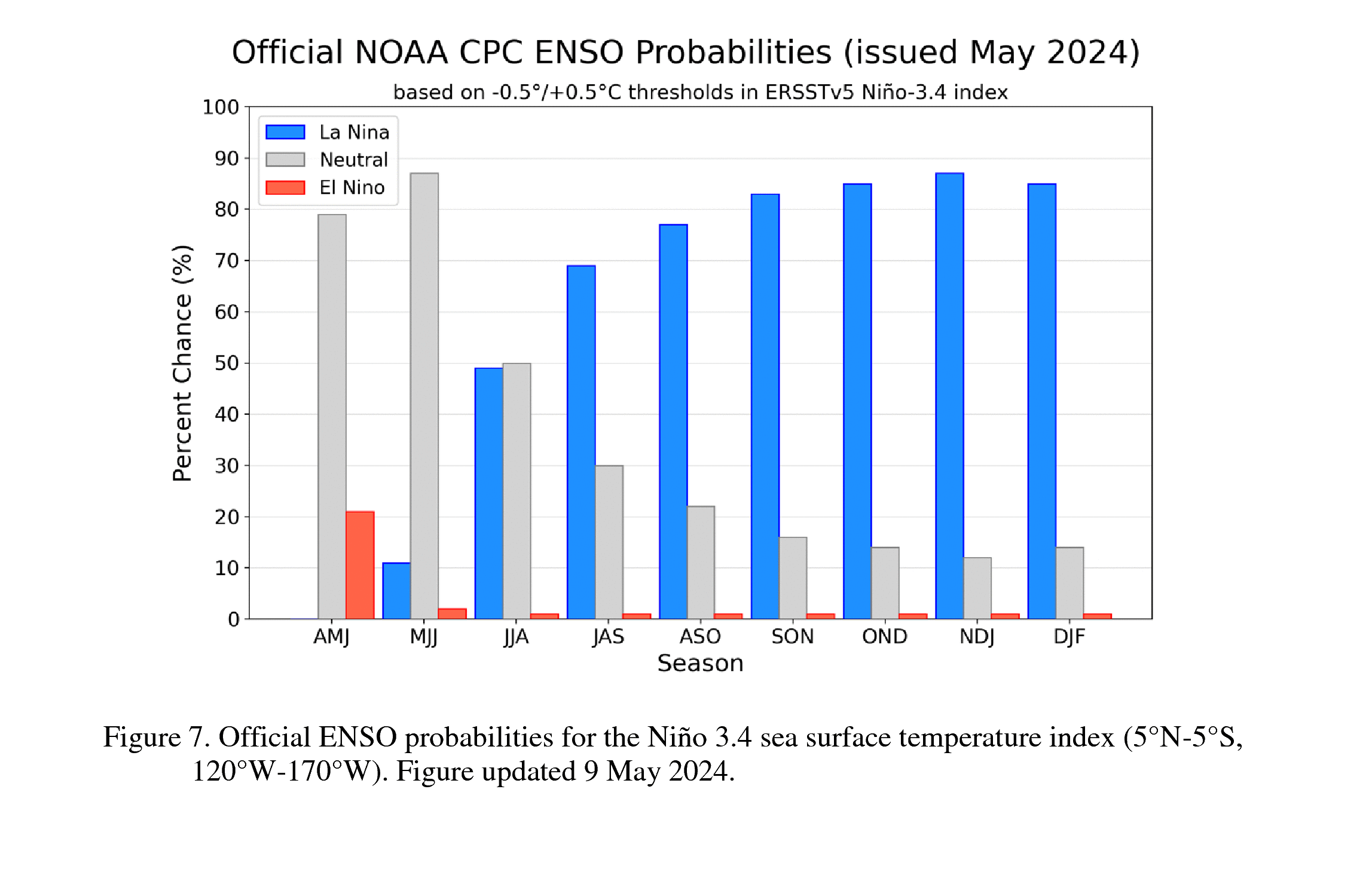
And with La Nina firmly placed in the forecasts, expected to develop this summer
and begin impacting us this fall through next spring, the dryness is more likely
to continue than not.
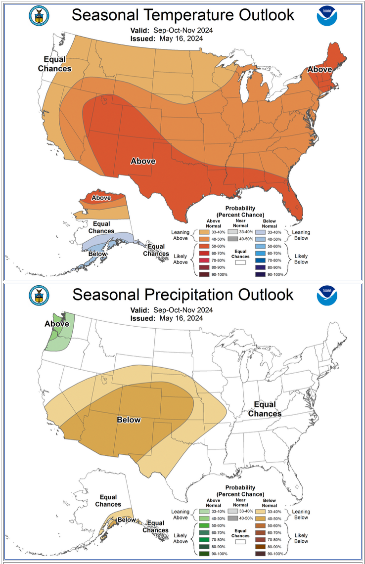
So as much drought that we can alleviate now, before the summer and fall, the
better. It doesn't need a boost.
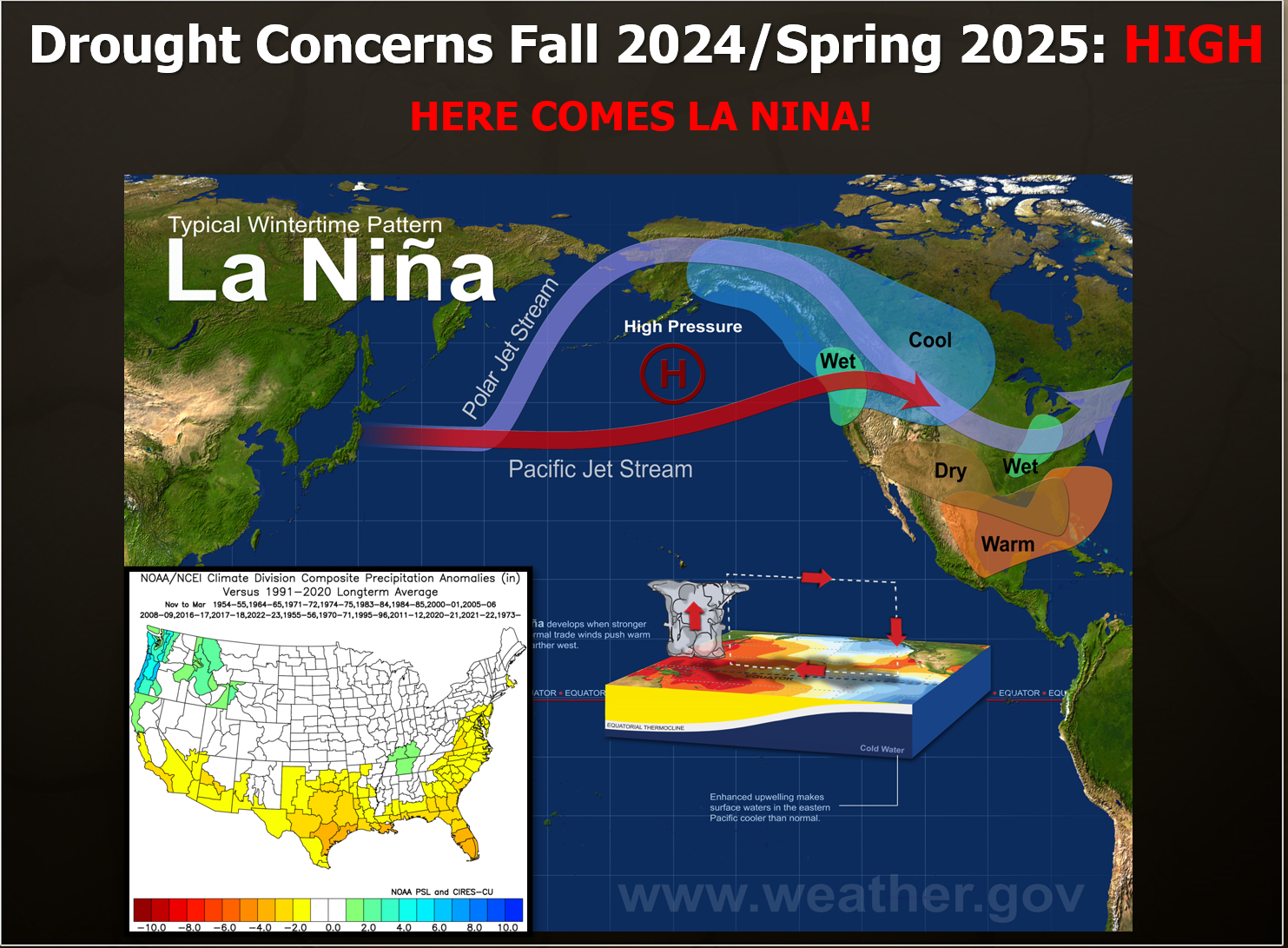
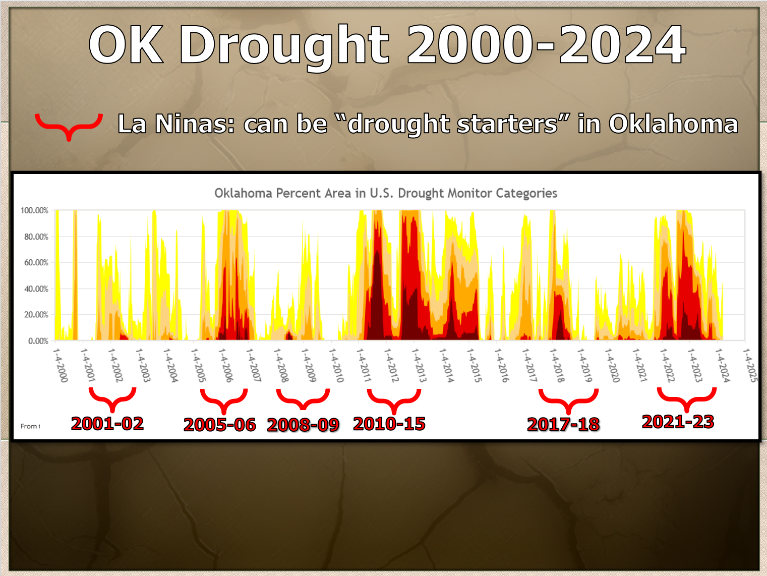
Let's get it straight, though, that La Nina doesn't ALWAYS cause drought. Not
every La Nina impacts us the same way. However, if you look back through the last
24 years since the Drought Monitor began, it does act as a drought starter...
again more often than not.
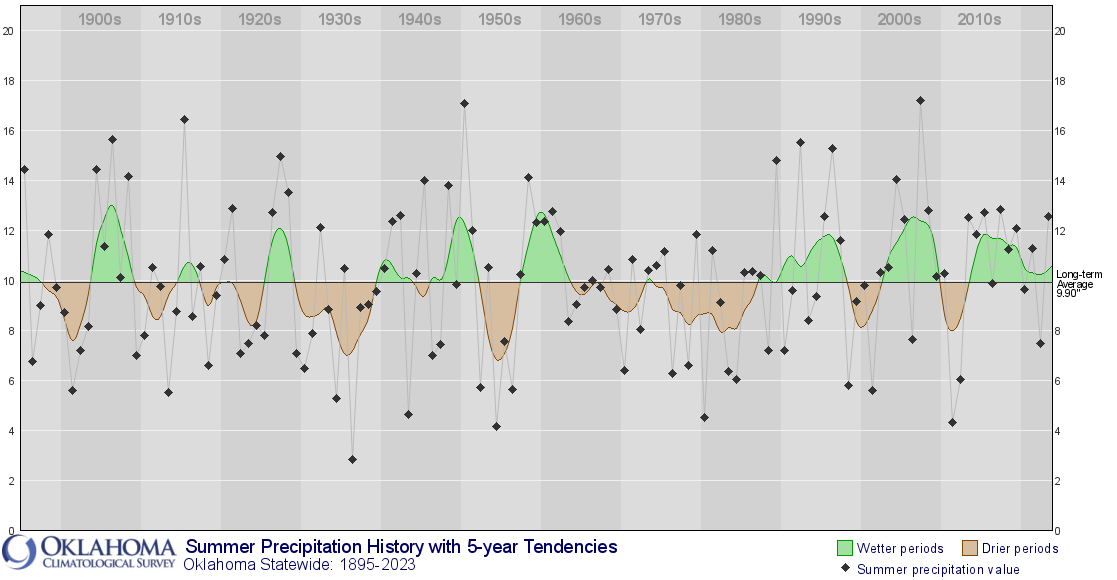
We've had a string of wetter-than-normal summers, though, so we'll see which
climate signal wins out.
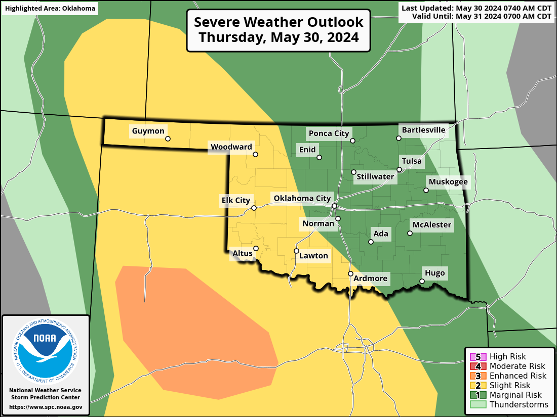
All that out of the way, you still with me? Okay, now for some possible good
news...more rain today through Saturday.

Possible bad news...more severe weather tonight.
No more drought, no more severe weather, and NO MORE STRAWBERRY POP-TARTS!
Gary McManus
State Climatologist
Oklahoma Mesonet
Oklahoma Climatological Survey
gmcmanus@Mesonet.org
May 30 in Mesonet History
| Record | Value | Station | Year |
|---|---|---|---|
| Maximum Temperature | 107°F | ALTU | 2003 |
| Minimum Temperature | 39°F | EVAX | 2019 |
| Maximum Rainfall | 4.47 inches | EUFA | 2001 |
Mesonet records begin in 1994.
Search by Date
If you're a bit off, don't worry, because just like horseshoes, “almost” counts on the Ticker website!